Highway Through Cisco [Column_Cisco Range]
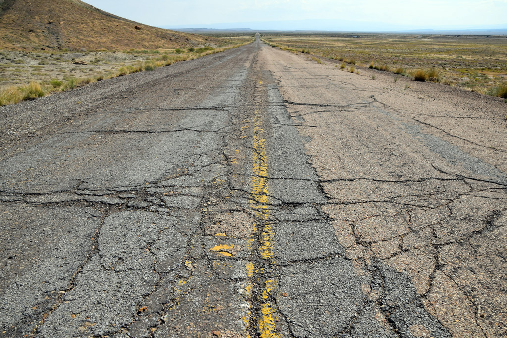 : old US Hwy 50 & 6 near Cisco, UT Sep. 10, 2017
Cisco, Utah was truly a railroad town. The town relied on the Rio Grande for its establishment and also for its survival. But utilities other than the railroad also made some contribution to its survival. Here is the story of how other utilities supported this remote tiny town in the desert.
Far before the motor age, the region called Utah today was covered by the Indian trail network.
In the frontier era, pioneered by Mexican trader Antonio Armijo in 1829, three routes connecting Santa Fe, NM, and Los Angeles, CA called the Old Spanish Trail crossed the region. One of which called the Northern Branch of Old Spanish Trail passed through the places later called Westwater, Cisco Landing, Thompson, and Green river.
In 1858, the Trail was improved by US Army Colonel William Wing Loring(1818 − 1886) enabling them to carry wagons, and the route became known as Salt Lake Wagon Road. But the town of Cisco didn’t arise yet.
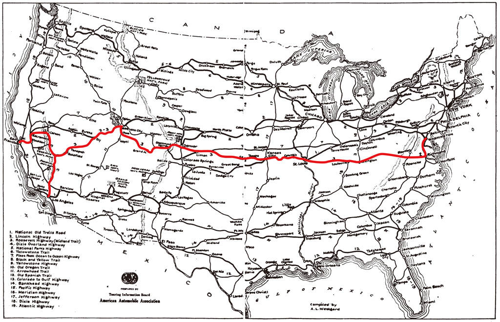 : map of Midland Trail
 Midland Trail, one of the first transcontinental autoroutes, was routed through the town of Cisco In the early 1910s tracing the predecessors which took 33 hours just to go from Mack, CO to Cisco[1]. The Trail was promoted by the Midland Trail Association backed by Salt Lake Tribune. The construction of the route within Grand County, partially reusing abandoned narrow-gauge railroad right of way, was completed in 1913[2]. But it was nothing more than a dirt wagon trail at that time.
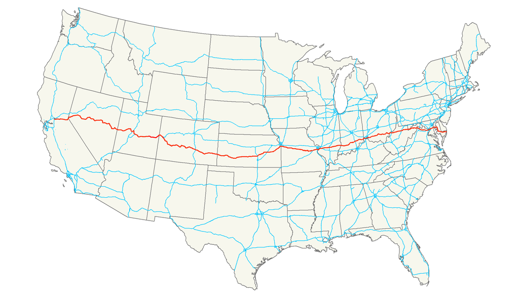 : map of US Hwy 50
US Route 50 (US Hwy 50), known as The Loneliest Road in America, connecting Sacramento, CA and Annapolis, MD was created in 1926 as a result of the Federal Aid Highway Act of 1925. Midland Trail within Grand County was designated as Route 50.
Reconstructing of the Trail to federal aid standard highway between Cisco and Colorado state-line was completed in 1931[3]. The contractor was Hall-Lumsden Construction Company of Grand Junction, CO. The portion, including the one-half mile stretch through the town of Cisco, was oil-surfaced in 1934[4, 5]. Westward from Cisco was delayed due to the state’s negotiation with D&RGW about obtaining rights of way through the railroad’s Floy gravel pits[6]. The remnants of the gravel pits penetrated by the highway can be still seen in Google maps satellite view.
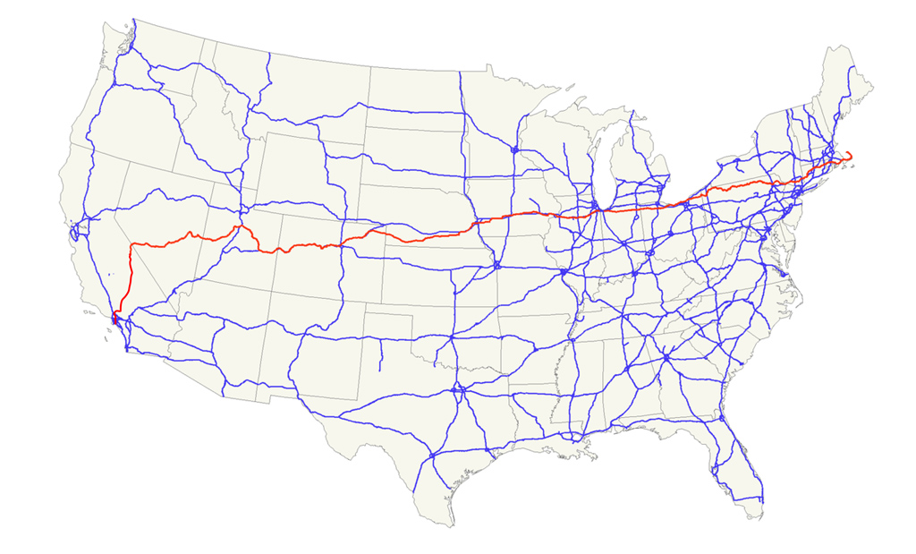 : map of US Hwy 6
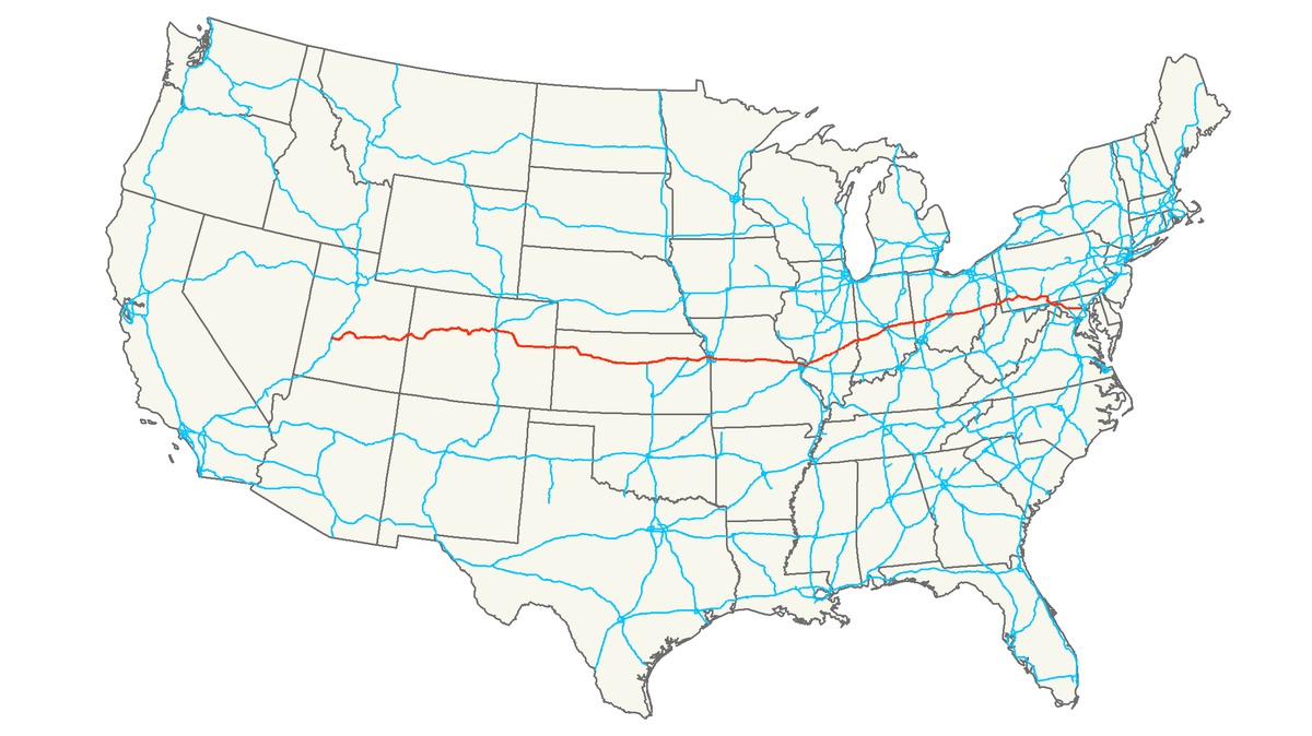
US Route 6 (US Hwy 6), described as route runs uncertainly from nowhere to nowhere by a historian George R. Steward, connecting Long Beach, CA and Provincetown (Cape Cod), MA, was first designated in 1925[7]. The portion within Grand County was designated in 1937. It was the longest highway in the United States at that time. The route traced US Hwy 50 within Grand County[8].
The US Route 6 gradually designated the Grand Army of the Republic Highway, honoring the Civil War soldiers, between 1937 and 1948. It was also the Roosevelt Highway since 1936. Jack Kerouac(1922 – 1969) mentioned the route in his 1957 Nobel On the Road.
 : map of I-70
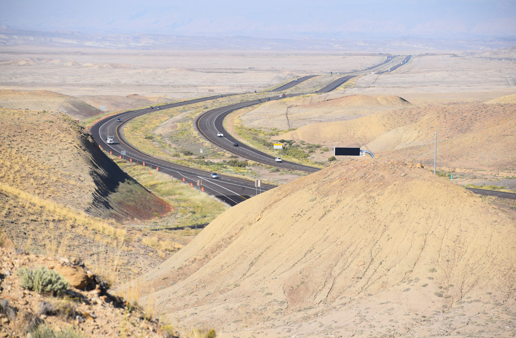
Interstate 70 (I-70) which had come to bypass Cisco began to construct at several sections within Grand County in the early 70s[9]. The last portion of I-70 in Grand County was finally completed in 1976[10]. Unfortunately, however, the seasonal elasticity of the Mancos Shale formation where I-70 lays caused buckling and heaving of the Interstate's pavement. Accordingly, it had to be reconstructed soon after its completion[11]. The portion in Grand County was designated National Scenic Byways in 2002.
 : I-70 near Brendel, Utah Sep. 11, 2014
After the completion of the Interstate, the portion of old US Hwy 50 & 6 between I-70 Exit 204 and 214 became Utah State Route 128 (SR 128). SR 128 was also designated National Scenic Byways in 1998[12]. The portion of US Hwy 50 & 6 west of Exit 204 became Grand County jurisdiction Frontage Road[13].
 : Mack, CO. Sep. 10, 2017
About that time when US Hwy 50 was completed, the state of Utah set up a highway maintenance station at Cisco, along with Elgin and Moab in Grand County[14]. The station was located in the easternmost of the town.
Several engineers were stationed according to the 1930 Census. Victor Kirby Murray(1893 – 1962), considered as one-time owner of the Ruth’s 66 Cafe structure, was the foreman[15]. Harry Ballard Harris(1914 – 2005), later husband of Ruth of Ruth’s 66 Cafe, was also the foreman[16]. However, unfortunately, the station was moved to Thompson in 1975[17, 18].
 : Sep. 10, 2017. Thompson Springs, UT
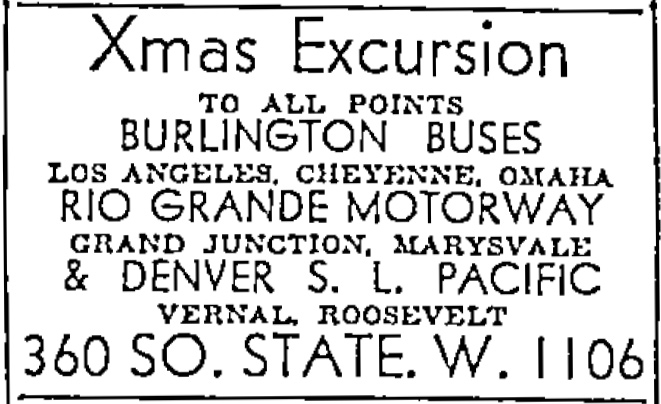
Bus Routes through Cisco and the vicinity was inaugurated in 1935, soon after the completion of the US Hwy 50, by the Rio Grande Motorway Inc., later, by the Rio Grande Trailways, a unit of National Trailways Bus System since 1936[19, 20].
The Motorway/Trailways bus initially connected Salt Lake City and Pueblo via Hwy 50, the route obtained from Southern Kansas Stage Lines[20]. It later added the Denver portion via Hwy 6 in 1937[21].
According to the April 1945 Rio Grande Trailways Bus Timetables, westbound departed Cisco at 3:29, 10:54, and 23:39, all for Salt Lake City, and eastbound departed Cisco at 5:06 for Pueblo, 14:26 for Pueblo, and 20:11 for Denver. It took about 7 hours to S.L.C., 11 and a half hours to Pueblo, and 12 hours to Denver.
The Motorway passenger operations were sold to Continental Trailways in 1948[22]. According to June 1971 Continental Trailways Timetable, westbound departed Cisco at 18:50 for Salt lake City and eastbound departed Cisco at 5:14 for Denver. It took about 5 hours and a half to S.L.C., and 10 hours to Denver. However, unfortunately, Cisco stops apparently ended up in 1973/4 due to the progress of Interstate construction: the portion of I-70 bypassing the town began to use on Nov. 16, 1973.
Today, Greyhound Lines buses connecting Las Vegas and Denver run through the region on I-70, with the nearest stop from Cisco at Green River, Utah, or Grand Junction, Colorado.
 : Dec. 5, 1935 Salt Lake Telegram
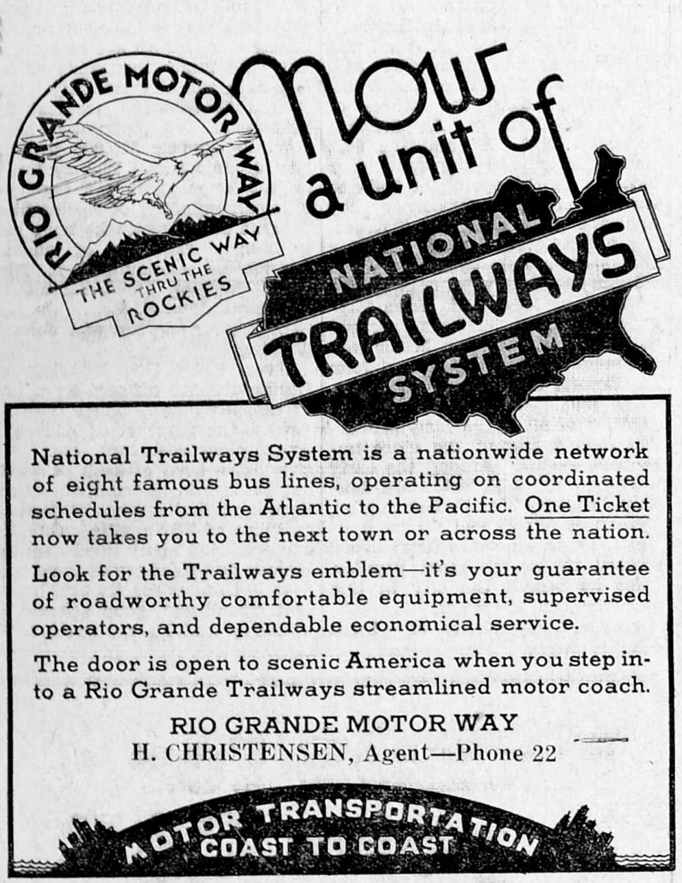 : Mar. 26, 1936 Springville Herald
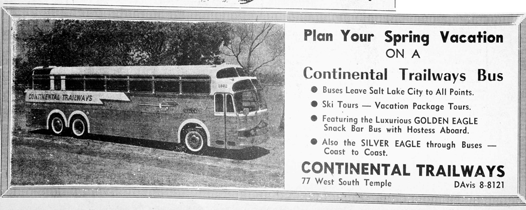 : Mar. 6, 1964 University of Utah Student Newspapers
Air Routes can also be considered as utilities in this region.
The YouTube movie below shows the approach to the remnants of Rogers Roost Airport at Thompson Springs west of Cisco. We can see similar remnants of an airstrip at Cisco itself, on the hill south of the former schoolhouse site.
The runway of Cisco is clearly seen at the southern end of Main Street in the 1952 USGS aerial photo, which is not found in the 1944 USGS photo. It was maintained by County Commissioner Frank Martin Shields(1896 − 1983)[23]. He owned a ranch near Cisco[24].
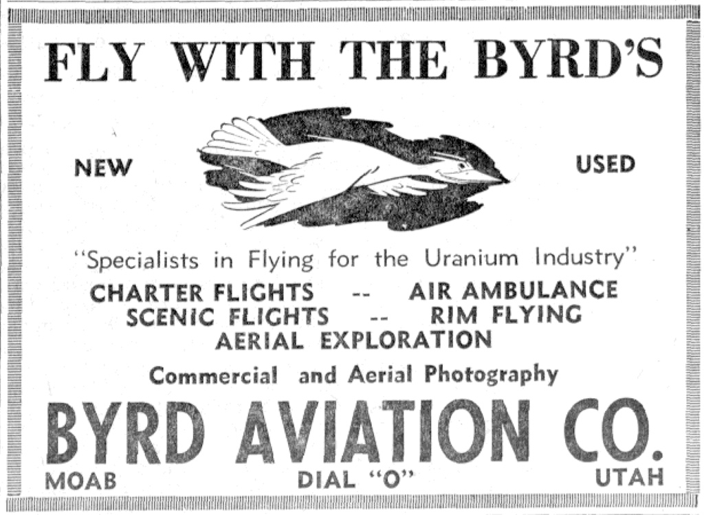
According to the interview with former pilot Dennis Earl Byrd Sr(1921 − 2007), mining companies and oil companies used private airplanes in this region[25]. He did fly Charles Steen's Cessna 195 to Cisco in 1953[26].
The dirt Cisco runway measured 2300 feet long and 70 feet wide, according to Brooks[27]. The 1969 USGS photo shows the replaced access road. Accordingly, it seems that the airstrip was used at least until the late 60s.
 : Jul. 21, 1955 Green River Journal
revised, Mar. 4, 2016
revised, Mar. 10, 2016
revised, Mar. 25, 2016
revised, Jan. 12, 2017
revised, Oct. 16, 2017
revised, Apr. 27, 2018
revised, Dec. 14, 2018
revised, Apr. 15, 2019
revised, Nov. 22, 2019
revised, Aug. 4, 2021
revised, May 16, 2022
[1] Nov. 15, 1912 Grand Valley Times;
[2] Jul. 11, 1913 Grand Valley Times;
[3] Apr. 30, 1931 Times-Independent;
[4] May 10, 1934 Times-Independent;
[5] May 31, 1934 Times-Independent;
[6] Feb 9, 1933 Times-Independent;
[7] Weingroff, Richard F. (2015) "U.S. 6 - The Grand Army of the Republic Highway", Highway Story, Federal Highway Administration;
[8] Dec. 31, 1936 Times-Independent;
[9] Sep. 6, 1973 Times-Independent;
[10] Firmage, Richard A., (1996) A History of Grand County, p.364, Utah State Historical Society;
[11] Apr. 22, 1976 Times-Independent;
[12] Jul. 16, 1971, Highway Resolutions, p.22, Utah Department of Transportation;
[13] Sep. 17, 1973, Highway Resolutions, p.29, Utah Department of Transportation;
[14] May 7, 1942 Times-Independent;
[15] Dec. 13, 1962 Times-Independent;
[16] Dec. 18, 2005 Deseret News;
[17] Jun. 1, 1972 Times-Independent;
[18] Rogers, A.J., (2018) "A Page Out of the Book Cliffs Page 35", Dec. 14, 2018, Times-Independent;
[19] Aug. 5, 1935 Salt Lake Telegram;
[20] Hobijn, Jon, Jon's Trailways History Corner website;
[21] Feb. 26, 1937 Pleasant Grove Review;
[22] Feb. 26, 1948 Times-Independent;
[23] Sep. 28, 1950 Daily Sentinel;
[24] Aug. 16, 1951 Times Independent;
[25] Dahl, Detta, (2003) Dennis E. “Pete” Byrd, Sr., Eastern Utah Human History Library;
[26] Byrd, Dennis E., (1997) Early Flying In Grand County, Vol. 30, Canyon Legacy, Dan O'Laurie Canyon County Museum
[27] Brooks, David W. (2012) Open and Closed Listing of Airports / Airfields;
* 1938 photo of Rio Grande Trailways coach #179 found at Jon's Trailways History Corner website;
Ciscoはその盛衰を鉄道に左右された町だったといえるだろう。しかし、鉄道以外のインフラストラクチャーがこの町の盛衰に果たした役割も少なくない。ここでは、それらがどのようにこの地の果てのような荒野のただ中にある町を支えたか紹介する。
Ciscoにはかつてガソリンスタンドが4軒、モーテルが1軒あり、そして州の道路営繕工営所がおかれていたことからも、道路が町の盛衰に果たした役割は少なくないといえるだろう。北米最初の大陸横断道路のひとつであるMidland Trailは1913年にCisco に到達している。
1926年制定の「最も孤独な道」とも称せられる国道50号線は、CiscoではMidland Trailを上書きするように設定された。1931年開通当初は砂利道だったが,1934年には早くも舗装されている。1936年に制定された「どこからどこへいくのかよく分からない道」とも称せられる国道6号線は、Ciscoでは国道50号線をなぞっている。
Ciscoを迂回することになる、インターステート70号線の工事は1970年代初めに始まった。Ciscoを含むGrand Countyにおける工事は1976年に完了した。インターステート70号線の開通後、従来の国道は州や郡に移管された。なお、この地域を通るインターステート70号線、州道128号線は景色のいい「National Scenic Byways」に指定されている。
空路について、Ciscoにはいくばくかの痕跡が残されているのみである。1952年撮影の航空写真には、町の南側の丘に滑走路がはっきりと写っている。資料によれば、長さ2300フィート・幅70フィートの未舗装滑走路であったというから、離着陸できるのは軽飛行機に限られただろう。1969年撮影の航空写真ではアプローチ道路が付け替えられているので、その頃はまだ使われていたようだ。誰がどのように使ったのだろう。動画はCiscoの隣り、Thompsonに遺る滑走路へのアプローチの様子である。
2016-01-08 09:00
コメント(0)
arx_Ph.D. さん

Here represented are my model railroad enthusiasm generated from the photos I took during my childhood at Knoxville, Tennessee, or from the photos I took during my recent trips.
I'm a retired professor of design, meanwhile a part-time associate at the architectural design office in Osaka, Japan where I live with my wife.


コメント 0