Thompson Hill, part 2 [Column_Photo Archives]
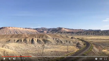 : 360° view of the Thompson Hill
“Thompson Hill” is located about two miles east of Thompson, Utah: on milepost 526 at Rio Grande track charts. It lies next to the Rio Grande's highest point between Grand Junction, Colorado and Green River, Utah.
The Hill is about 500 ft walk from the paved old US Hwy 50 & 6, and another 700 ft walk from Utah Welcome Center on westbound I-70: a little hill climb is needed, but seem far easy to access compared with “Patrick’s Point” west of Floy.
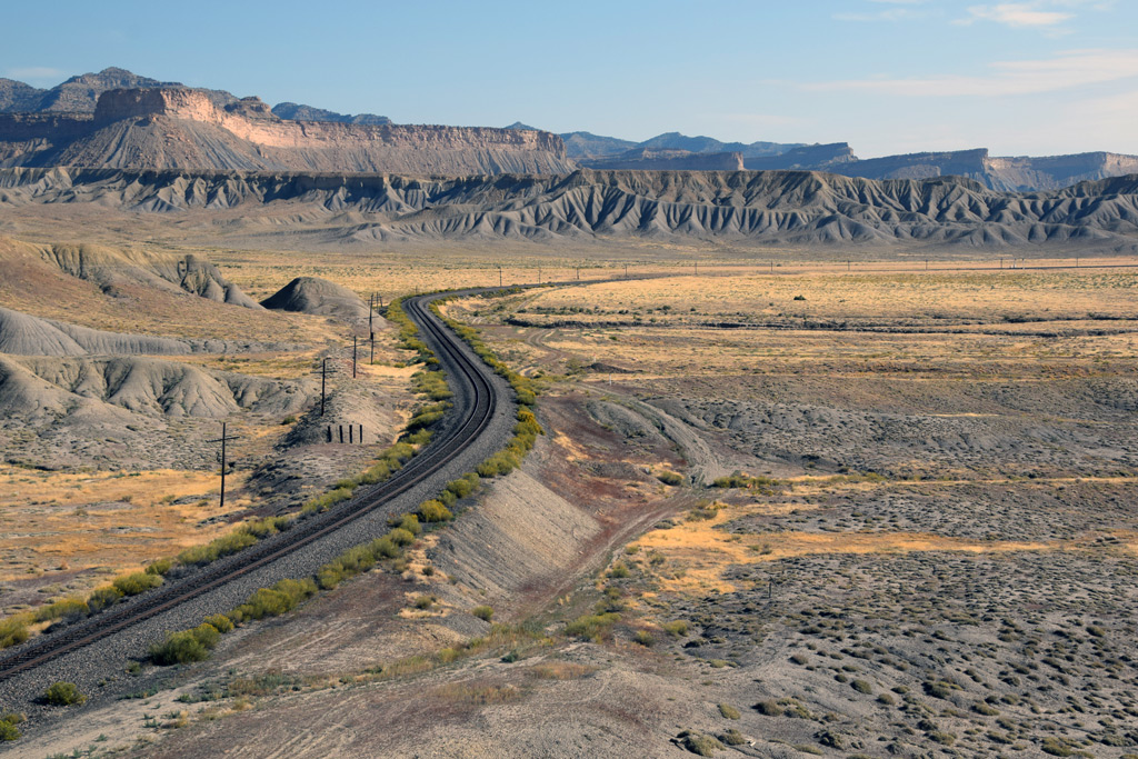 : Mac Owen's view
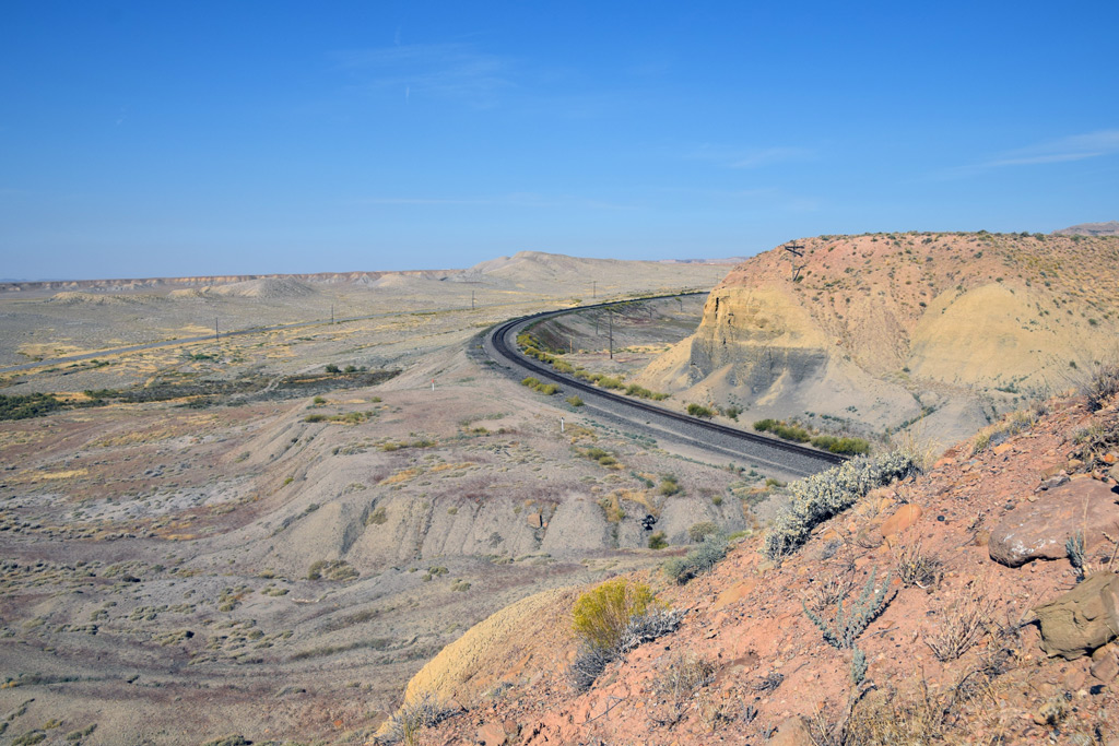 : Mike Danneman's view
The setting is composed of tight and loose curves which lead to reversed curves both directions. Here, also are the cut and fill which allow various heights of viewpoints. The setting faces the south and it seems nothing gets in the way of sunlight all day long. Trains reduce speed due to its 5° curve in both directions. Accordingly, they smoke them up after negotiating it.
As you can see, we can choose the right angle from various opportunities according to the train’s direction, train’s length, the position of sunlight or purpose of the photo. I think that’s why many photographers made the pilgrimage to this setting.
 : Mark M. Hemphill's view
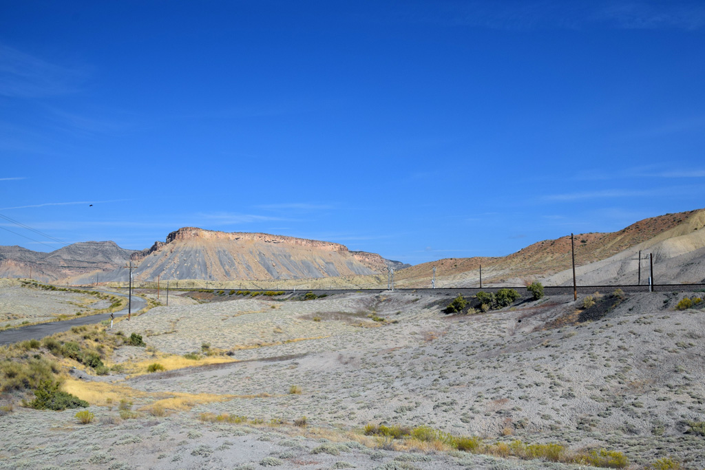 : Ken Crist's view
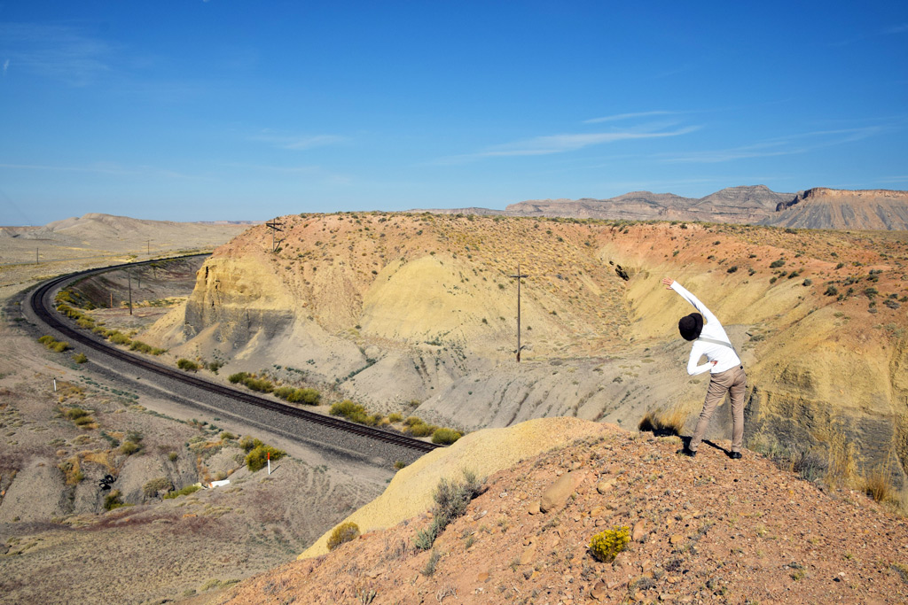
The view from the point is vast and wonderful without an obstacle. You can admire the breathtaking panorama of the desert, the Book Cliffs and the La Sal Mountains: even my wife, who isn’t interested in trains, could wait an hour for the Zephyr. I believe that’s another reason why many photographers left their footprints here.
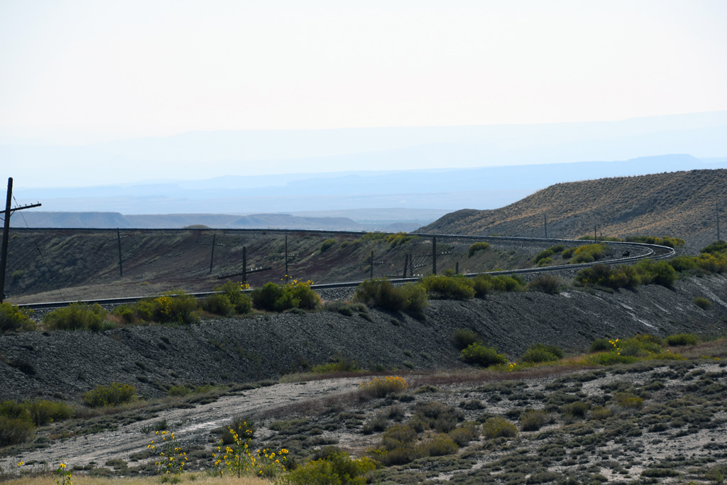
 : my wife prepares for the session
 revised, Feb 1, 2020
およそ350Rの「Thompson Hill」はThompsonの約3キロ東に位置する。 Rio GrandeのDenverを起点とする里程標では526マイル地点に当たる。舗装が遺る旧国道50号線の路肩に車を駐めればおよそ150メートル、近くを通る高速道路のレストエリアからでも400メートル足らずの徒歩で到達可能。舗装道路に限ると契約書に記されているレンタカーでも、ここなら躊躇無く行ける。
行ってみて分かったのは、ここは「お立ち台」に欠くことのできない要素をいくつも兼ね備えていることである。すなわち簡易なアプローチ、登り勾配、S字カーブ、切り通し、築堤、位置取り次第で終日順光かつ廻りに目障りな邪魔物なし。特に東側は蛇行する線路がどこまでも見通せる。多分国有地なのだろう、柵や立入禁止のサインもない。
ポイントに立って見回せば、広大な砂漠や、Book Cliffと呼ばれる州を越えて延々と連なる断崖、標高3878.9mのMt Pealeを始めとするLa Sal Mountainsの山々を望むことができる。おかげで、鉄道にはあまり興味のない筆者の妻でも、列車が来るまで炎天下の小一時間を辛抱することができた。ひょっとすると、これがこの地点を「お立ち台」たらしめるもう一つの理由かもしれない。
2017-10-13 09:00
コメント(0)
arx_Ph.D. さん

Here represented are my model railroad enthusiasm generated from the photos I took during my childhood at Knoxville, Tennessee, or from the photos I took during my recent trips.
I'm a retired professor of design, meanwhile a part-time associate at the architectural design office in Osaka, Japan where I live with my wife.


コメント 0