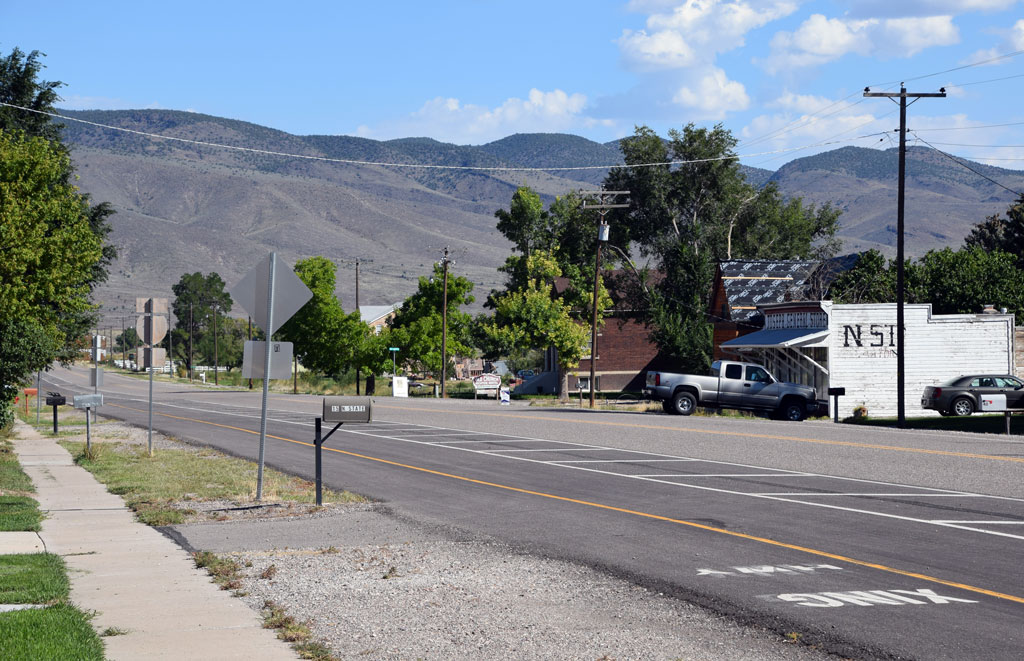
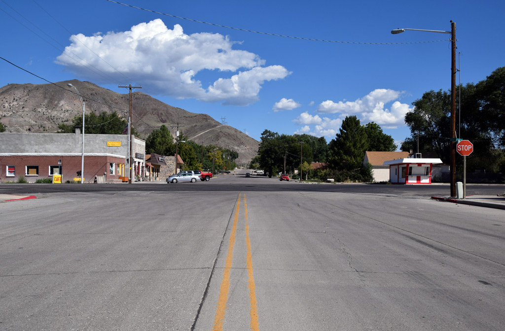
Reminder of the 70's along Rio Grande 31 – Moab, Utah [Trackside Utah PA]
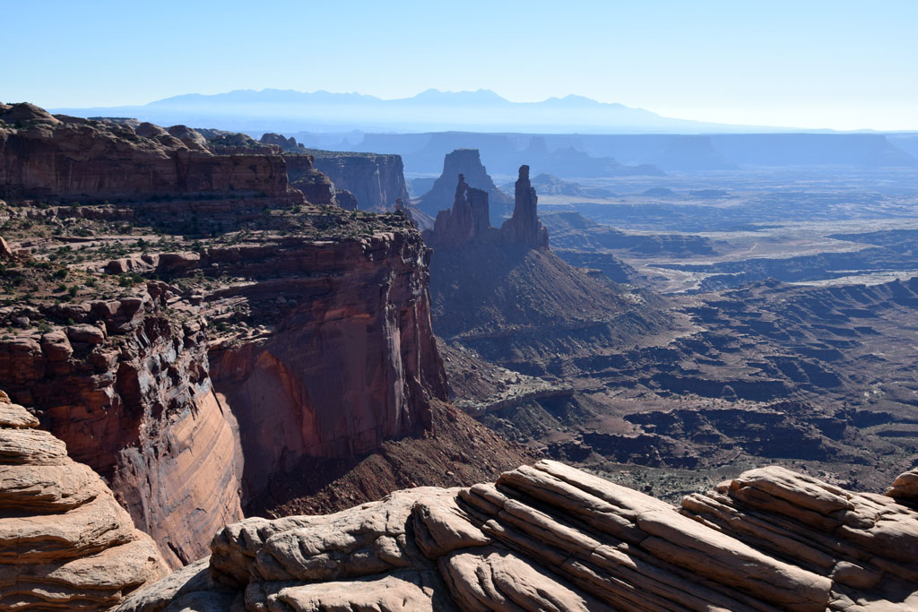 : Canyonlands National Park, UT Sep. 12, 2014
Moab, settled in 1878, is a city in Grand County, with a population of 4793 according to 1970 Census, 5046 according to 2010 Census.
Moab is the biblical name of the Jordan River east bank area, or is the Paiute word means mosquito.
The city was once served by Moab Garage Co., a Rio Grande Motor Ways connecting carrier. The city is escaped narrowly from Rio Grande Cane Creek Branch; tailings at former Atlas Minerals uranium mill site in Moab is now moved by train to the disposal site at Brendel.
The town is the gateway to the Arches National Park, Canyonlands National Park and Goosenecks State Park. Apache Motel at S 4th E St is listed on the National Register of Historic Places.
Map below shows the location of 70’s remnants in Moab. Introduction for each structure will follow this post.
2015-08-07 09:00
コメント(0)
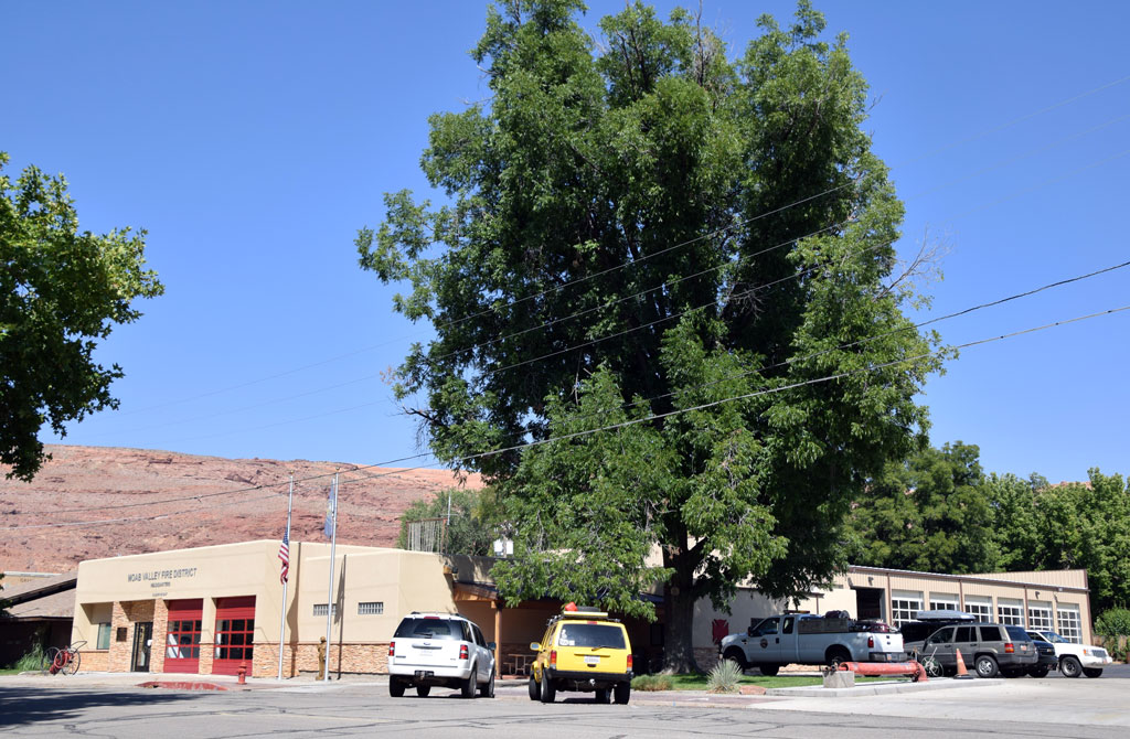
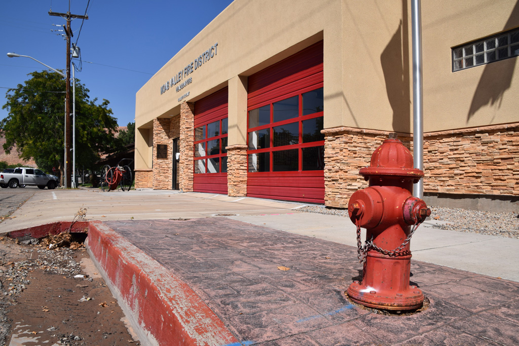
Reminder of the 70's along Rio Grande 32 – Moab Valley Fire District Headquarters, Moab, Utah [Trackside Utah PA]
 : Moab, UT Sep. 11, 2014
Moab Valley Fire District Headquarters is located at the center of Moab, Utah on South 1st East St.
The fire station was first built in 1956. Haines and Purhonen was the architect[1]. It houses a beautifully restored vintage fire engine.
The town of Cisco is covered by the Lower Valley Fire District since 2018 after the copletion of the fire station at Loma, CO[2].
revised, Feb. 26, 2021
[1] Feb. 16, 1956 Times-Independent
[2] Jul. 19, 2020 Daily Sentinel;
 : Moab, UT Sep. 11, 2014
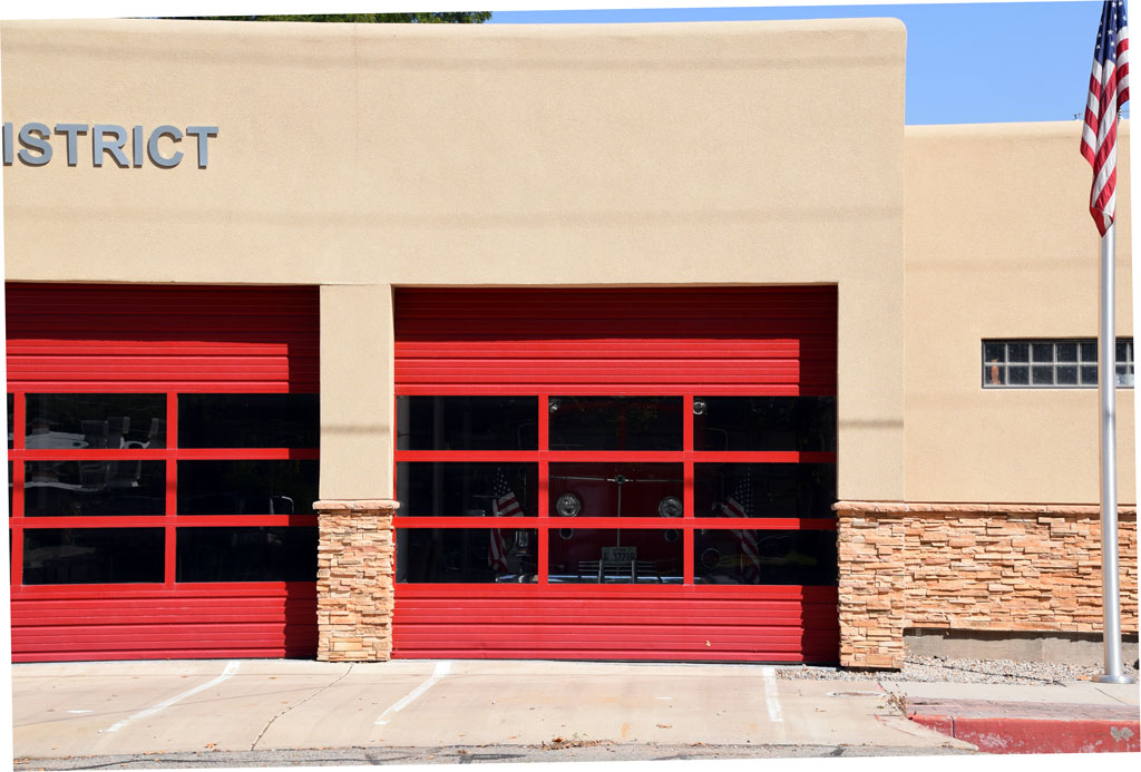 : Moab, UT Sep. 11, 2014
2015-08-08 09:00
コメント(0)
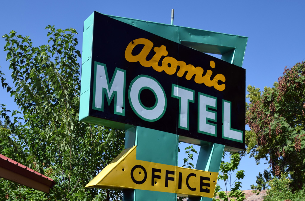
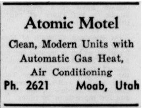
Reminder of the 70's along Rio Grande 33 – Atomic Motel, Moab, Utah [Trackside Utah PA]
 : Moab, UT Sep. 11, 2014
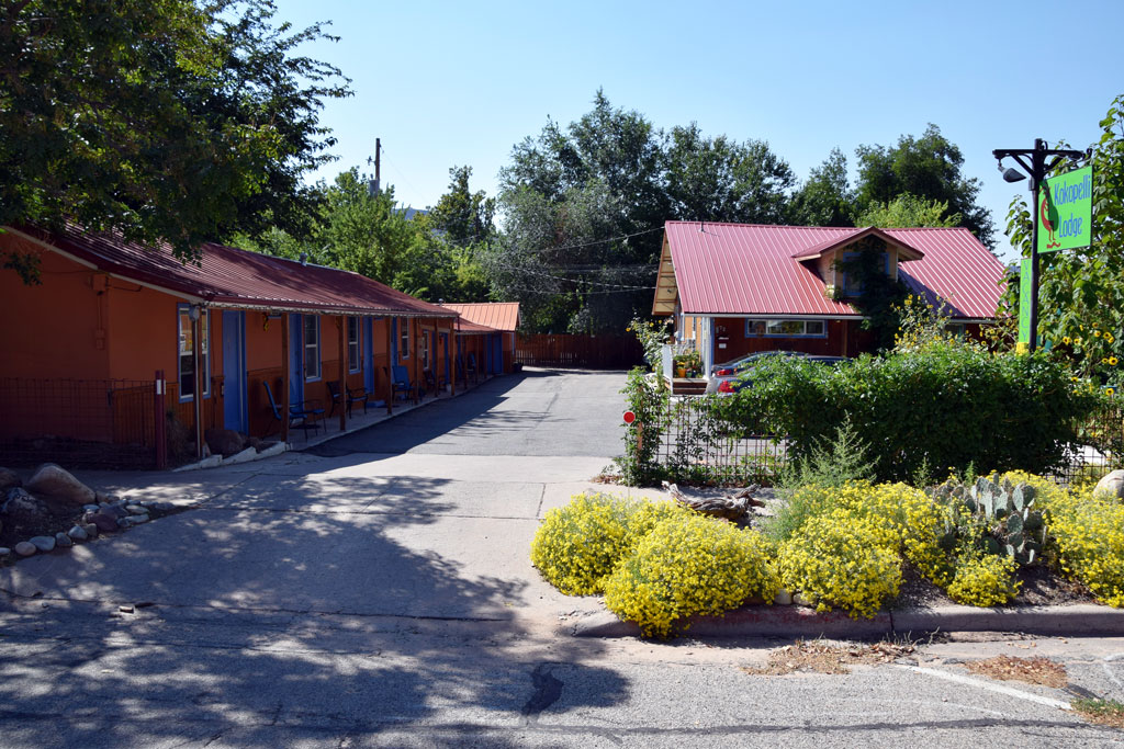 : Moab, UT Sep. 11, 2014
Atomic Motel is located at the center of Moab, Utah on 72 South 1st East St.
According to Utah Division of State History (UDSH), this commercial building was built in 1940[1].
Lillian H. Baldwin(1895 – 1981) established the motel[2]. Jerry L. West(1933 – 2014), Robert Thurman succeeded the business in turn. The name of the motel reflects the uranium boom of the town in the 50’s. It is still active today as Kokopelli Lodge.
[1] UDSH Historic Building Search results;
[2] Dec 31, 1954 Winslow Mail ad;
 : Feb. 24, 1955 Garfield County News
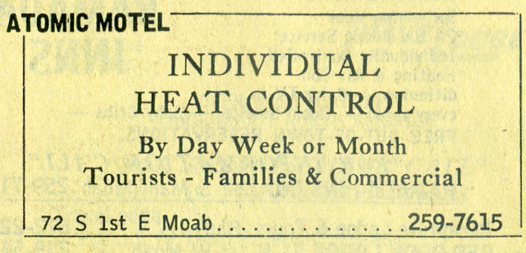 : 1974-1975 Continental Telephone Company of Utah
2015-08-09 09:00
コメント(0)
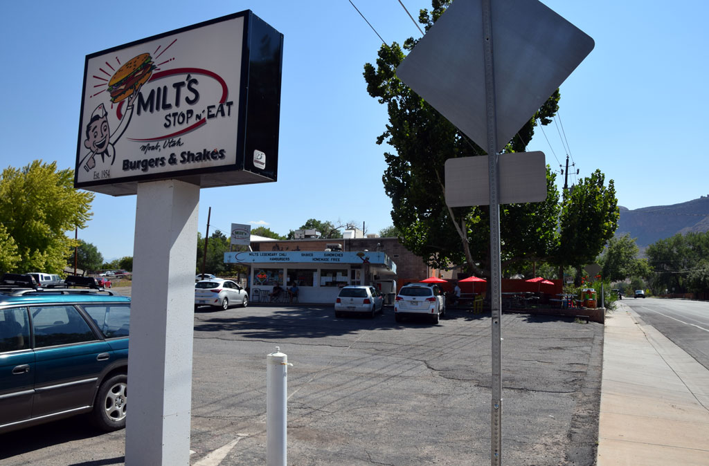
Reminder of the 70's along Rio Grande 34 – Milt’s Stop n’ Eat, Moab, Utah [Trackside Utah PA]
 : Moab, UT Sep. 11, 2014
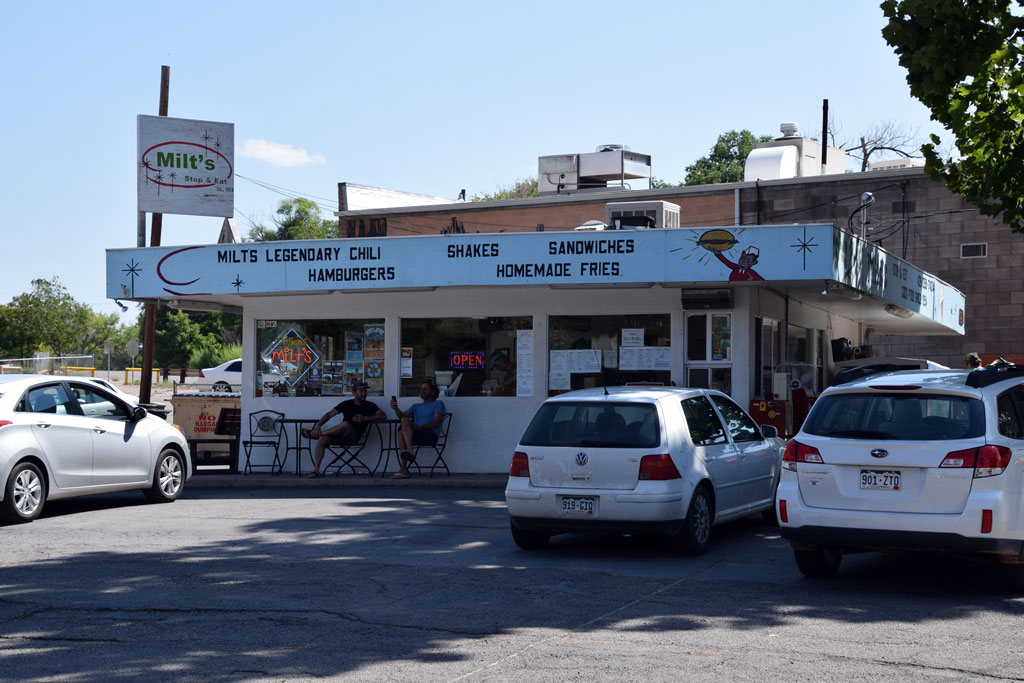 : Moab, UT Sep. 11, 2014
Milt’s Stop n’ Eat is located at the center of Moab, Utah on 356 East Mill Creek Drive.
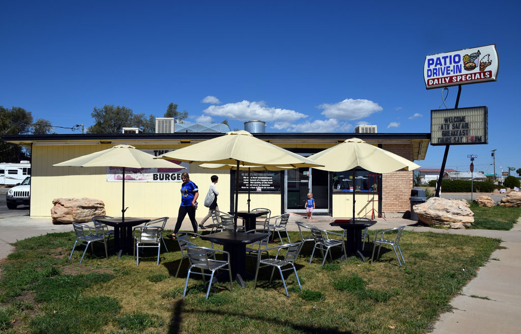
Milton Earl(1925 – 2014) and Audrey F. Galbraith established this first in the town restaurant in 1954[1]. The Salt Lake Tribune selected Milt’s as one of the top 10 small-town drive-ins, along with nearby Patio Drive-In in Blanding[2].
[1] Milton E Galbraith obituary;
[2] May 31, 2012 Salt Lake Tribune;
 : Blanding, UT Sep. 12, 2014
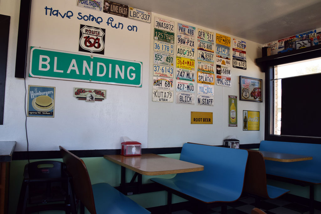 : Blanding, UT Sep. 12, 2014
 : 1974-1975 Continental Telephone Company of Utah
2015-08-10 09:00
コメント(0)
Reminder of the 70's along Rio Grande 35 – Blanding, Utah [Trackside Utah PA]
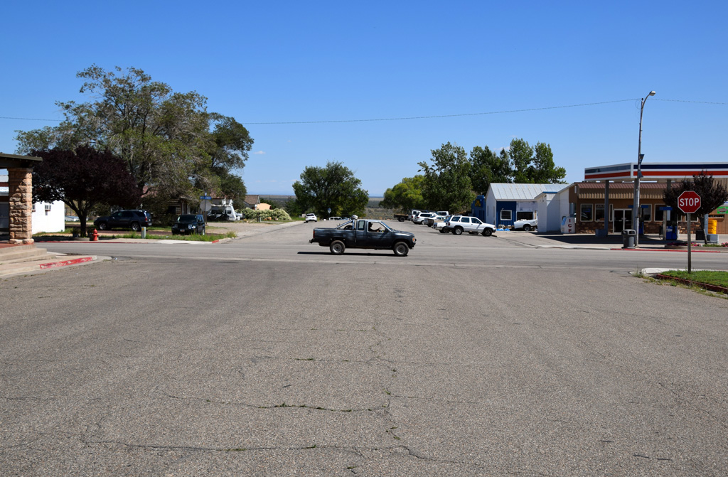 : Main & 100 S St, Blanding, UT Sep. 12, 2014
Blanding, founded in 1905, is a city in San Juan County, with a population of 2250 according to 1970 Census, 3375 according to 2010 Census.
The city changed its name from Grayson to Blanding, maiden name of Amelia, who was the wife of Thomas Bicknell, for the return of 500 books donation in 1916.
The city is never served by rail, but Rio Grande Motor Ways once served the city through connecting carrier Moab Garage Co. The city is the gateway to Natural Bridges National Park, Goosenecks State Park and Monument Valley.
Map below shows the location of 70’s remnants in Blanding. Introduction for each structure will follow this post.
2015-08-14 09:00
コメント(0)
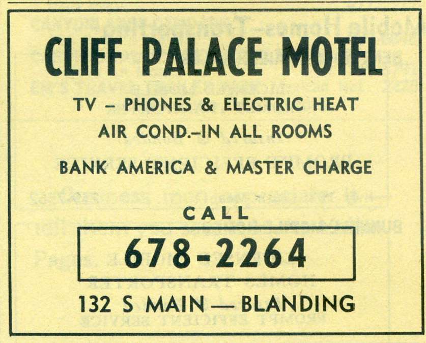
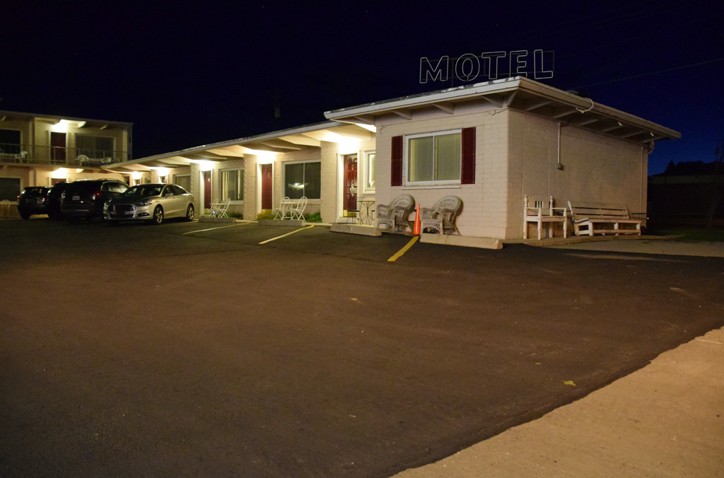
Reminder of the 70's along Rio Grande 36 – Cliff Palace Motel, Blanding, Utah [Trackside Utah PA]
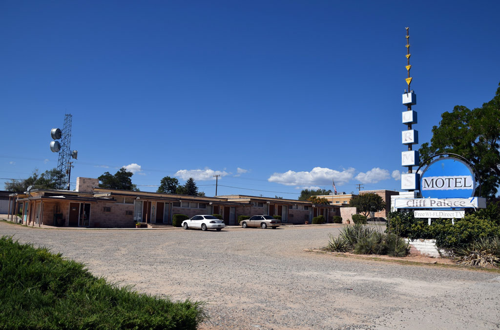 : Blanding, UT Sep. 12, 2014
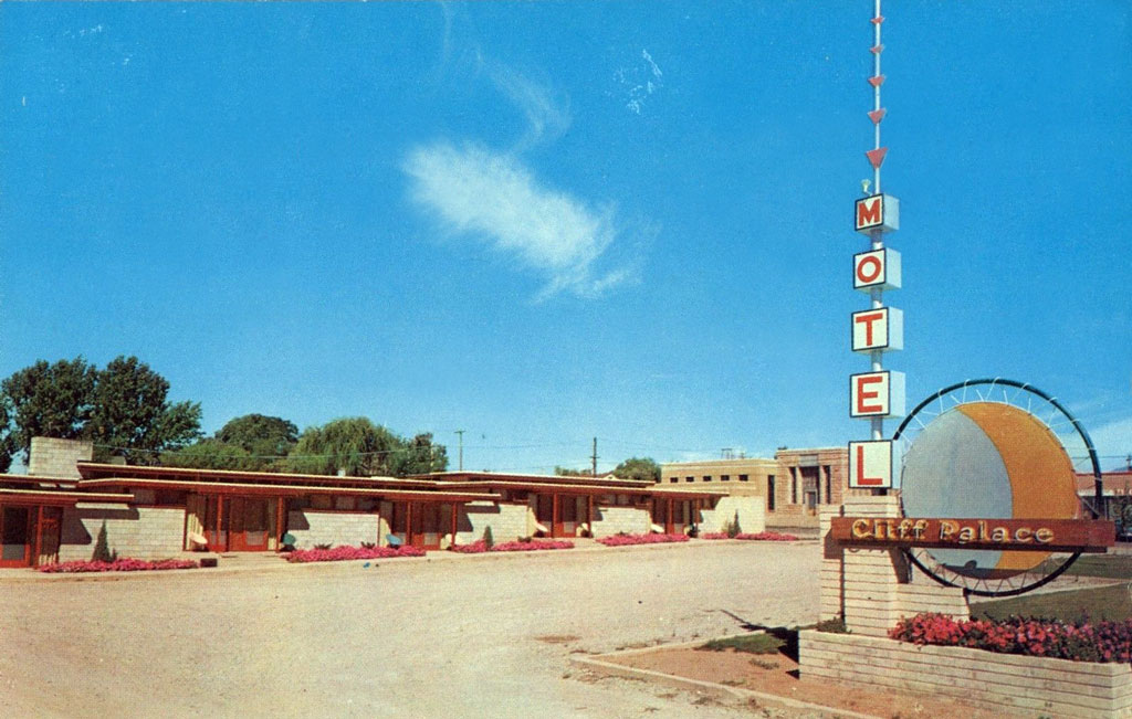 : postcard maybe printed in the 60’s
Cliff Palace Motel is located at the center of Blanding, Utah on 105 S Main St (US Hwy 191).
According to Utah Division of State History (UDSH), this prairie school style building was built in 1955[1].
Marvin Finlinson(1894 – 1972) and Margie Jeanette(1898 – 1994) Lyman built the motel[2]. Marvin was a son of Walter Clisbee Lyman(1863 – 1943) who founded the town. The motel architecture was designed by Margie’s brother Philip Hurst(1900 – 1976), who was said to be a student of Frank Lloyd Wright.
Cecil Arvin Wormell(1920 – 2013) succeeded the business in 1970[3].
The motel is named after the cliff dwelling located in nearby Mesa Verde National Park. Denise Lyman succeeded the business in 1984[4]. It is active today as Blue Sage Inn owned by Cheryl Bowers since 2020.
revised, Jul. 23, 2021
[1] UDSH Historic Building Search results;
[2] May 15, 1955 Marvin’s letter;
[3] Aug. 23, 1973 Salt lake Tribune;
[4] United States Business Database;
 : 1974-1975 Continental Telephone Company of Utah
2015-08-15 09:00
コメント(0)
Reminder of the 70's along Rio Grande 37 – Panguitch, Utah [Trackside Utah PA]
 : Main & Center, Panguitch, UT Sep. 15, 2014
Panguitch, settled in 1864, is a city in Garfield County, with a population of 1318 according to 1970 Census, 1520 according to 2010 Census.
The city is named after Paiute word meaning “big fish”. The city is never served by rail, but Rio Grande Motor Ways once served the city. Panguitch Historic District is listed on the National Register of Historic Places since 2006. The city is the gateway to Bryce Canyon National Park and Zion National Park.
Map below shows the location of 70’s remnants in Panguitch. Introduction for structure will follow this post.
2015-08-16 09:00
コメント(0)
Reminder of the 70's along Rio Grande 38 – Purple Sage Motel, Panguitch, Utah [Trackside Utah PA]
 : Panguitch, UT Sep. 14, 2014
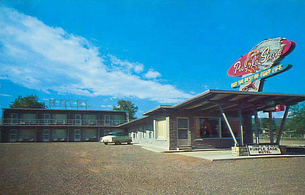 : postcard maybe printed in the 50’s
Purple Sage Motel is located at the center of Panguitch, Utah on 132 E Center St (US Hwy 89).
The motel was built in 1957 by Clement L.(1911 – 1997) and Irene Houston(1913 – 1999) McEwen[1]. It was later sold to George Dewey(1899 – 1969) and Eliza Ann(1908 – 1982) Moore. Today, Grant and LaRetta Olenslager own and manage the motel.
Purple Sage, also known as Salvia, is the plant native to western United States.
[1] SUU Digital Library photo and description;
 : Panguitch, UT Sep. 15, 2014
2015-08-17 09:00
コメント(0)
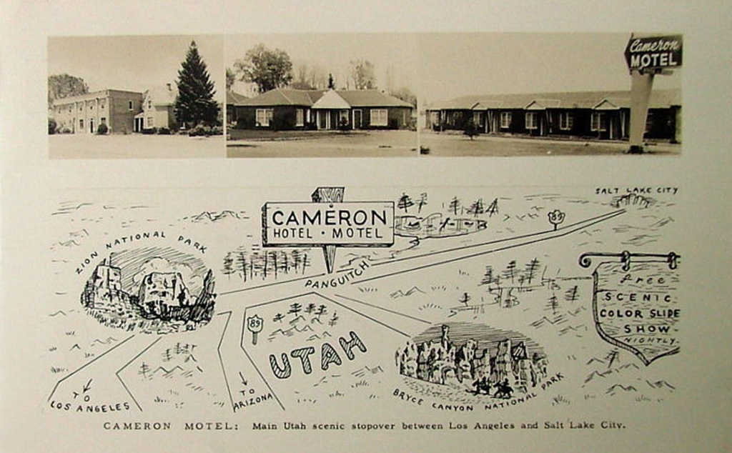
Reminder of the 70's along Rio Grande 39 – Cameron Motel, Panguitch, Utah [Trackside Utah PA]
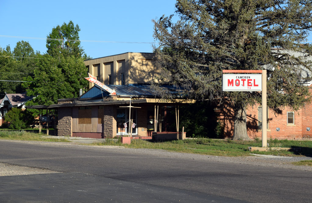 : Panguitch, UT Sep. 15, 2014
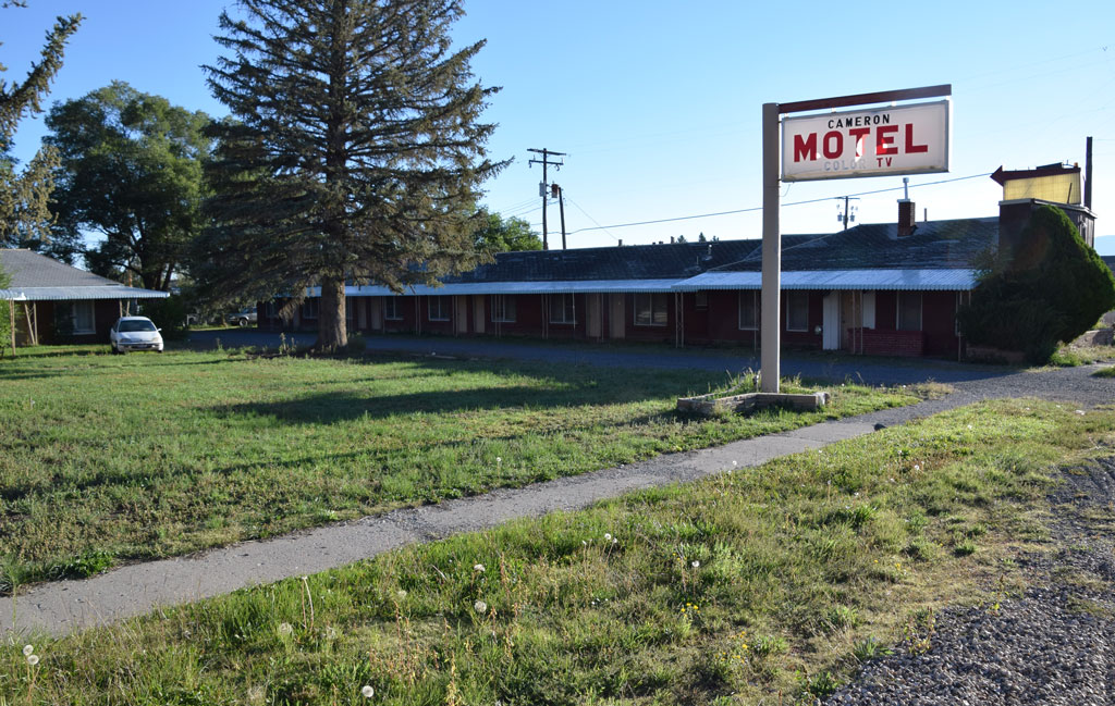 : Panguitch, UT Sep. 15, 2014
Cameron Motel was located at the center of Panguitch, Utah on 90 W Center St.
According to Utah Division of State History (UDSH), the hotel section was built in 1890, and the motel section was built in 1950[1]. In the Rio Grande promotional film Detour to the Wonderland maybe shot in the 50's appears the motel.
According to Althea Worthen, Joseph(1854 – 1941) and Lillis Minerva(1858 – 1942) Cameron built the hotel[2]. Joseph’s brother Ben, Ben’s sons Bennie and Allen, Allen’s daughter Margaret and Charles B. Farmer succeeded the business in turn. Another daughter Bertha and Bernett Hendryx also participated in the business. Gale Hendricks seems the latest owner at least in 2003[3].
The complex was composed of 17 brick construction motel units, 3 car garage and 22 hotel units with Trailway bus station, making $94,000 a year in 1967[4]. Unfortunately, it is no longer in business.
revised, Oct. 11, 2016
[1] UDSH Historic Building Search results;
[2] Althea Worthen Letter to LaRee Porter;
[3] Nov. 6, 2003 Garfield County News
[4] Sep. 14, 1967 Garfield County News
 : postcard maybe printed in the 50’s
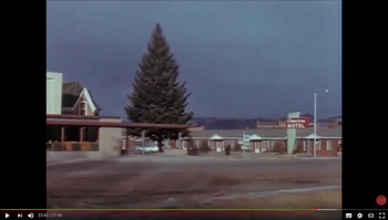 : Cameron Motel appeared in D&RGW promotional film
2015-08-18 09:00
コメント(0)
Reminder of the 70's along Rio Grande 40 – Circleville, Utah [Trackside Utah PA]
 : Main & Center, Circleville, UT Sep. 15, 2014
Circleville, founded in 1864, is a town in Piute County, with a population of 443 according to 1970 Census, 547 according to 2010 Census.
The town is named after the shape of the valley in which it is located: completely circled by mountains except the Sevier River. The town is never served by rail, but Rio Grande Motor Ways once served the town.
Map below shows the location of 70’s remnants in Circleville. Introduction for structure will follow this post.
2015-08-21 09:00
コメント(0)
Reminder of the 70's along Rio Grande 41 – Country Motel, Circleville, Utah [Trackside Utah PA]
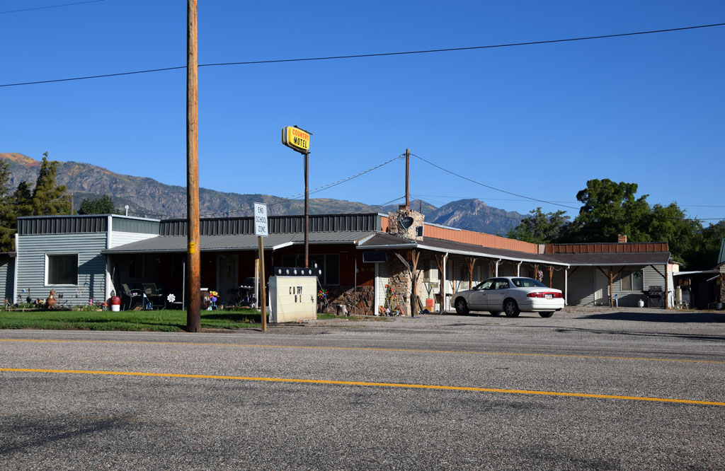 : Circleville, UT Sep. 15, 2014
Country Motel is located at the center of Circleville, Utah on 30 W Main St (US Hwy 89).
The four units motel was built maybe in the 40’s[1]. It is still active today, owned by Larry and Glenda Reitz since 1980[2].
[1] Jun. 20, 1947 Piute County News
[2] Sep. 27, 1988 Deseret News;
2015-08-22 09:00
コメント(0)
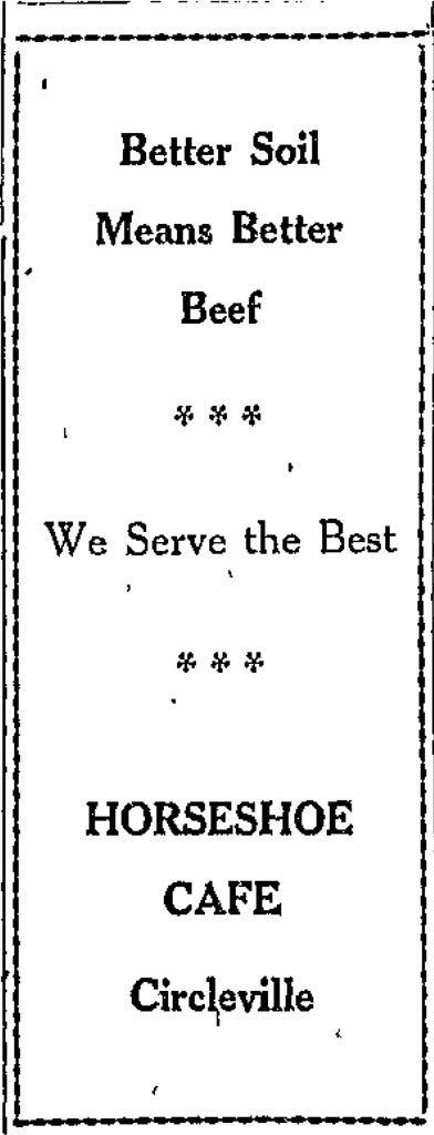
Reminder of the 70's along Rio Grande 42 – Horseshoe Cafe and Motel, Circleville, Utah [Trackside Utah PA]
Horseshoe Cafe and Motel was located at the east entrance of Circleville, Utah on E Main St (US Hwy 89).
Morris Johnson built the motel in 1947[1, 2]. Clarence R. and Alice Nay(1906 – 1995) LeFevre succeeded and managed it until 1965[3]. Unfortunately, it is no longer in business.
[1] Jul. 4, 1947 Piute County News
[2] 1949 legal text;
[3] May 27, 1995 Deseret News;
 : Feb. 20, 1948 Piute County News
2015-08-23 09:00
コメント(0)
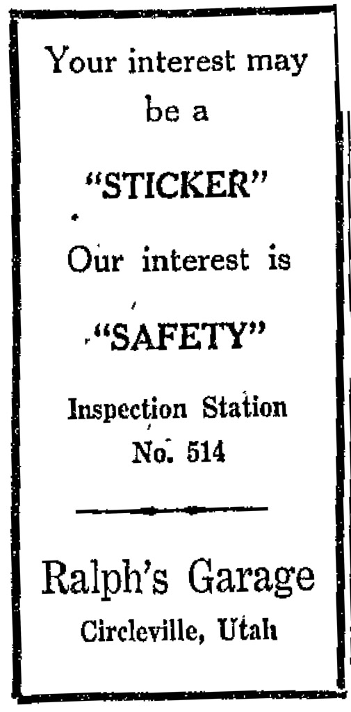
Reminder of the 70's along Rio Grande 43 – Ralph’s Garage, Circleville, Utah [Trackside Utah PA]
 : Circleville, UT Sep. 15, 2014
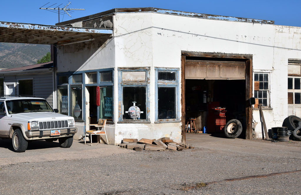 : Circleville, UT Sep. 15, 2014
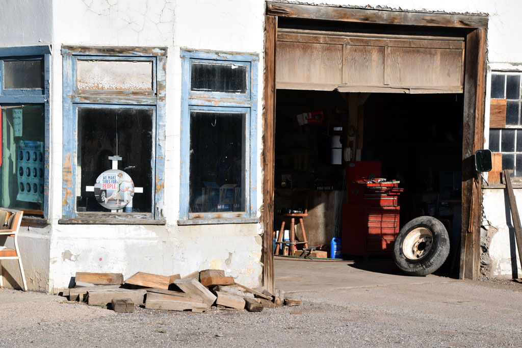 : Circleville, UT Sep. 15, 2014
Ralph’s Garage was located at the center of Circleville, Utah on 20 W Main St (US Hwy 89).
Ralph Aloys Stapel(1909 – 1979) established the garage maybe in the 40’s[1]. It is still active today as Steve’s Service owned by Steve Bird.
It was like full detailed Woodland Scenics structures when I visited. Notice the still working garage door made of wood.
[1] Jun. 20, 1947 Piute Couty News
 : Jun. 20, 1947 Piute County News
2015-08-24 09:00
コメント(0)
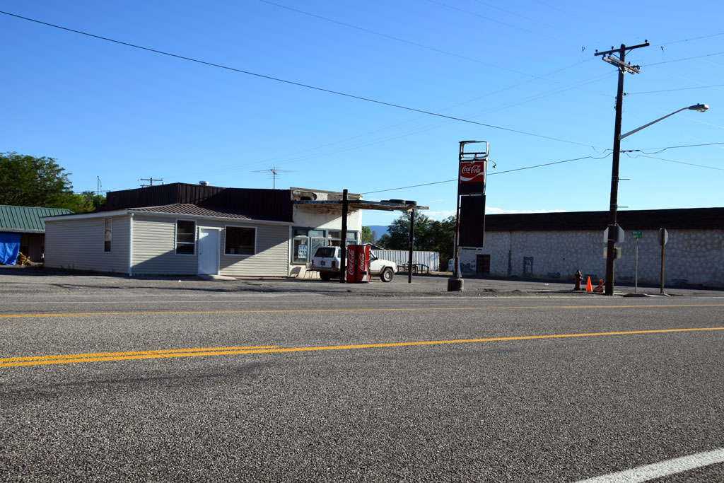
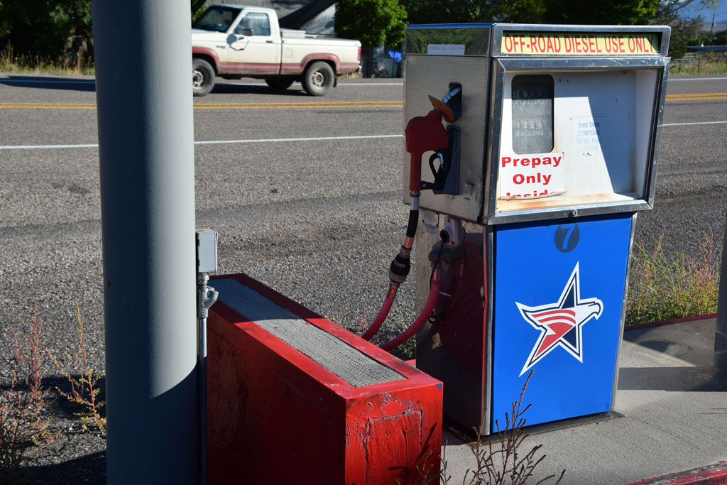
Reminder of the 70's along Rio Grande 44 – Circleville Station, Circleville, Utah [Trackside Utah PA]
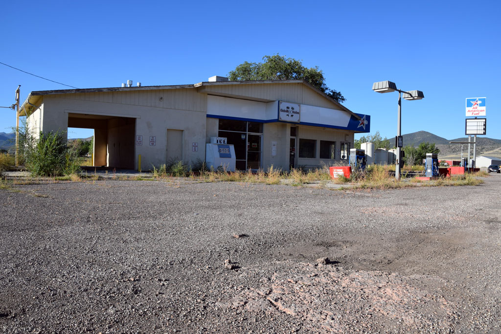 : Circleville, UT Sep. 15, 2014
Circleville Station was a gas service station, grocery and car wash located at the west entrance of Circleville, Utah on 193 W Main St (US Hwy 89). Paul Edward(1941 – 2003) and Veda Mae(1921 – 2003) Hampton was the owner[1]. Unfortunately, it is no longer in business.
[1] Circleville Station Business Database;
 : Circleville, UT Sep. 15, 2014
 : Circleville, UT Sep. 15, 2014
2015-08-25 09:00
コメント(0)
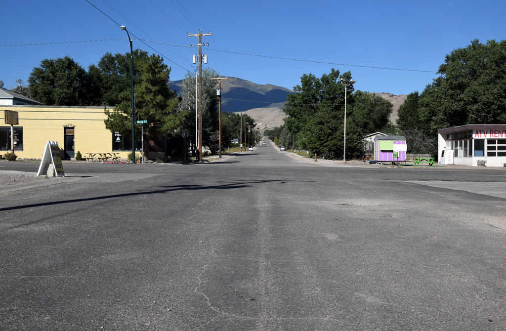
Reminder of the 70's along Rio Grande 45 – Junction, Utah [Trackside Utah PA]
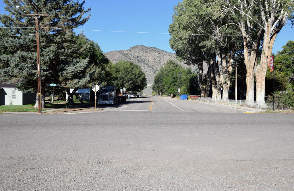 : Main & Center, Junction, UT Sep. 15, 2014
Junction, settled in 1880, is a town in Piute County, with a population of 135 according to 1970 Census, 191 according to 2010 Census.
The town is named after the location where Sevier River and East Fork meet. The town is never served by rail, but Rio Grande Motor Ways once served the town.
Map below shows the location of 70’s remnants in Junction. Introduction for structure will follow this post.
2015-08-28 09:00
コメント(0)
Reminder of the 70's along Rio Grande 46 – Post Office, Junction, Utah [Trackside Utah PA]
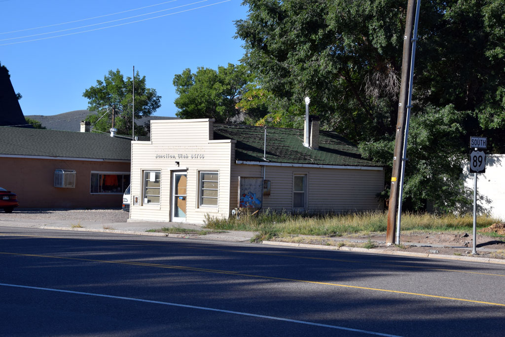 : Junction, UT Sep. 15, 2014
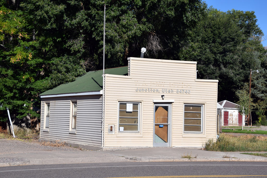 : Junction, UT Sep. 15, 2014
Post Office was located at the center of Junction, Utah on 60 S Main St (US Hwy 89).
According to Utah Division of State History (UDSH), this one part block commercial building was built in 1920[1].
Unfortunately, the post office was moved to 500 N Main St in 1997, and the structure is vacant since then[2].
[1] UDSH Historic Building Search results;
[2] Piute History web page;
2015-08-29 09:00
コメント(0)
Reminder of the 70's along Rio Grande 47 – Junction General Store, Junction, Utah [Trackside Utah PA]
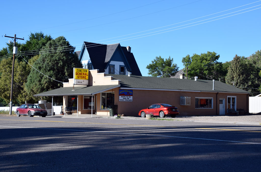 : Junction, UT Sep. 15, 2014
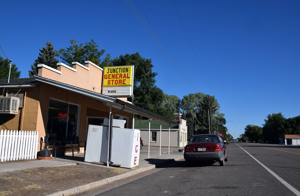 : Junction, UT Sep. 15, 2014
Junction General Store is located at the center of Junction, Utah on 70 S Main St (US Hwy 89).
According to Utah Division of State History (UDSH), this one part block commercial building was built in 1950[1].
Lawrence Gilbert(1927 – 1986) and Catherine Ellen(1930 – 2012) Lopshire owned and operated the store between 1974 and 1981[2]. Larry Proctor might have succeeded the business in the 80’s[3]. It is still active today, owned and operated by Jodi Barnson since 2007[4].
[1] UDSH Historic Building Search results;
[2] Catherine Ellen Rauch Lopshire obituary;
[3] Jun. 4 1984 Deseret News;
[4] Bizapedia page;
2015-08-30 09:00
コメント(0)
Reminder of the 70's along Rio Grande 48 – Marysvale, Utah [Trackside Utah PA]
 : Main & Center, Marysvale, UT Sep. 15, 2014
Marysvale, settled in 1863, is a town in Piute County, with a population of 354 according to 1970 Census, 408 according to 2010 Census.
It is said that the name of the town is a euphonious terms of “Merry Vale”. The town was once the terminus of D&RGW Marysvale Branch, went out of service in 1983 and formally abandoned in 1986. Depot itself was retired in 1964.
Map below shows the location of 70’s remnants in Marysvale. Introduction for structure will follow this post.
2015-09-04 09:00
コメント(0)
Reminder of the 70's along Rio Grande 49 – Marysvale Motel 4-U, Marysvale, Utah [Trackside Utah PA]
 : Marysvale, UT Sep. 15, 2014
Marysvale Motel 4-U is located at the center of Marysvale, Utah at 240 N Main St (US Hwy 89).
Thello Darwin(1914 – 1976) and Louise Cuff(1916 – 2003) Bay purchased the motel in 1953[1]. Today, their daughter Mary Louise and David Pratz manage the motel.
[1] April 9, 2006 Salt Lake Tribune;
2015-09-06 09:00
コメント(0)
Reminder of the 70's along Rio Grande 50 – Sportsman’s Motel and Cafe, Marysvale, Utah [Trackside Utah PA]
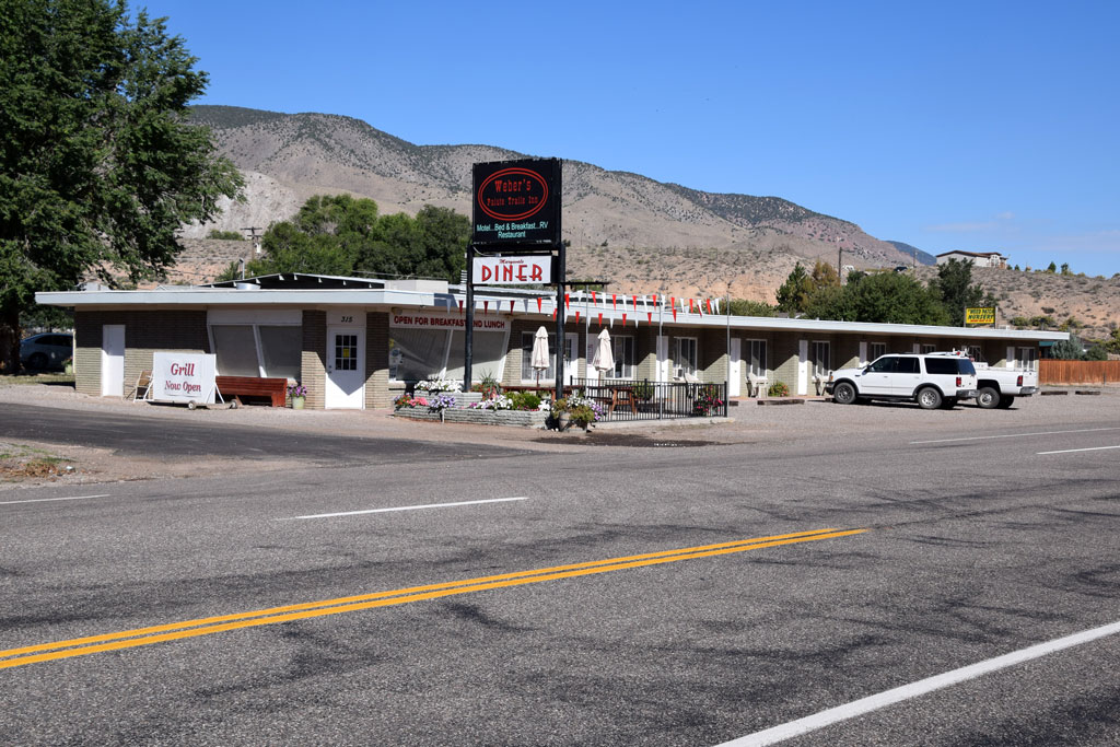 : Marysvale, UT Sep. 15, 2014
Sportsman’s Motel and Cafe was located at the north entrance of Marysvale, Utah at 315 N Main (US Hwy 89).
This structure seems relatively new, maybe built in the 60’s or the 70’s. We cannot see anything in the 1953 USGS aerial photo. Center portion of the structure can be seen in the 1973 USGS aerial photo.
According to Mar. 27, 2012 Richfield Reaper, Raymond(1923 – 2012) and Aileen Marie Shepherd(1927 – 2013) Furnal owned and managed the motel and cafe since 1985[1]. Michael Troy Madsen succeeded the business in 1997[2]. It is still active today as Weber’s Paiute Trails Inn, owned and managed by Bill Weber.
[1] Ray Furnal obituary;
[2] Bizapedia page;
2015-09-07 09:00
コメント(0)
Reminder of the 70's along Rio Grande 51 – Candy Mountain Motel, Marysvale, Utah [Trackside Utah PA]
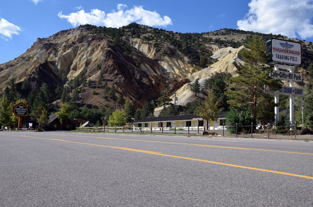 : Marysvale, UT Sep. 15, 2014
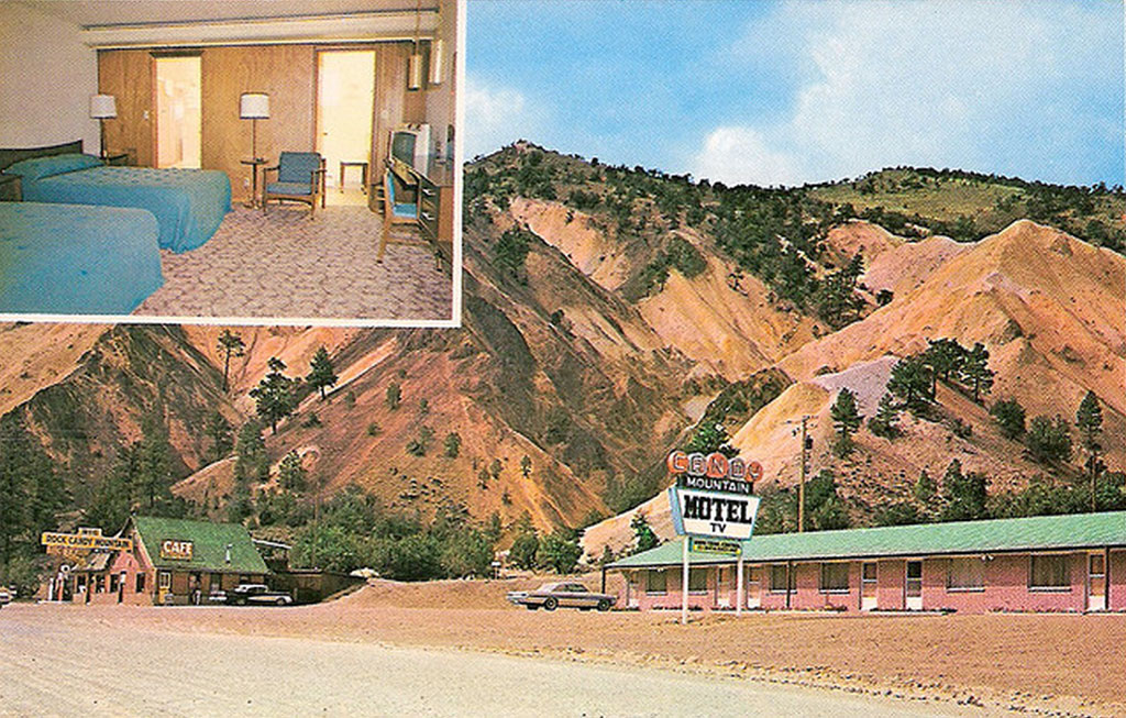 : postcard maybe printed in the 60’s
Candy Mountain Motel is located between Marysvale and Sevier, Utah on 4550 US Hwy 89.
Ben J.(1897 – 1991) and LaRue(1905 – 1974) Dieringer built the motel in 1937[1]. They managed the motel, gas station, gift shop, restaurant and campground for more than 30 years. In 1974, John Herbert(1940 – 2014) and Gloria Kay Gibson Gledhill succeeded the business and ran the resort for next 20 years[2]. Today, it is owned and operated by Terry Briggs as a part of Big Rock Candy Mountain Resort since 2000[3].
Rio Grande Marysvale Branch ran opposite the Beaver Creek in front of the motel. They are now building Caboose Village using cabooses, boxcars and passenger cars[4].
[1] Dec 18, 1991 Deseret News;
[2] John Gledhill obituary;
[3] Jul. 13, 2014 Daily Herald;
[4] Caboose Village web page;
* follow-up report, Mar. 31, 2016 Daily Herald;
2015-09-11 09:00
コメント(0)
Reminder of the 70's along Rio Grande 52 – Joseph, Utah [Trackside Utah PA]
 : Main & State, Joseph, UT Sep. 15, 2014
Joseph, settled in 1871, is a town in Sevier County, with a population of 125 according to 1970 Census, 344 according to 2010 Census.
The town is named after Joseph Young, who was a local leader of The Church of Jesus Christ of Latter-day-Saints. The town was once served by D&RGW Marysvale Branch, went out of service in 1983 and abandoned in 1986; The 26 cars siding was located a mile east of the town, opposite the Sevier River.
 : Main & State, Joseph, UT Sep. 15, 2014
2015-09-18 09:00
コメント(0)
Reminder of the 70's along Rio Grande 53 – Elsinore, Utah [Trackside Utah PA]
 : Elsinore, UT Sep. 15, 2014
Elsinore, settled in 1874, is a town in Sevier County, with a population of 357 according to 1970 Census, 847 according to 2010 Census.
The town is named after the namesake town in Denmark. The town was once served by D&RGW Marysvale Branch, went out of service in 1983 and abandoned in 1986. Depot itself was retired in 1953.
The white shack with the red trimming in the photo above is one of the Burger Bar Model drive-in produced by Valentine manufacturing, Inc in the 60’s[1]. It is now operated as the sub sandwich parlor The Icebox[2].
Map below shows the location of 70’s remnants in Elsinore. Introduction for structure will follow this post.
[1] history of Valentine Diners;
[2] The icebox web page;
2015-09-19 09:00
コメント(0)
Reminder of the 70's along Rio Grande 54 – Sugar Factory, Elsinore, Utah [Trackside Utah PA]
 : Elsinore, UT Sep. 15, 2014
Sugar Factory is located at the easternmost of Elsinore, Utah on Utah State Route 118.
Sugar beets were once the principal product of the region. Many processing factories were built in this area. One of them, Elsinore Factory was completed in 1911. Unfortunately, however, it was closed in 1929 due to blight[1,2]. The Factory is the only surviving sugar factory structure in the area and is listed on the National Register of Historic Places since 1980.
Another sugar factory nearby, Gunnison Valley Sugar Company’s Centerfield Factory was completed in 1918. The Factory was served by the Rio Grande spur diverting west from the main at Spearmint. 1951 Rio Grande system route map shows the factory as “Gunnison Sugar Fact’y”. Unfortunately, however, the Factory was closed in 1961 and scrapped in 1966.
[1] Oct. 26, 1911 Salt Lake Telegram
[2] Jan. 4, 1929 Richfield Reaper
2015-09-20 09:00
コメント(0)
Reminder of the 70's along Rio Grande 55 – Richfield, Utah [Trackside Utah PA]
 : Center & 600 E St, Richfield, UT Sep. 15, 2014
Richfield, settled in 1864, is a city in Sevier County, with a population of 4471 according to 1970 Census, 7551 according to 2010 Census.
The city is named after its fertile soil rich land. The city was once served by D&RGW Marysvale Branch, went out of service in 1983 and abandoned in 1986. Depot at Center & 600 E St was retired in 1985.
Map below shows the location of 70’s remnants in Richfield. Introduction for structure will follow this post.
2015-09-25 09:00
コメント(0)
Reminder of the 70's along Rio Grande 56 – New West Motel, Richfield, Utah [Trackside Utah PA]
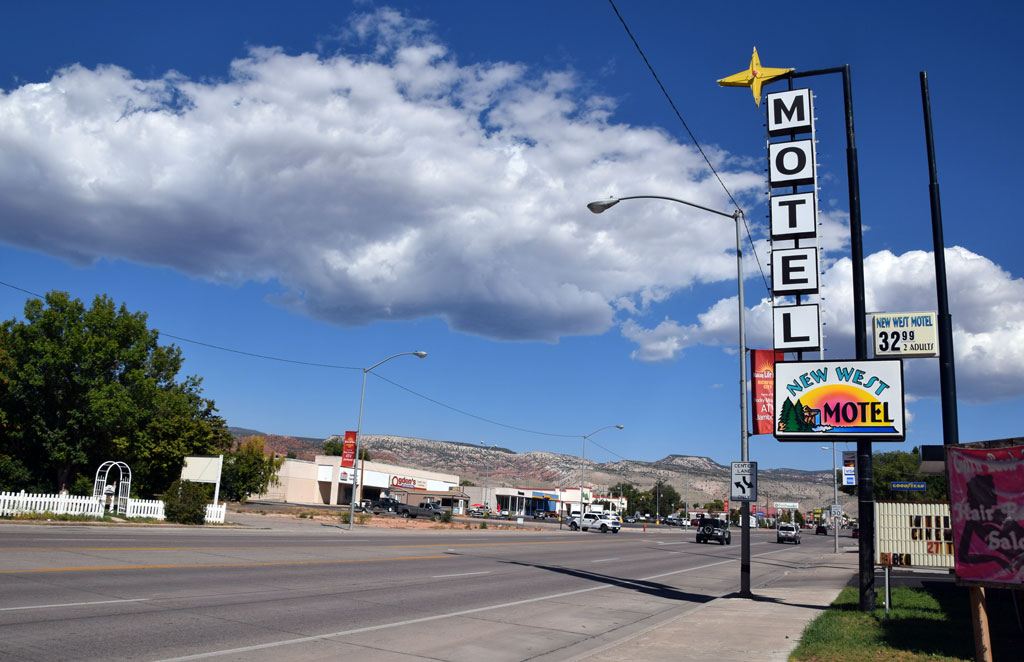 : Richfield, UT Sep. 15, 2014
New West Motel is located at the south entrance of Richfield, Utah on 447 S Main St (US Hwy 89).
I couldn’t identify the structure in the 1953 USGS aerial photo. But it has the 50’s to the 60’s taste. According to Feb. 18, 2007 Deseret News, David Carlyle(1924 – 2007) and Iris Belle Hansen(1916 – 1994) Simonsen owned and managed the motel between 1972 and 1986[1]. It is still active today, owned by Frank Bradley Ford.
[1] Carlyle Simonsen obituary;
 : Richfield, UT Sep. 15, 2014
2015-09-27 09:00
コメント(0)
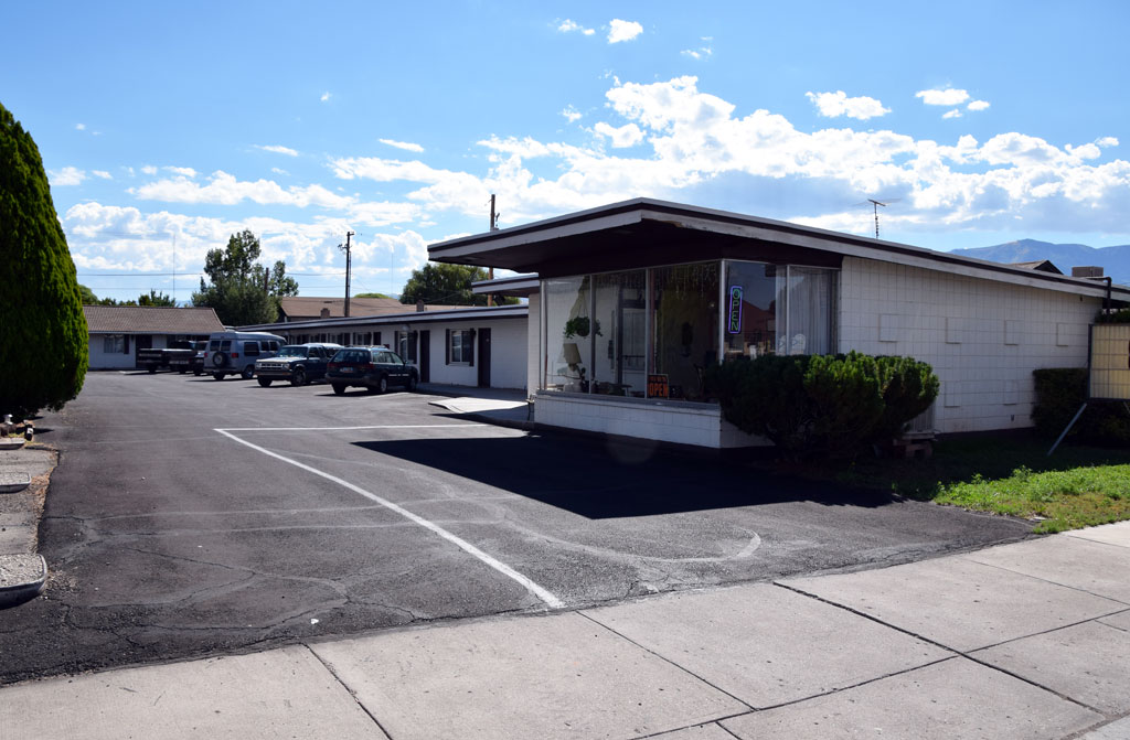
Reminder of the 70's along Rio Grande 57 – Mountair Motel, Richfield, Utah [Trackside Utah PA]
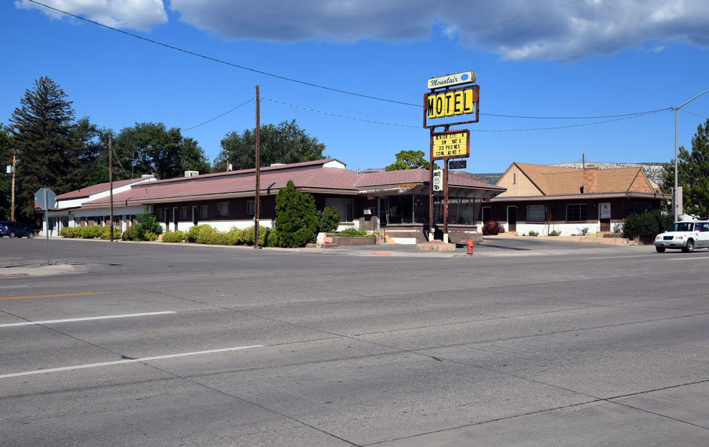 : Richfield, UT Sep. 15, 2014
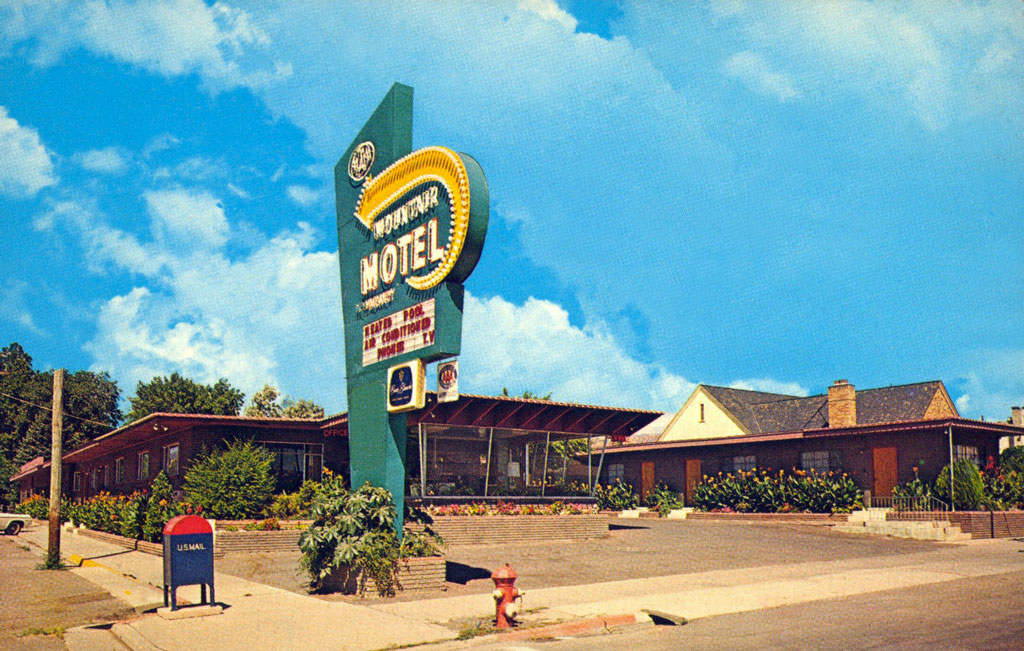 : postcard maybe printed in the 70’s
Mountair Motel was located at the center of Richfield, Utah at 190 S Main St (US Hwy 89).
The structure is barely identified in the 1953 USGS aerial photo. Lee Daines(1924 – 1997) and Salome Braegger(1924 – 2011) Eaton owned and managed the motel from 1973 to 1983[1]. Their son Harold Grant Eaton succeeded the business. Unfortunately, however, it seems closed recently according to Yelp.
[1] Lee D. Eaton obituary;
2015-09-28 09:00
コメント(0)
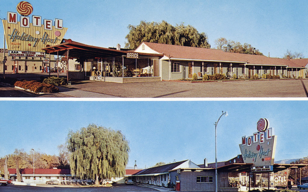
Reminder of the 70's along Rio Grande 58 – Motel Holiday Host, Richfield, Utah [Trackside Utah PA]
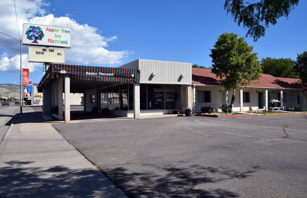 : Richfield, UT Sep. 15, 2014
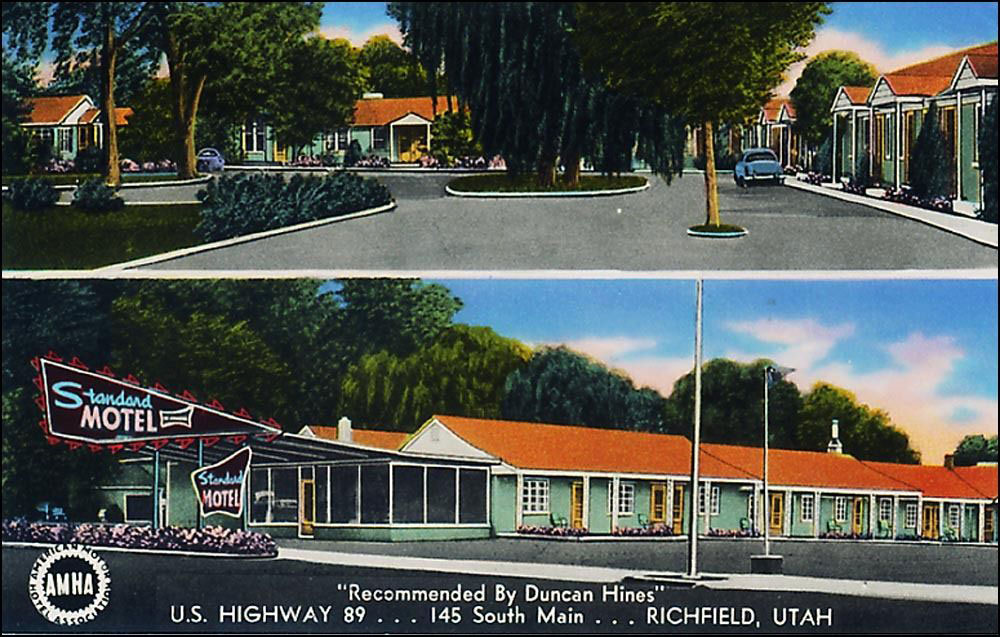 : Standard Motel postcard maybe printed in the 50’s
Motel Holiday Host was located at the center of Richfield, Utah at 145 S Main St (US Hwy 89).
According to Utah Division of State History (UDSH), this commercial structure was built in 1945[1].
In 1960, Ronald Dwain(1926 – 2001) and Donna Vee(1929 – 2012) Christensen bought the by-then Standard Motel and renovated it to Motel Holiday Host[2]. Their son Terry Lee Christensen succeeded the business to this day as Apple Tree Inn.
[1] UDSH Historic Building Search results;
[2] Ronald D. Christensen obituary;
 : Motel Holiday Host Postcard maybe printed in the 60’s
2015-09-29 09:00
コメント(0)
Reminder of the 70's along Rio Grande 59 – Sigurd, Utah [Trackside Utah PA]
 : Main & Center, Sigurd UT Sep. 15, 2014
Sigurd, settled in 1874, is a town in Sevier County, with a population of 291 according to 1970 Census, 429 according to 2010 Census.
US Post Office named the town Sigurd, the name of the legendary Swedish king, because of many Danish people in the erea. The town was once served by D&RGW Marysvale Branch, went out of service in 1983 and abandoned in 1986.
The spur diverting east from the depot served the wallboard factory in the town to ship its products. 1951 Rio Grande system route map shows the spur and the factory as “Jumbo Mill”. Depot itself was retired in 1978.
Map below shows the location of 70’s remnants in Sigurd. Introduction for structure will follow this post.
2015-10-02 09:00
コメント(0)
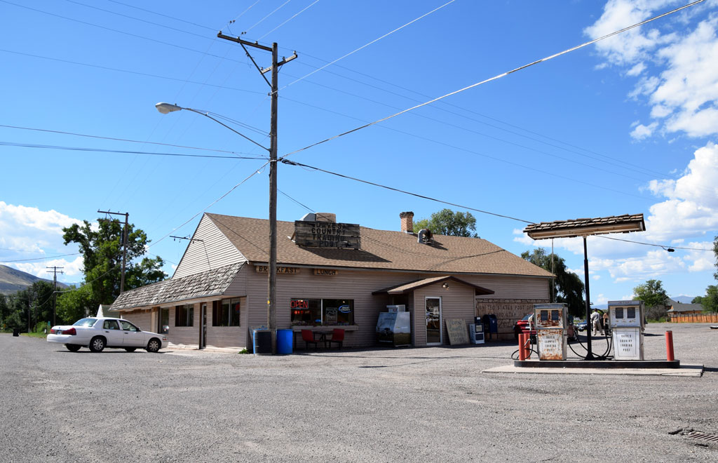
Reminder of the 70's along Rio Grande 60 – Sigurd mercantile Co. and Post Office, Sigurd, Utah [Trackside Utah PA]
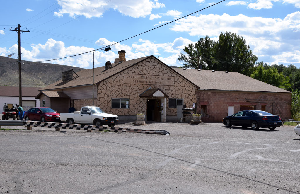 : Sigurd, UT Sep. 15, 2014
Sigurd mercantile Co. and Post Office was located at the center of Sigurd, Utah on 20 S Main St. Both were sharing a one-story structure back to back.
Ole(1869 – 1926) and Ephraim(1878 – 1928) Dastrup established the Sigurd mercantile Co. and built the general merchandise store/warehouse complex in 1906[1].
Claude Sevy(1890 – 1955) owned and managed the store in the 20’s[2]. His father, Reuben Warren Sevy(1863 – 1941) and/or Carl Spencer Sevy(1900 – 1987) succeeded the business in the 30’s, maybe in 1932[3].
Recent structure was built in 1955[4]. David Ray and Neoma B. Fordham own and operate the store since 1988 as Dave’s Country Trading Post[5]. The Trading Post is consisted of grocery and cafe. The two Wayne E-732 pumps in front of the store seemed out of service.
[1] Jul. 19, 1906 Richfield Reaper
[2] Roger Warren Sevy, Sigurd - a memoir;
[3] Sep. 29, 1941 Salt Lake Tribune
[4] Property information on web;
[5] Jul. 31, 2005 Salt Lake Tribune;
 : Sigurd, UT Sep. 15, 2014
 : Sigurd, UT Sep. 15, 2014
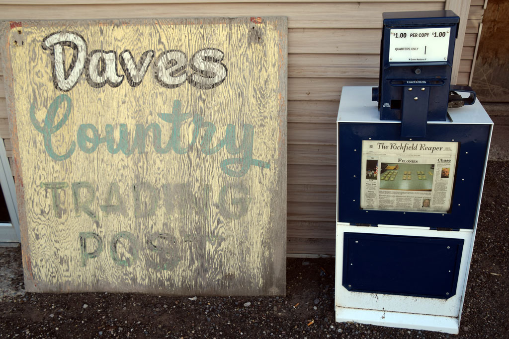 : Sigurd, UT Sep. 15, 2014
2015-10-03 09:00
コメント(0)
arx_Ph.D. さん
Here represented are my model railroad enthusiasm generated from the photos I took during my childhood at Knoxville, Tennessee, or from the photos I took during my recent trips.
I'm a retired professor of design, meanwhile a part-time associate at the architectural design office in Osaka, Japan where I live with my wife.


