Some Southwestern Sands, part 3 [Trackside Colorado PA]
I'm collecting the “Sands Motel”s.
By searching “Sands Motel” at Google maps, we notice that “Sands Motel”s are mostly old, and are unevenly located in the United States: mostly on both seaboards and in the southwest. That is to say, these vintage motels are one of the vanishing icons of the particular region we should record.
Here is the example located in the southwest:
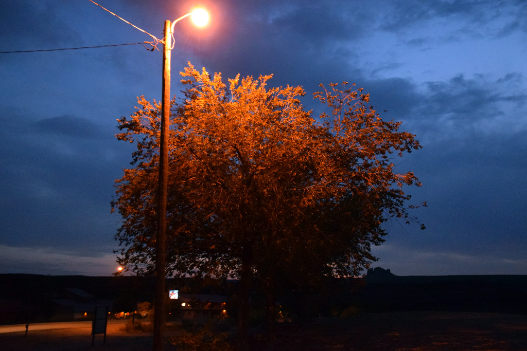
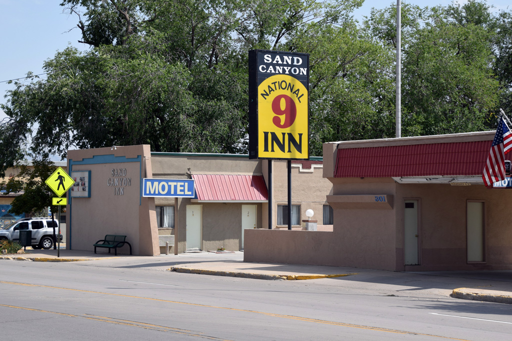 : Cortez, CO. Sep. 8, 2017
Sand Canyon Inn at 301 W Main St, Cortez was operated as Travelers Motor Lodge in its heydays. The name “Sand” seems registered in 2013[1].
The town of Cortez, Colorado is the gateway to the Mesa Verde National park, Canyons of the Ancients National Monument, Yucca House National Monument and Hovenweep National Monument.
[1] company information web page for Tryksha Inc;
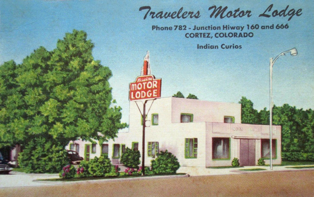 : postcard maybe printed in the 40’s
2018-04-20 09:00
コメント(0)
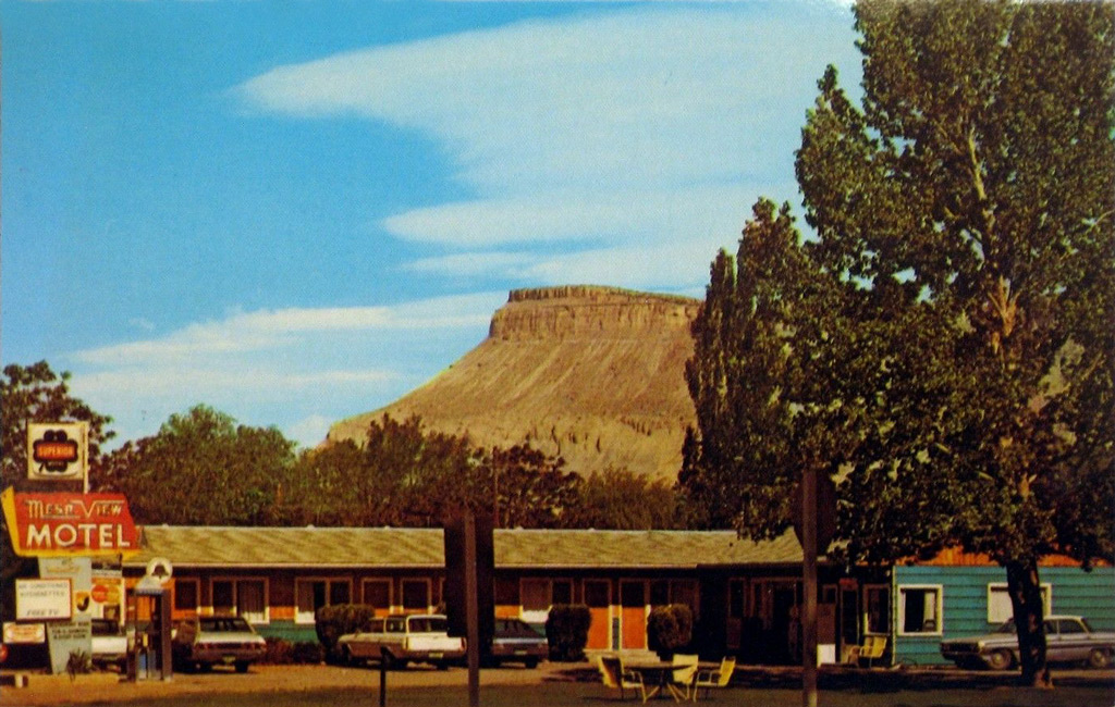
Reminders of the 70’s along Rio Grande 88 − Mesa View Motel, Palisade [Trackside Colorado PA]
 : Sep. 11, 2017
Mesa View Motel is located at the center of the town of Palisade, Colorado on 424 W 8th St facing old US Hwy 50 & 6.
Robert Randal(1927 – 2016) and Vera Lois(1929 – 2010) Kittel built the motel in 1953 and operated it until 1964[1]. William T. and Adda Mae(1925 – 2007) Lowrance succeeded the business from 1970 to 1985[2]. It was owned by Terry Hammer since 1994[3]. In 2019, it became Spoke and Vine Motel owned by Jeff Snook and Jody Corey[4].
The mesa shown behind the motel is the Mt. Garfield; the iconic outcrop of the Book Cliffs overlooking Grand Valley. My dad also took the photo 47 years ago.
revised, Sep. 20, 2019
[1] Jan. 6, 2010 Daily Sentinel;
[2] Adda Mae Lowrance obituary;
[3] manta web page;
[4] Spoke and Vine Motel web page;
 : postcard maybe printed in the 70’s
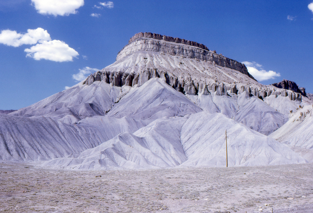 : Aug. 1971
 : Sep. 11, 2017
2018-06-22 09:00
コメント(0)
Monte Vista Industry Trackage [Trackside Colorado PA]
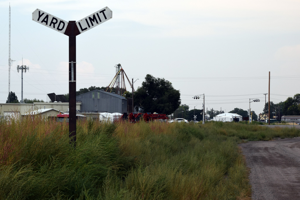 : Monte Vista yard limit
Rio Grande only defined the word siding in its rulebook but used the word industry trackage and lead in its timetable: the word spur was designated to particular industry trackage like Rocky Spur at MP18.0 or C. V. Spur at MP615.8 between Wellington and Price.
Here, I’ll represent the former D&RGW/ now SLRG Industry Trackage at Monte Vista, Colorado, one of the surviving industry trackage in a town, as a record.
 : 1960 USGS aerial photo of the industry trackage with trackside industries identified in 2017
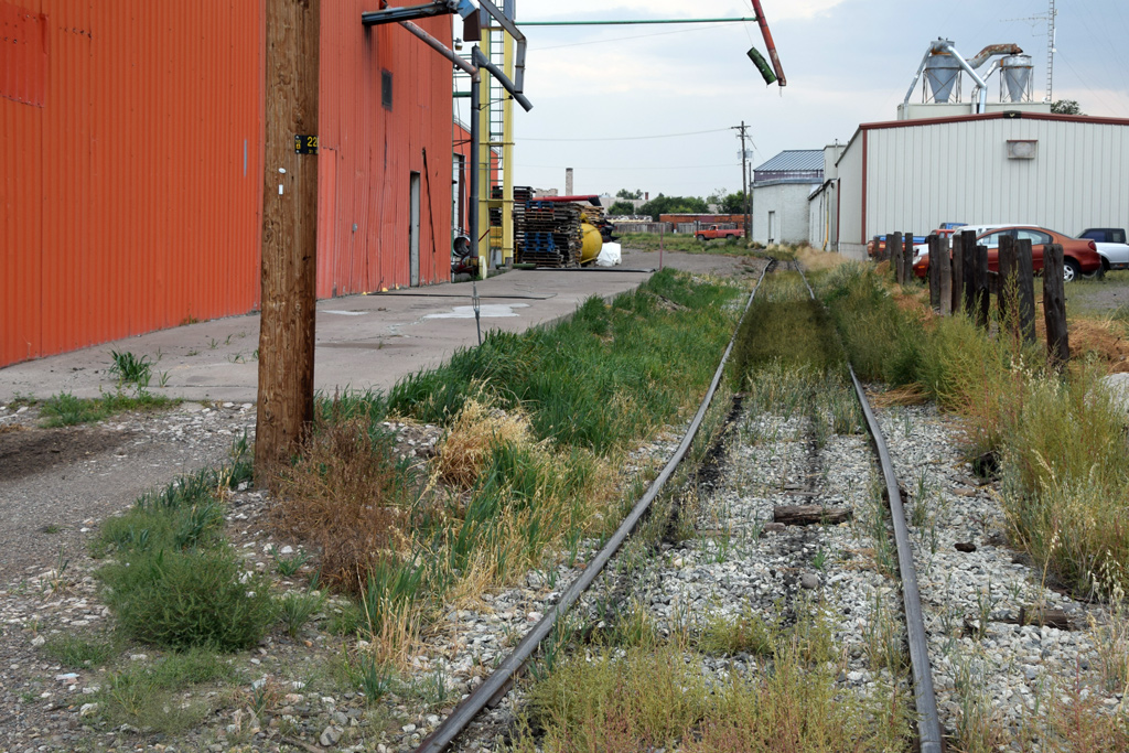
The Monte Vista Industry Trackage (1997 UP Zone-Track-Spot 150, Coors Lead) diverts from the main track within the yard limit, west of depot team track switch, and curves cross the Acequia Dr at North Washington St. The facility now occupied by U.S. AutoForce, former Premier Tire Terminal, still retains loading gate facing the curved track.
 : crossing Acequia Dr
Continuing north, the trackage stretches between facilities: former A. E. Staley Manufacturing Co. (ZTS 712, Staley) now occupied by brightly painted Colorado Seed Co. and San Luis Valley Auto Repair. Colorado Seed still retains the loading spout.
 : looking south from BPW Way crossing
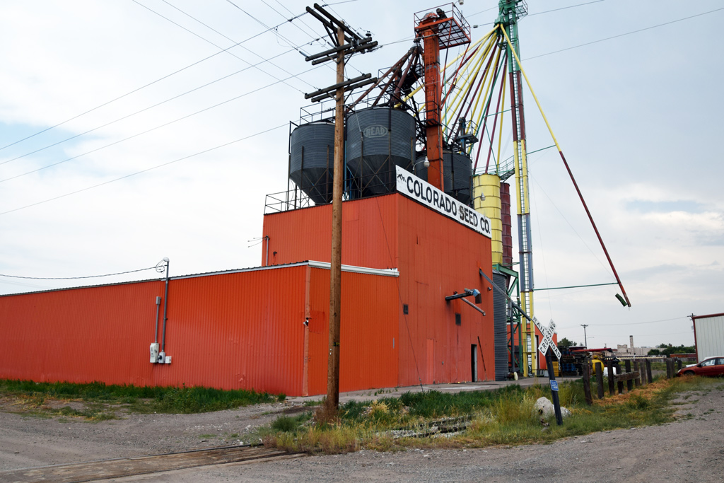 : Colorado Seed
North of BPW Way crossing, the trackage draws reverse curves next to the facility now occupied by San Luis Valley Precast. End of the reverse curves locates a switch diverting a siding for the facilities now occupied by MountainKing Potatoes (ZTS 713, Mountain King Potato). Switch stand is barely seen in the photo below.
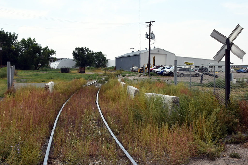 : looking north from BPW Way crossing
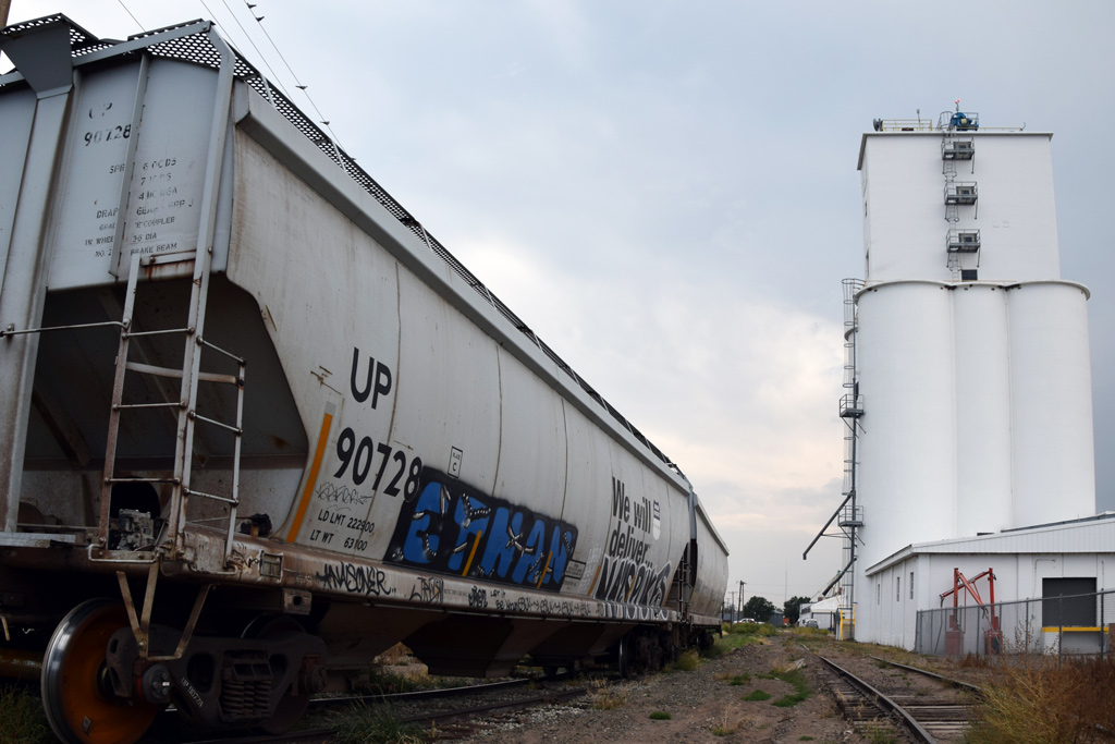
In 1960, the end of the industry trackage at Schaefer Rd served the grain elevator now occupied by Coors. In 2014, the trackage extended further north to the new huge Coors elevator (ZTS 714, Coors)[1]. The trackage at the right in the photo below is the former end of the industry trackage, and the trackage with hopper cars is the lead to the new facility.
 : looking south from Schaefer Rd crossing
[1] “Miller-Coors – Barley Storage Facility”, Halverson Company web page;
* 1992 photo of D&RGW GP60 #3155 switching ZTS-712 by James Belmont;
* 2012 photo of SLRG B39-8E #8527 switching ZTS-712 by Chris Starnes;
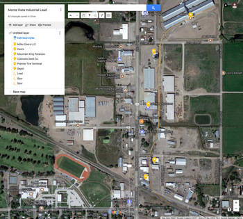 : Google map of Monte Vista Industry Trackage
2018-07-13 09:00
コメント(0)
Reminders of the 70’s along Rio Grande 90 − El Palomino Motel, Grand Junction [Trackside Colorado PA]
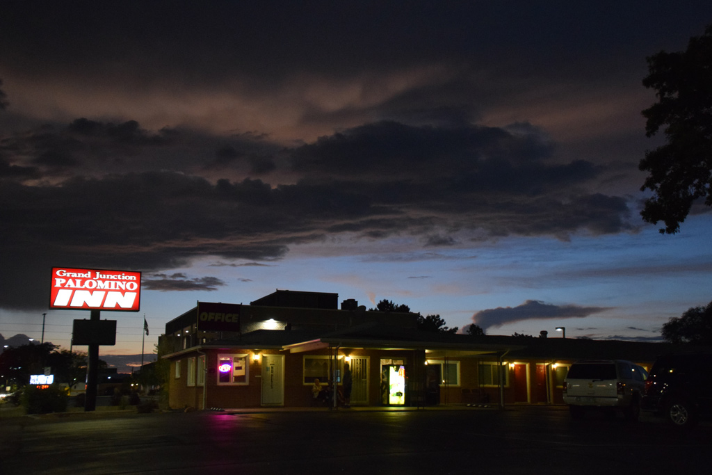 : Sep. 10, 2017
El Palomino Motel was located at the center of Grand Junction, Colorado, on 2400 North Ave facing old US Hwy 50 & 6. Palomino means white horse in Spanish.
Robert and Elberta V.(1919 – 2013) Senn purchased the motel in 1956 and operated it for more than 50 years[1]. Today, it is owned and operated by Harriet Kowalczyk as Grand Junction Palomino Inn[2].
[1] Mar. 21, 2013 Daily Sentinel;
[2] manta web page;

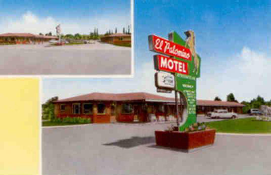 : postcard maybe printed in the 50's
2018-11-09 09:00
コメント(0)
Grand Junction Industry Trackage – part 1 [Trackside Colorado PA]
 : end of the lead at S 5th St
These are the Rio Grande original facilities remained along its route in Colorado; industry trackage at Grand Junction.
The Rio Grande only defined the term "siding" in its Rules and Regulations of the Operating Department[1]. But the railroad also used the terms "spur", "industry trackage", and "lead" in its Special Time-Table Rules: the term "spur" was designated to relatively long particular industry trackage like Rocky Spur at MP18.0 or C. V. Spur at MP615.8 between Wellington and Price[2].
In this way, the proper use of these terms remained uncertain for me. Accordingly, I chose the term "industry trackage" for the title of this post because of its broad sense.
Anyhow, the Rio Grande at Grand Junction had quite a number of customers served by way of siding, spur, industry trackage, or lead.
As of Dec. 4, 2018, Trains News Wire, the introducing of Precision Scheduled Railroading at Union Pacific will be implemented by the middle of 2019. It is already announced that tri-weekly MNYRO/MRONY between Denver and Salt Lake City was switched to tri-weekly MNYGJ/MGJNY between Denver and Grand Junction since Dec. 2018. These may bring some changes to the local traffic at Grand Junction and its vicinity. Here, I represent the documents of the local traffic at Grand Junction and its vicinity as of summer 2017 as a reminder.
 : historical industrial trackage and industries
In the brochure "SITE-SEEING TOUR OF Rio Grande COLORADO-UTAH BUSINESS BELT" printed by the railroad in the mid-'60s, the variety of industry in Grand Junction is introduced as "gilsonite plant produces gasoline, coke, diesel fuel and gilsonite, and there are two large uranium and vanadium ore processing plants. Electronic manufacturing, along with precision instruments and missile parts plants, are typical examples of recent additions to the Grand Junction industry. Peaches, pears, and row crops are grown in the warm, fertile, irrigated Grand Valley". And various sizes of industrial sites are claimed available at Rio Grande East Yard property.
According to the Utah Industry Maps of the ’60s at the UtahRails.net web page, there was industry trackage at both east and west of the depot, diverting both north and south from the main and siding. Six of them survive, five of them are still active today.
1973 USGS aerial photo above shows Grand Junction industrial area east of the depot. Surviving industry trackage is shown in yellow line, while yellow dots show abandoned ones. Identified rail-served industry names at 1919 Sanborn Fire Insurance Maps are represented in blue, names at D&RGW Industry Map of the ’60s are represented in green, and recent names such as at City of Grand Junction GIS Business Map are represented in black.
All photos are taken on Sep. 11, 2017
revised, Oct. 28, 2019
[1] 1965 Rules and Regulations of the Operating Department, Denver & Rio Grande Western Railroad Company;
[2] 1974 System Time-Table No. 2, Denver & Rio Grande Western Railroad Company;
* 1919 Sanborn Fire Insurance Maps;
* D&RGW Utah Industry Map of the ’60s;
* City of Grand Junction GIS Business Map;
 : end of the lead at GMCO Corp.
2019-02-22 09:00
コメント(0)
Grand Junction Industry Trackage – part 2 [Trackside Colorado PA]
 : ZTS 701 looking west from S 9th St
Here is one of the Rio Grande original facilities remained along its route in Colorado; industry trackage at Grand Junction.
As of Dec. 4, 2018, Trains News Wire, the introducing of Precision Scheduled Railroading at Union Pacific will be implemented by the middle of 2019. It is already announced that MNYRO/MRONY was switched to tri-weekly MNYGJ/MGJNY since Dec. 2018. These may bring some changes to the local traffic at Grand Junction and its vicinity. Here, I represent my record of the local traffic at Grand Junction and its vicinity as of summer 2017.
The longest industry trackage at Grand Junction was the Sugar Beet Spur (2001 Union Pacific Zone-Track-Spot 701) to the Holly Sugar Factory/Climax Uranium Mill southeast from the center of the city. The part of the spur is still active today.
The Spur diverts from the Leg of Wye (ZTS 110) at under the S 5th St viaduct. Reverse curve leads the track to 4th Ave running east/west.
The industry trackage to the uranium mill once diverted south at the corner of 4th Ave and S 9th St.
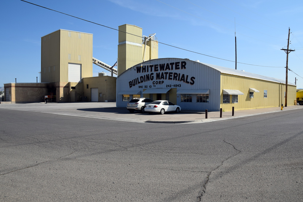
The industry trackage to the Whitewater Building Materials (ZTS 770, Whitewater Bldrs. Supply) diverts south at the end of 4th Ave, while the industry trackage extends east into the former Grand Junction Steel Fabricating Co. (ZTS 769, Grand Jct. Steel) toward the end at S 12th St.
 : ZTS 701 looking west from S 10th St
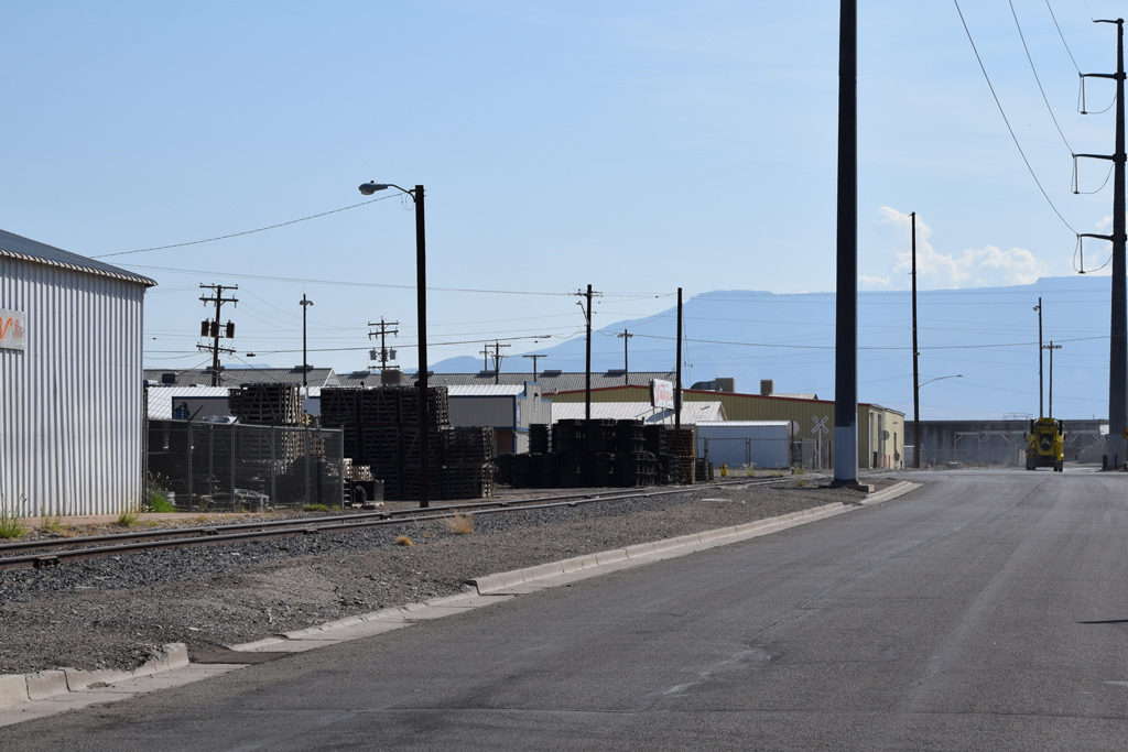 : ZTS 701 looking east from S 8th St
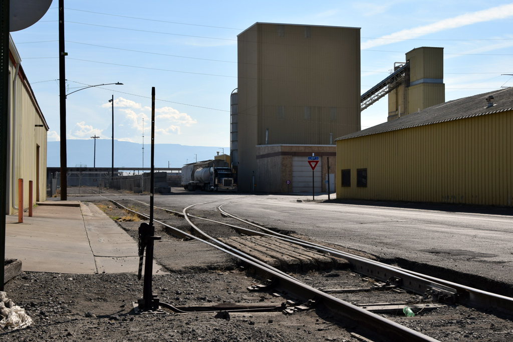 : ZTS 701 looking east from S 10th St
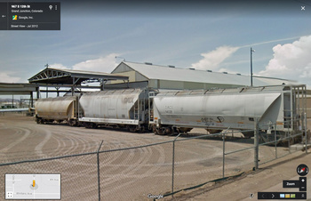 : end of ZTS 769 at S 12th St
Whitewater Building Materials Corporation established in 1948, provides ready-mixed-concrete, sand and gravel[1]. The appealing office structure was built in 1955[2]. The company appears in 1962 D&RGW Utah Industry Map as The Grand Jct. Building Mat. Co., Inc.[3]. It receives cement by hopper cars.
In 2015, Trainworx produced N scale NACC PD3000 NAHX and MILX hopper cars lettered WHITEWATER BUILDING MATERIALS CORP. GRAND JUNCTION, COLORADO[4].
 : Whitewater Building Materials Corp.
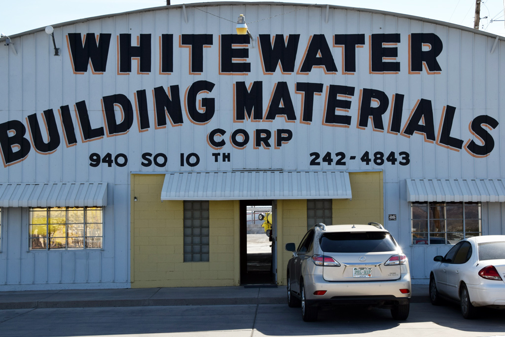 : Whitewater Building Materials
West of Whitewater Building Materials, warehouse of Castings Inc. still keeps a loading gate and platform facing the trackage. Castings Inc. was established in 1920 as a cast iron foundry[5]. The company still states its rail access in its web page. The structure itself was built in 1950[2].
 : ZTS 701 and Castings inc.
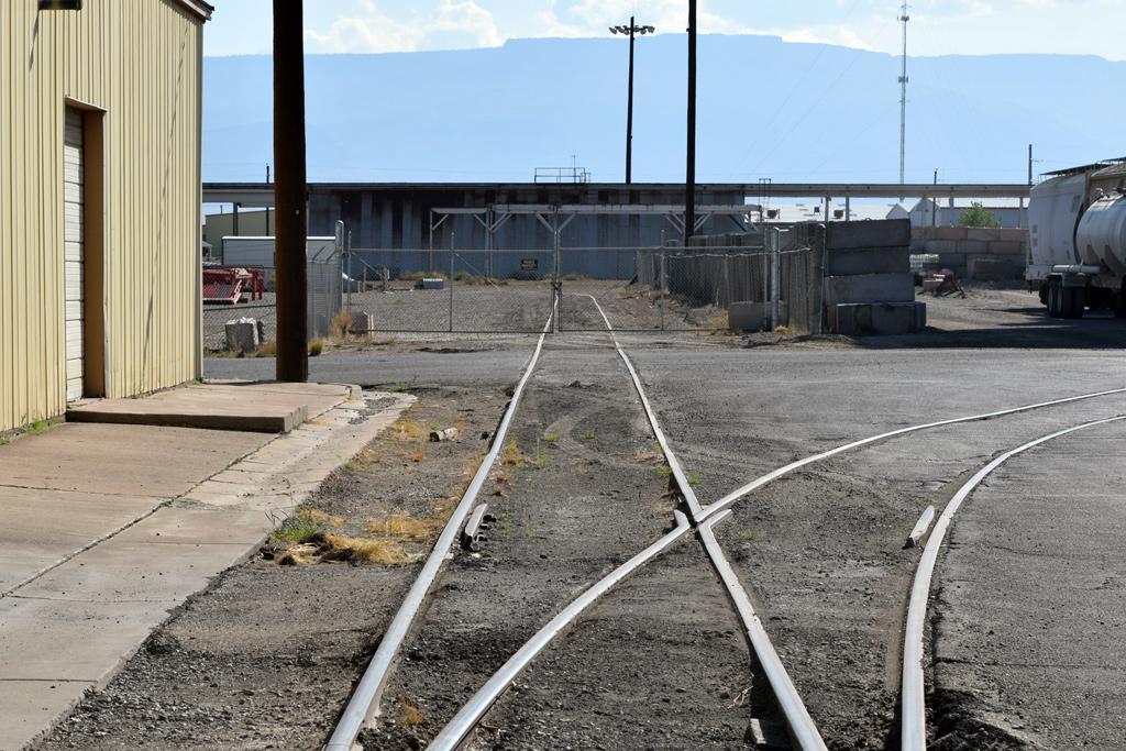 : ZTS 769 former Grand Junction Steel Fabricating Co.
The industry at the eastern end of the industry trackage was the Grand Junction Steel Fabricating Co.[6]. The company established in 1947 produced bridges, building frames, industrial bins and tanks from heavy steel plates. The structure itself was built in 1922[2].
The company appears in 1962 D&RGW Utah Industry Map as Grand Jct. Steel Fabricating Co.[3]. It used to receive three to four cars a week of raw material[7]. Hirschfeld Holdings purchased the company in 2007. Unfortunately, however, it went out of business in 2009.
All photos are taken on Sep. 11, 2017
[1] Whitewater Building Materials Corp. web page at Manta.com;
[2] City of Grand Junction Business Map;
[3] 1962 D&RGW Utah Industry Map;
[4] Trainworx web page for Whitewater hopper cars;
[5] Castings Inc. homepage;
[6] Feb. 17, 1955 Aspen Daily Times;
[7] Rail District, Grand Junction Greater Downtown Plan;
* aerial photo of Climax Uranium Mill found at Wall Street Journal website;
* photo of Holly Sugar Mill found at Colorado Encyclopedia website;
* 2010 photo of HLCX #3856 switching ZTS 770 found at Trainboard.com web site;
 : Map of Grand Junction Industries Served by rail
2019-03-01 09:00
コメント(0)
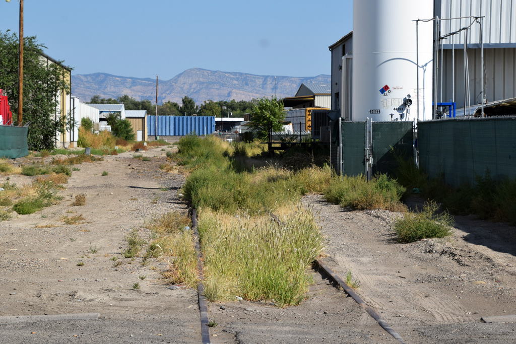
Grand Junction Industry Trackage – part 3 [Trackside Colorado PA]
 : ZTS 765 crossing 4th St
 : Western Metals Recycling
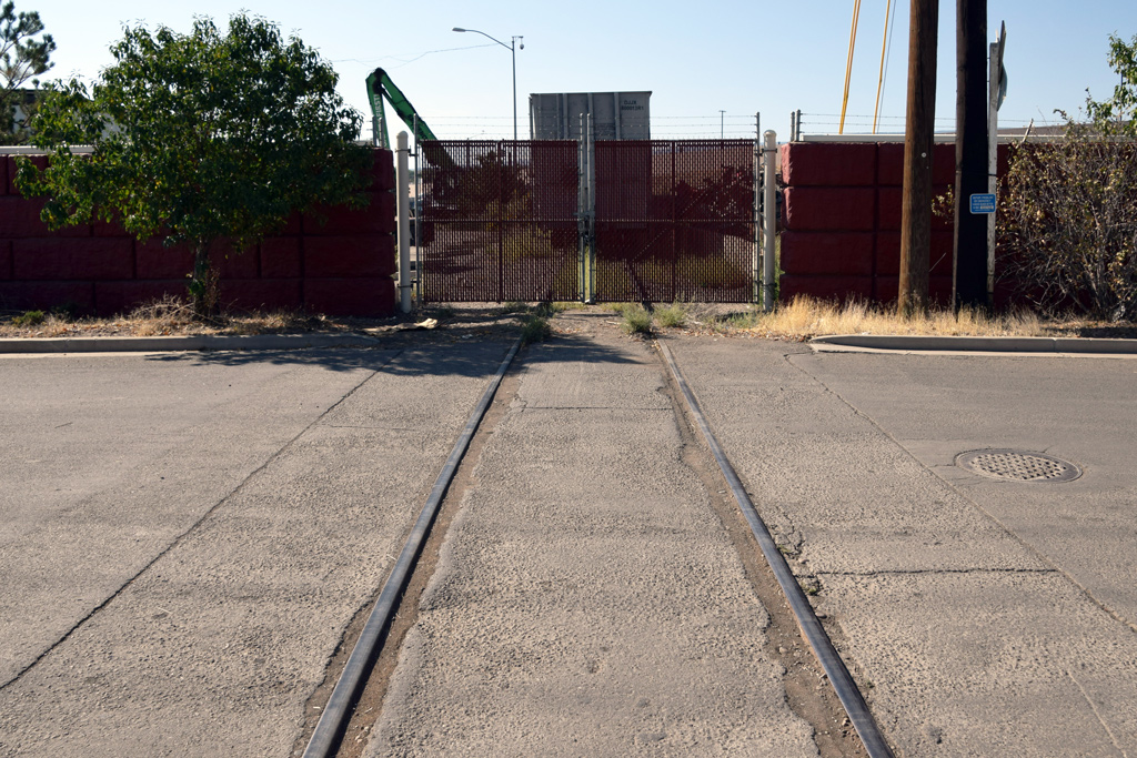 : ZTS 765
Here is one of the Rio Grande original facilities remained along its route in Colorado; industry trackage at Grand Junction.
As of Dec. 4, 2018 Trains newswire, the introducing of Precision Scheduled Railroading at Union Pacific will be implemented by the middle of 2019. It is already announced that MNYRO/MRONY was switched to tri-weekly MNYGJ/MGJNY since Dec. 2018. These may bring some changes to the local traffic at Grand Junction and its vicinity. Here, I represent my record of the local traffic at Grand Junction and its vicinity as of summer 2017.
Another railroad track crosses the 4th Ave west of S 7th St. It’s the short industry trackage (2001 Union Pacific Zone-Track-Spot 765, VanGundy’s) serving the scrap metal company. The industry trackage diverts from the West Leg of Wye (ZTS 110) under 5th St viaduct, drawing a semicircle toward the south, crosses the street and reaches the scrap yard.
Van Gundy’s Automobile, Metals & Plating Co.(AMPCO), Inc. was established in 1929[1]. Once, two parallel industry trackage served the company. Unfortunately, however, the one on the east was abandoned and the other on the west was shortened by the construction of Riverside Parkway[2]. The company was absorbed by Western Metals Recycling LLC in 2012[3]. It ships scrap metals by gondola cars.
The large Quonset structure painted beige shown opposite the former Rio Grande main in the first photo was also a scrap metal company to be served by rail: the Grand Junction Metal Movers LLC (ZTS 712, Vacant)[4]. The company had a plan to ship scrap metals to Pueblo, CO. but seems never happened. John O. Spendrup and his Great Basin Development LLC, the owner of the property, also own quite plats at Cisco, Utah.
[1] company overview web page on Bloomberg website;
[2] Apr. 20, 2011 The Business Times;
[3] Feb. 1, 2012 The Daily Sentinel;
[4] Oct. 6, 2011 The Daily Sentinel;
* 2011 photo of UP #1480 switching ZTS 765 at Trainboard.com web site;
: Map of Grand Junction Industries Served by rail2019-03-08 09:00
コメント(0)
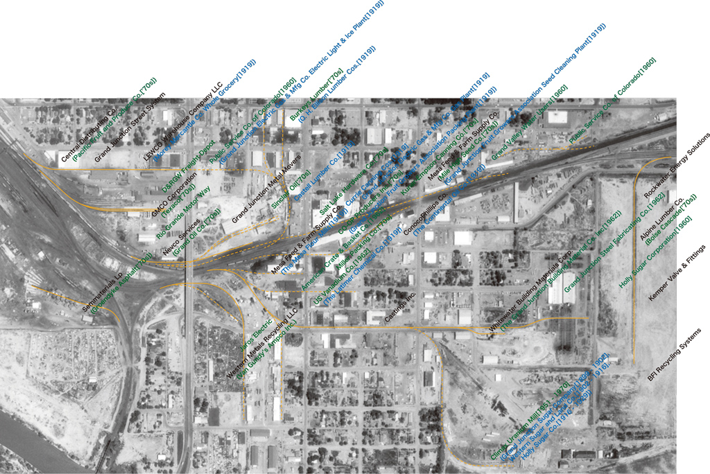
Grand Junction Industry Trackage – part 4 [Trackside Colorado PA]
 : ZTS 775 looking north from the D Rd
Here is one of the Rio Grande original facilities remained along its route in Colorado; industry trackage at Grand Junction.
As of Dec. 4, 2018, Trains News Wire, the introducing of Precision Scheduled Railroading at Union Pacific will be implemented by the middle of 2019. It is already announced that MNYRO/MRONY was switched to tri-weekly MNYGJ/MGJNY since Dec. 2018. These may bring some changes to the local traffic at Grand Junction and its vicinity. Here, I represent my record of the local traffic at Grand Junction and its vicinity as of summer 2017.
A railroad track crosses the D Rd between S 12th St and S 17th St. It’s the industry trackage (2001 Union Pacific Zone-Track-Spot 775, Holsum Bakers) serving several industries. The industry trackage diverts from the Yard Alternate Track (ZTS 103), drawing a semicircle toward the south, crosses the D Rd and reaches several industries.
According to 1960 D&RGW Utah Industry Map, this industry trackage was the contract with Holly Sugar Corporation[1]. Unfortunately, however, the sugar mill was closed and consolidated into the factory at Delta, CO. in 1929; the sugar mill site later became Climax Uranium Mill in 1951. The siding on the west side of the industry trackage was also assigned to the sugar mill as beet holding track (ZTS 776, Beet Holr track), but is ripped up today.
The northernmost industry served by this industry trackage today is the Rockwater Energy Solutions (ZTS 780, Earth Grains, Inc.) established in 2011, providing fluids and environmental solutions[2]. Western Pump & Dredge in 1992, Earth Grains Inc. in 2001, were the successive contractors at this facility. The structure itself was built in 1975[3]. The short industry trackage diverts east to the unloading station.
 : ZTS 780 to Rockwater Energy Solutions and ZTS 778 to Alpine Lumber
The rail served industry next to the Rockwater Energy Solutions on the south today is the Alpine Lumber Company (ZTS 778, Boise Cascade).
Independent Lumber established in 1904 is the predecessor of the company[4]. It was sold to Boise Cascade in 1978. But the former Independent Lumber owner established the Alpine Lumber and returned to the facility in 1983[5]. The structure itself was built in 1979[3].
Alpine Lumber prepares 7 car capacity lead diverting east from the industry trackage[6]. It receives boxcars and center beam flatcars of raw materials.
 : ZTS 781 looking north from Winters Ave
The rail served industry next to the Alpine Lumber Company on the south today is the Kemper Valve & Fittings Corporation (ZTS 777, Hub Oi St) established in 1965[7]. The structure itself was built in 1979[3]. The industry trackage is intact and the company states the rail access in the company homepage, but the rail traffic is uncertain.
The industry trackage (ZTS 779, Vacant) extends east to Bimbo Bakeries USA established in 1994, the successor of Holsum Bakers, and Hercules Industries Inc established in 1962[8, 9]. The structure of Bimbo was built in 1980 and of Hercules was built in 1976[3]. Unfortunately, however, they seem don’t use the rail.
 : ZTS 781 looking south from Winters Ave
The recent end of the industry trackage draws a semicircle toward the east at the south of Winters Ave at Waste Management Inc. (ZTS 781, BFI Recycling) backyard. The preceding contractor was the BFI Recycling Systems according to 2001 Union Pacific ZTS Map.
[1] 1960 D&RGW Utah Industry Map;
[2] Rockwater Energy Solutions company homepage;
[3] City of Grand Junction Business Map;
[4] Aug. 3, 2013 The Daily Sentinel;
[5 Dec. 9, 2015 The Denver Post;
[6] Dec. 7, 2015 The Daily Sentinel;
[7] Kemper Valve & Fittings Corporation company homepage;
[8] Bimbo Bakeries USA company homepage;
[9] Hercules Industries Inc company homepage;
* 2010 photo of HLCX #3856 switching ZTS 778 found at Trainboard.com web site;
: Map of Grand Junction Industries Served by rail2019-03-15 09:00
コメント(0)
Grand Junction Industry Trackage – part 5 [Trackside Colorado PA]
 : ZTS 728 Team Track
 : ZTS 041 Depot #1 Track leased to BNSF
Here are some of the Rio Grande original facilities remained along its route in Colorado; industry trackage at Grand Junction.
As of Dec. 4, 2018, Trains News Wire, the introducing of Precision Scheduled Railroading at Union Pacific will be implemented by the middle of 2019. It is already announced that MNYRO/MRONY was switched to tri-weekly MNYGJ/MGJNY since Dec. 2018. These may bring some changes to the local traffic at Grand Junction and its vicinity. Here, I represent my record of the local traffic at Grand Junction and its vicinity as of summer 2017.
There was industry trackage diverting from the main track at the depot. The trackage parallels South Ave once extended east to S 6th St, drew a semicircle toward the south and merged into another industry trackage paralleled the main, making a kind of balloon track, commonly known as the "circle track", surrounding the downtown industrial district[1].
 : ZTS 729 and Central Distributing Co. warehouse
 : ZTS 729 and LEWCO Warehouse Co. warehouse
The industry trackage parallels South Ave still remains as far as to S 5th St. This portion of the "circle track" served the businesses until the 80s[2]. Along the industry trackage, two warehouses within the downtown industrial district retains loading gates facing the track.
Warehouse on South Ave occupied by Central Distributing Co. (2001 Union Pacific Zone-Track-Spot 729, Central Distributing) has loading gates facing the trackage. The structure itself was built in 1980[3].
Warehouse on South Ave occupied by LEWCO Warehouse Co. has loading gates and the platform facing the trackage. The structure was built in 1915, and housed Morey Mercantile Co., the J.S. Brown Mercantile Co., and Armour & Co. in 1919 according to Sanborn Fire Insurance Map[3, 4].
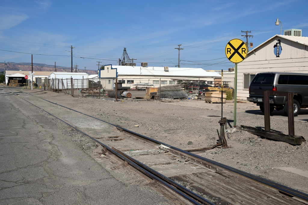
 : GMCO Corporation depot
 : ZTS 725 and 726 GMCO Corporation spur
Within the downtown industrial district, besides former D&RGW freight depot, several industries are still served by rail.
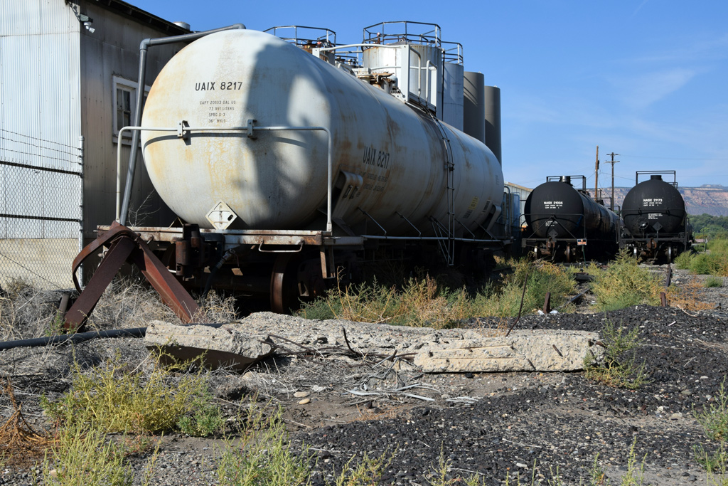
GMCO Corporation (ZTS 725, G. M. C. O. and 726, House #6) established in 1964, provides road maintenance and dust control products[5]. GMCO receives chemical products by tank cars. One of the steel tanks at the facilities retains TEXACO stencil representing the predecessor.
NVECO Services Inc. established in 2005, next to the south of GMCO is also served by rail (ZTS 710, Mobil Oil)[6]. NVECO ships collected used oil by tank cars.
revised, Dec. 25, 2020
[1] 1960-61 D&RGW Utah Industry Map;
[2] Hight, Denise, (2020) Christmas trees for sale, Grand Junction, circa 1950., Historical Photos of Fruita & Western Colorado;
[3] City of Grand Junction Business Map;
[4] 1919 Sanborn Fire Insurance Map of Grand Junction;
[5] GMCO Corporation company homepage;
[6] Quick Transport Solutions website;
: Map of Grand Junction Industries Served by rail2019-03-22 09:00
コメント(0)
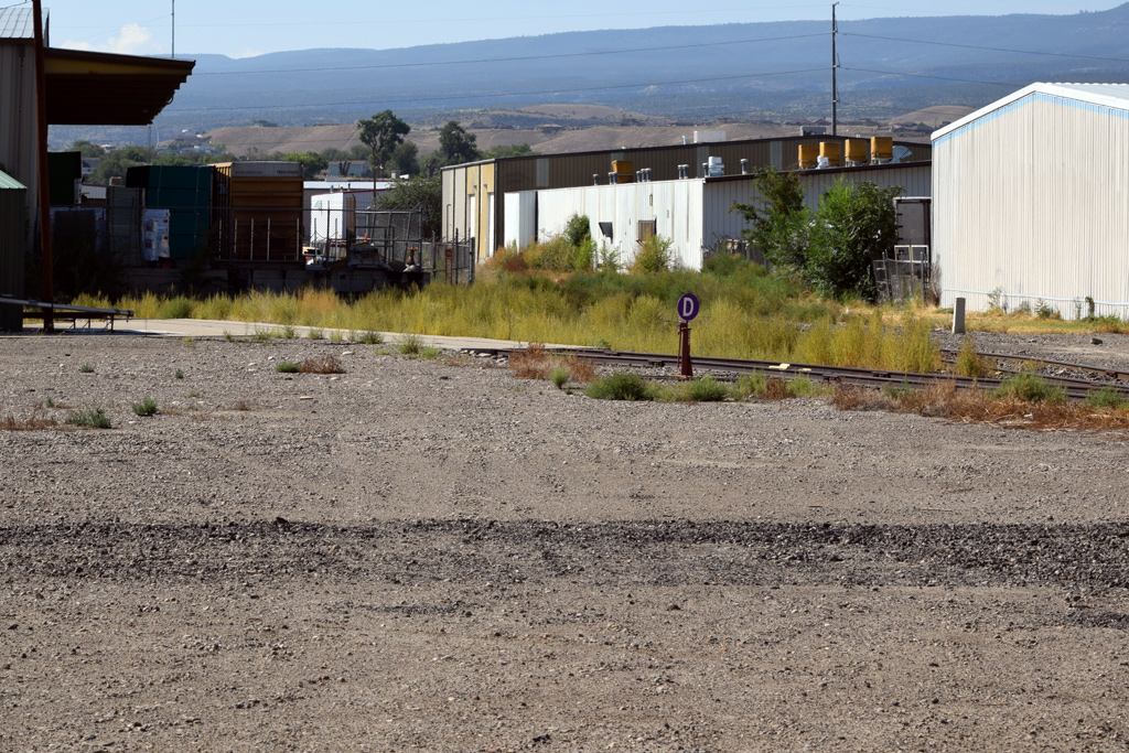
Grand Junction Industry Trackage – part 6 [Trackside Colorado PA]
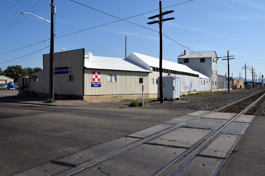
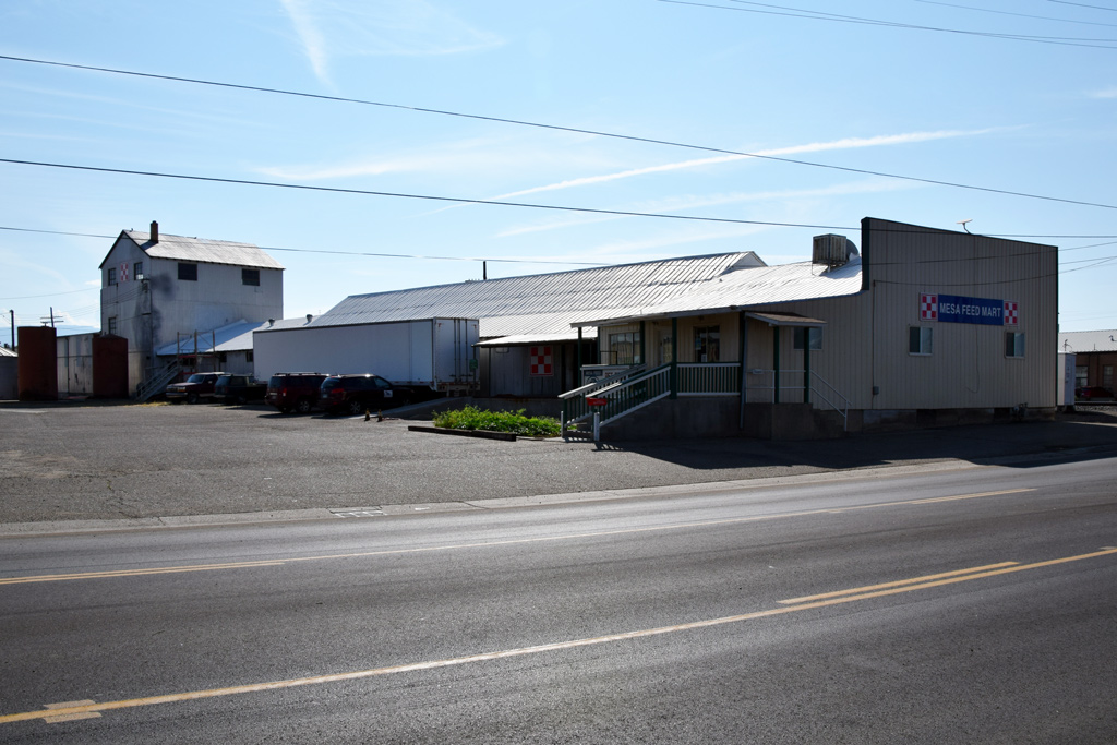 : Mesa Feed & Farm Supply Co. facilities
Here are some of the industries formerly served by the Rio Grande at Grand Junction. The industry trackage is long gone but several structures still retain the memory of their rail-served days.
Mesa Feed & Farm Supply Co. predecessor, Grand Junction Fruit Growers Association Seed Cleaning Plant on the north of S 9th St crossing, was formerly served by rail[1]. According to the Grand Junction Business Map, the structure was built in 1901. Walthers Cornerstone Sunrise Feed Mill maybe the substitute for a layout.
 : ConocoPhillips Co. facilities
Structure opposite the Mesa Feed & Farm Supply Co. on the south side of main track was the part of Continental Oil Co. facilities in 1919[1]. According to the Grand Junction Business Map, the structure was built in 1931.
Once, industry trackage diverted from South Bound Industrial Lead served the facilities. A part of the industry trackage (2001 Union Pacific Zone-Track-Spot 771 and 772, Conoco) still remains by the Lead. Continental Oil Co. Successor ConocoPhillips Co. operated the facilities till 2007[2]. Walthers Cornerstone Mission-Style Freight House maybe the substitute for a layout.
 : former Grand Junction Fruit Growers Association site
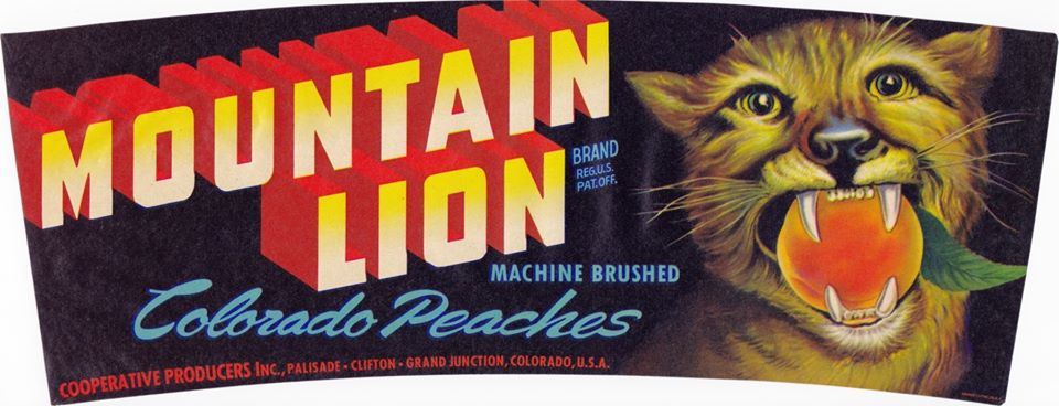 : Cooperative Producers crate label
The Continental Oil industry trackage once extended further west and served Grand Junction Fruit Growers Association, later Cooperative Producers Inc. between 1937 and 1971, packing plant, storage & shipping station[1]. Related industries in this district like American Crate & Basket Co. and the Mesa Flour Mills were also served by rail[3, 1]. According to the Grand Junction Business Map, the silo was built in 1974. Walthers Cornerstone Grain Conveyor maybe the substitute for a layout.
 : The Mesa Flour Mills
D&RGW industry trackage and industries I mentioned in this series of posts are shown in the Google Map below: Industry trackage still intact is shown in orange line, rails abandoned are shown in the grey line. Businesses using rail are shown in orange pins, businesses formerly used rail are shown in grey pins.
revised, Apr. 24, 2020
[1] 1919 Sanborn Fire Insurance Map of Grand Junction;
[2] “Toxic Waste and Media Silence”, Dec. 2010 Red Pill;
[3] D&RGW Utah Industry Maps;
* City of Grand Junction GIS Business Map;
: Map of Grand Junction Industries Served by rail2019-03-29 09:00
コメント(0)
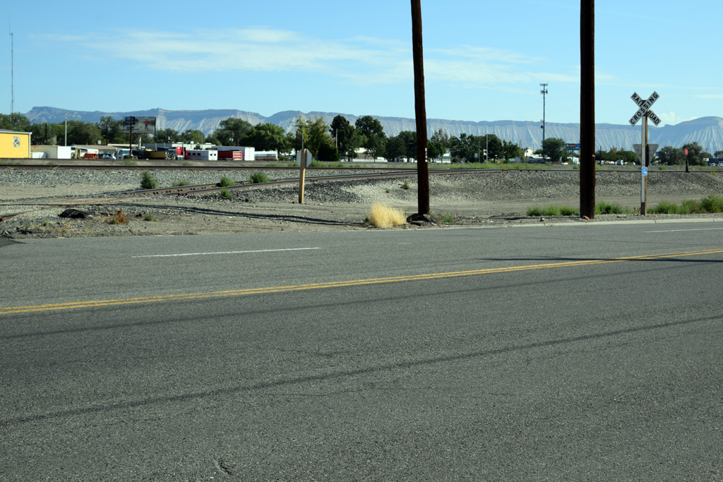
Reminders of the 70’s along Rio Grande 91 − Rainbow Lodge and Grocery, South Fork [Trackside Colorado PA]
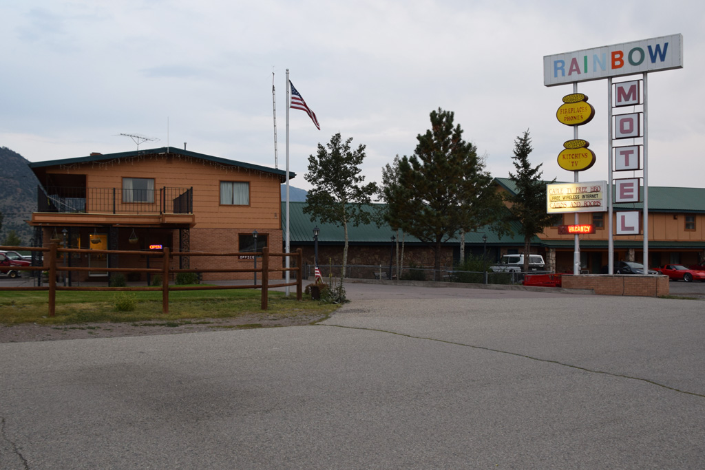

 : South Fork CO. Sep. 6, 2017
Rainbow Lodge is located at the center of South Fork, Colorado, on the junction of US Hwy 160 and State Hwy 149. Rio Grande Creede Branch once ran the backyard of the facilities along the namesake Rio Grande.
Three generations of the Fleming family have been serving the motel, cabin, grocery, cafe, RV park, and the service station since 1946[1]. Lawrence Denton Fleming Jr. (1936 – ) is taking charge of the motel today[2].
[1] Rainbow Lodge and Grocery website;
[2] Rainbow Lodge and RV Park web page at manta.com;
 : postcard maybe printed in the ‘50s
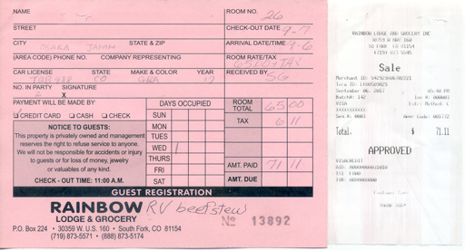
2020-06-05 09:00
コメント(0)
arx_Ph.D. さん

Here represented are my model railroad enthusiasm generated from the photos I took during my childhood at Knoxville, Tennessee, or from the photos I took during my recent trips.
I'm a retired professor of design, meanwhile a part-time associate at the architectural design office in Osaka, Japan where I live with my wife.


