Virtual Trip with The Guide - 01 [Column_Photo Archives]
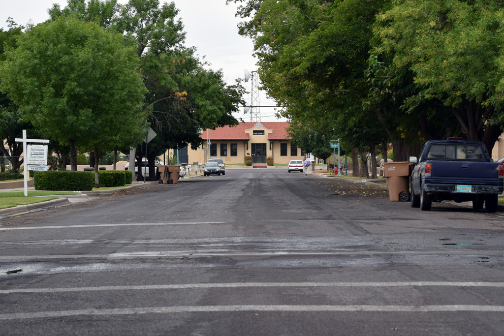
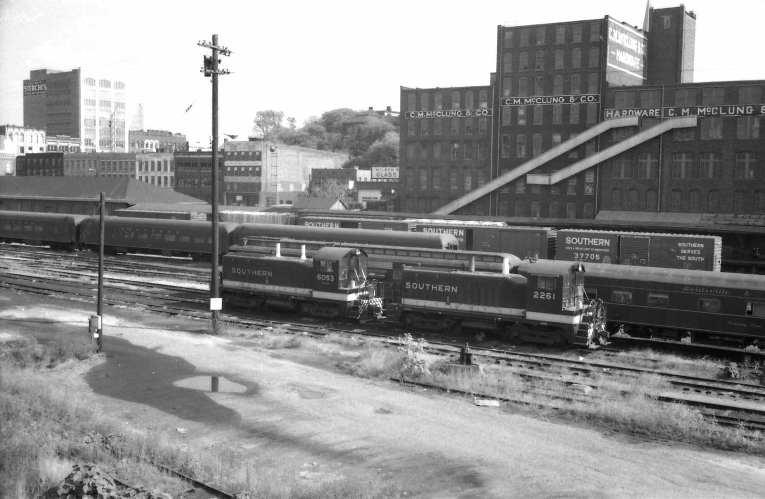 : the west end of Knoxville SOU station looking from the North Broadway St. viaduct
Let’s try a virtual trip using The Guide (OGR) to where my archive photos were taken.
First of all, I would like to begin the trip from Knoxville, TN. The town had 2 stations about a half mile apart: SOU and L&N. SOU’s main lays east-west, while L&N terminates at the station from the south.
archive photo of SOU station:
archive photo of L&N station:
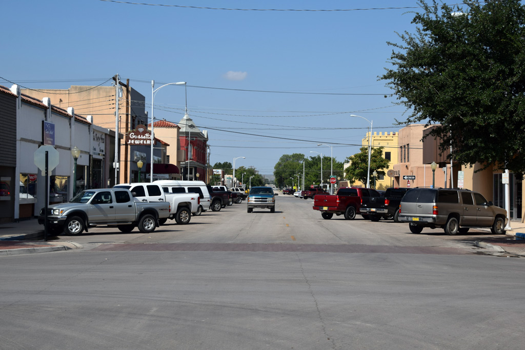
If I take SOU, the eastbound train brings me to New York (No.18, Birmingham Special), Boston (No.42, The Pelican/Tennessean), Greensboro (No.28, Carolina Special) or Bristol (No.46). The westbound train reaches Birmingham (No.17, Birmingham Special), New Orleans (No.41, The Pelican), Memphis (No.41, Tennessean), Chicago (No.27, Carolina Special) or Chattanooga (No.45). We can see the remnants of the through passenger service equipment in the photo above.
If I take L&N, the choice is only Cincinnati (coach only No.17) or Atlanta (No.18).
My choice is the No.27, Carolina Special sleeping car bound for Chicago. The train leaves Knoxville with a box meal at 10:05PM and arrives at Chicago Central Station on 1:30PM, the next day. At the Chicago Central Station, I can watch “South Shore” and IC electric cars for commuter trains.
archive photo of Chicago Central Station:
archive photo of “South Shore” train:
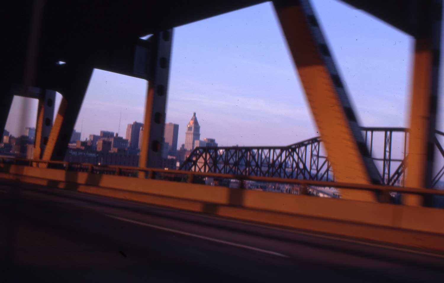 : city of Cincinnati
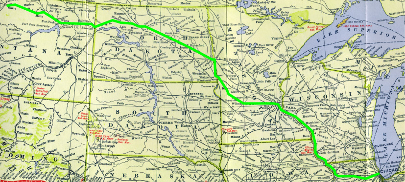
 : route map of the virtual trip
2011-10-07 19:48
コメント(0)
Virtual Trip with The Guide – 02 [Column_Photo Archives]
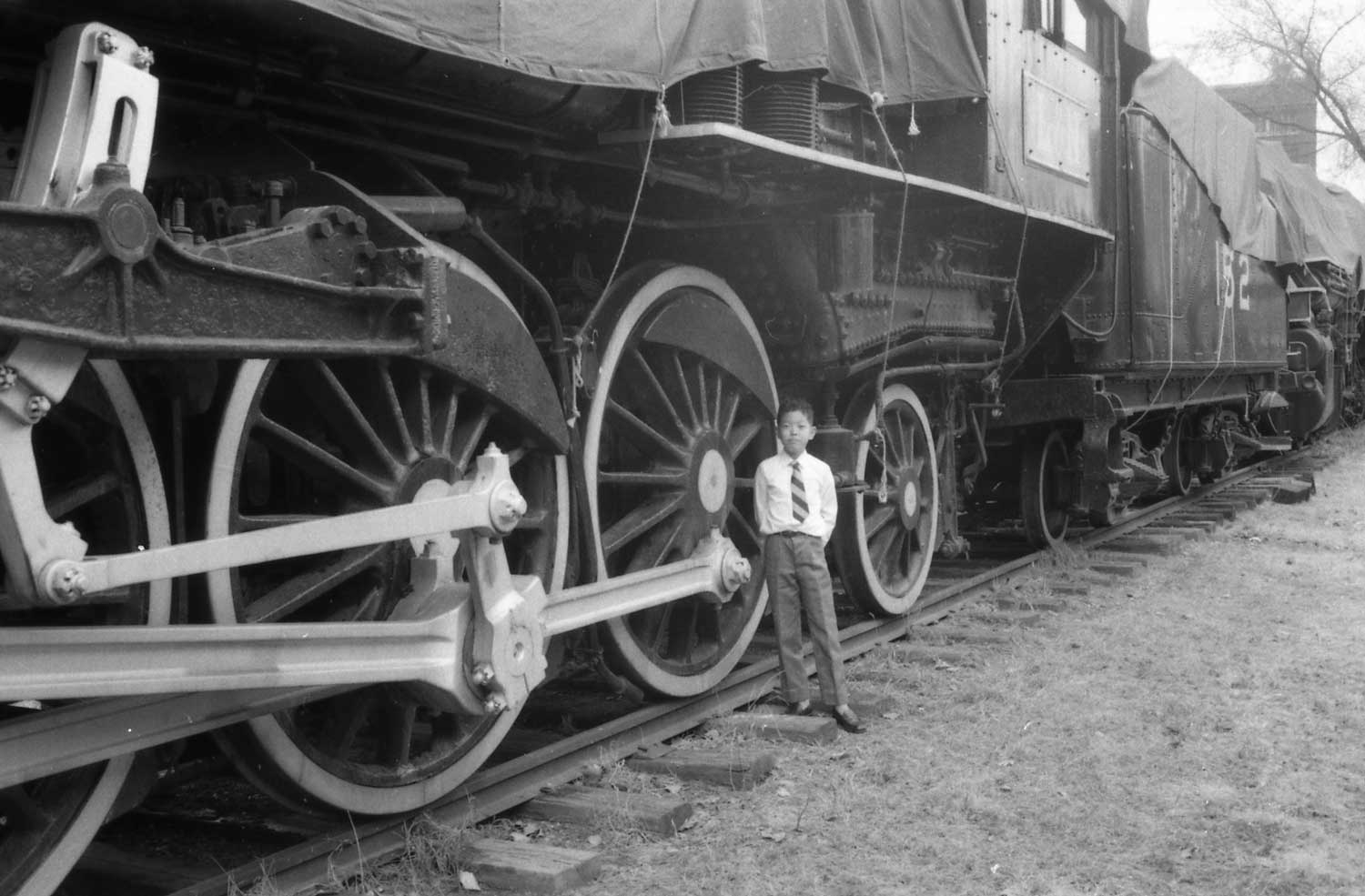
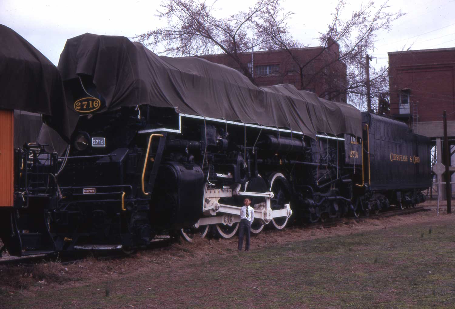 : C&O 2716 under the sheet at East River Rd.
From Chicago, I move back to Louisville, KY to visit Kentucky Railway Museum. There seems no direct train to Louisville from Knoxville. L&N’s No.15, The South Wind leaving Chicago Central Station at 8:35AM brings me to Louisville at 4:10PM.
Here, I can meet L&N 152, C&O 2716 and others along with foreknown L&N E6A 770. When these photos were taken, the museum was located at 1837 East River Road. The museum is now at New Haven, KY.
大きな地図で見る: street view of the former site from East River Rd.
When I actually visited the museum in 1971, it looked rather like only storage tracks than a museum: no fence, no visitors, sheeted equipment.
L&N 152, a Pacific type steam locomotive built in 1905 by Rogers, is now back in steam and makes excursions from the museum to Boston, KY on the former L&N branch. C&O 2716, a Kanawha type steam locomotive built in 1943 by Alco is now under the shed without the sheet. L&N 770 donated to the museum in 1968, 3 years before my visit, is now under restoration.
archive photo of L&N F6A 770:
http://riogrande.blog.so-net.ne.jp/2011-07-07
 : L&N 152 under the sheet at East River Rd.
2011-10-14 14:49
コメント(0)
Virtual Trip with The Guide – 03 [Column_Photo Archives]
 : city of Chicago
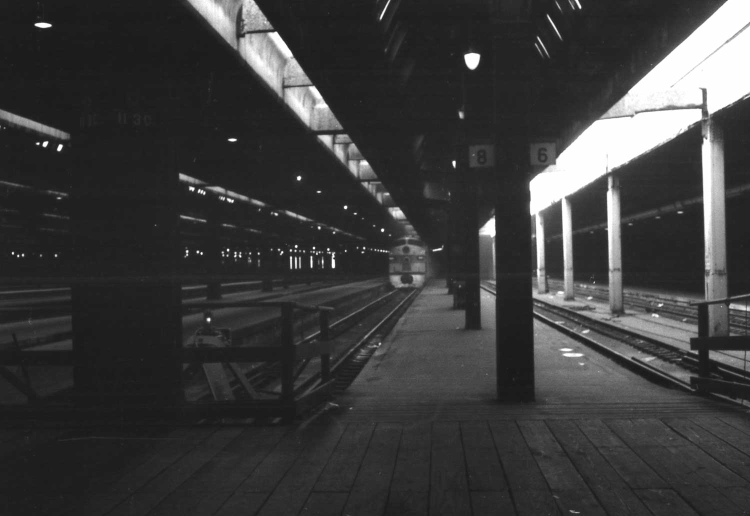 : CB&Q train at Chicago Union Station
The trip continues.
City of Chicago in the late '60s/early '70s looks like made of "Cornerstone Series" structures by Walthers.
From Chicago, my choice is the CB&Q/GN at the Union Station where I can also see MILW’s commuter trains. Noontime platform tracks shown in the photo above look rather desolate at the Union Station.
archive photo of MILW train at Chicago Union Station:
I can take the No.31, The Empire Builder leaving at 2:30PM or the No.27, The Western Star leaving at 9:30PM from the Chicago Union Station. My choice is the Empire Builder because the arrival time at the destination of the No.27 is 3:00AM, midnight.
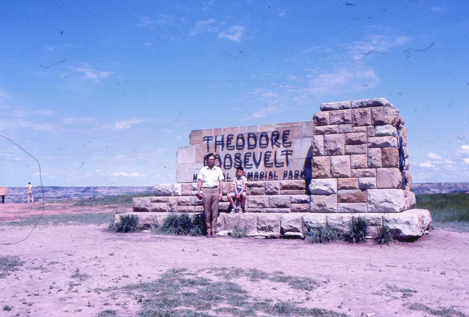 : park sign
Along the route in North Dakota, I can visit the Theodore Roosevelt National Memorial Park, listed in the “list of National Parks” on page 1050 of The Guide (actually, the suggested approach to the park is from NP Modora).
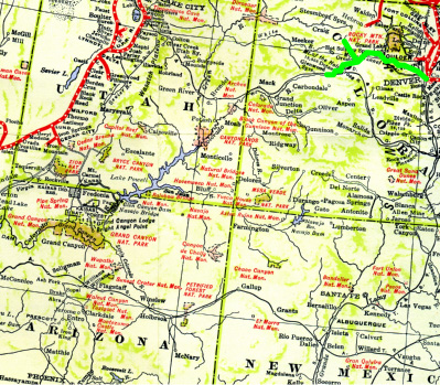
 : route map of the virtual trip
2011-10-24 17:47
コメント(0)
Virtual Trip with The Guide – 04 [Column_Photo Archives]
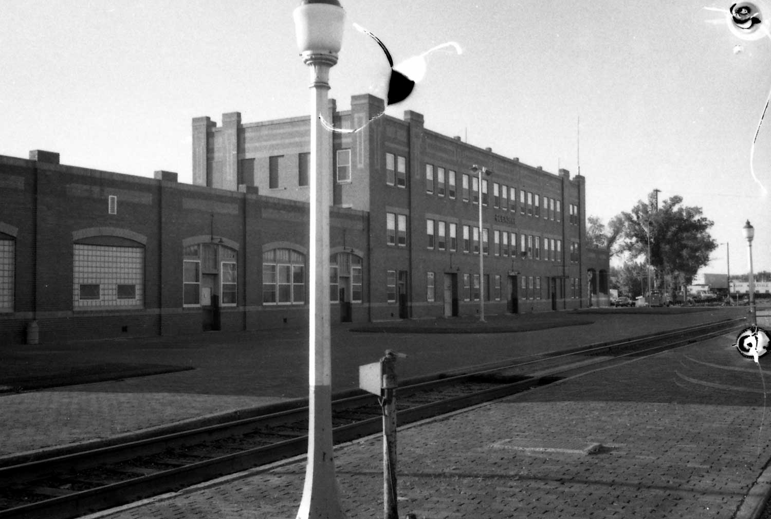 : Glendive station platform
The trip continues.
At 12:55PM the next day, I arrive at Havre, MT. Here, I can take a photo of GN steam locomotive, The only S-2 class northern preserved next to the station.
From here, I have several choices for the next destination.
archive photo of Glendive station platform:
 : “Big Sky Country” from the rear window
2011-10-27 14:29
コメント(0)
Virtual Trip with The Guide – 05 [Column_Photo Archives]
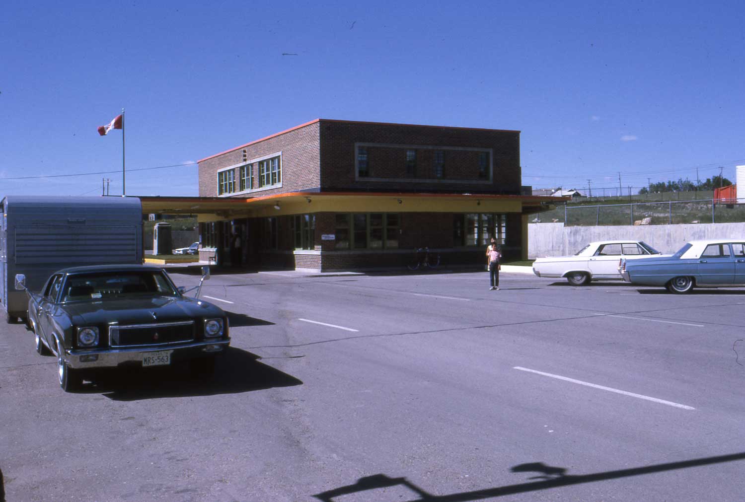 : customs building at Coutts
The trip continues.
From Havre, I have several choices.
If I get off at next stop, Shelby, MT, I can catch GN’s combine put to caboose but freight service only on Sweet Grass Branch. This branch connects United States and Canada at the border with CP Rail’s Coutts Subdivision.
The international depot structure of Sweet Grass/Coutts is preserved today at Sterling, AB, Canada[1].
* archive photo of GN’s south-bound local with a combine on Sweet Grass Branch:
* archive photo of CP’s Coutts bound local caught at north of Coutts:
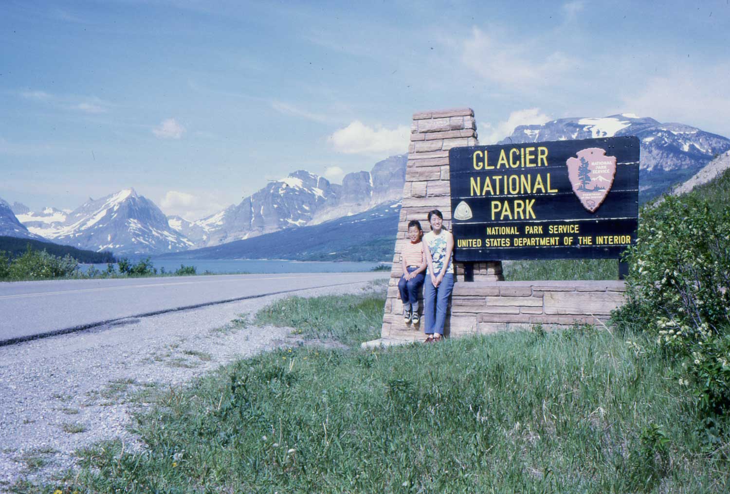
Or, I can visit Glacier National Park from Glacier Park Station, 2 stops from Havre.
GN built not only station but lodge and hotel for the tourists. Both accommodations still serve the tourists visiting the park today.
revised, Mar. 8, 2021
[1] Galt Historic Railway Park homepage;
 : park sign
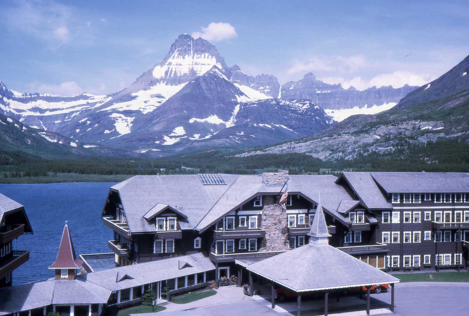 : Many Glacier Hotel built by GN
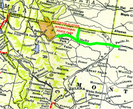 : route map of the virtual trip
2011-10-31 17:38
コメント(0)
Virtual Trip with The Guide – 06 [Column_Photo Archives]
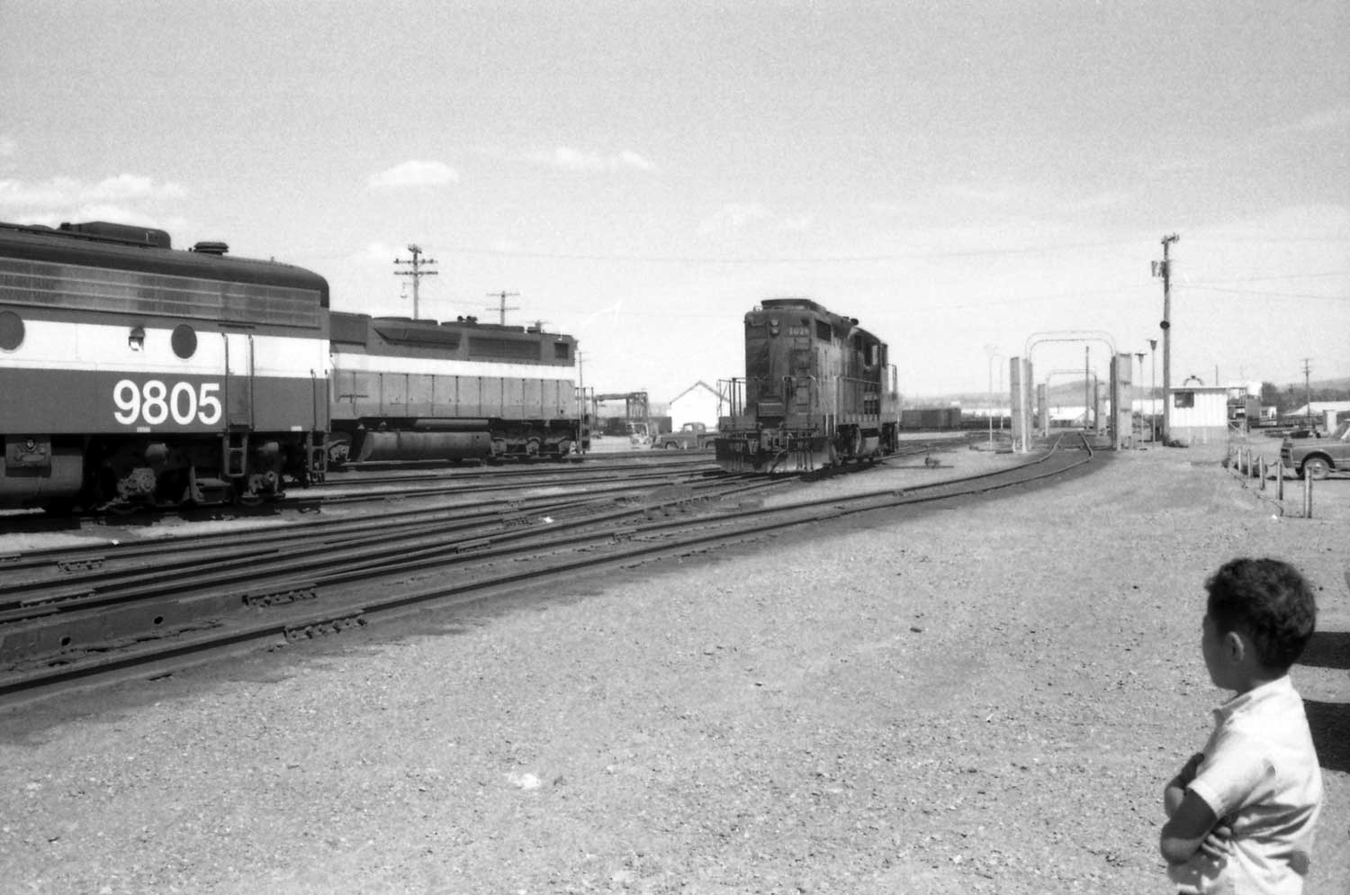 : Havre engine service yard
The trip continues.
The third choice for the next destination is Yellowstone National Park.
From Havre, I take the No.27, The Western Star leaving at 3:15AM to Great Falls, MT. At 6:20AM after the arrival, I take GN bus to Helena, MT leaving at 7:50AM. After 2 hours ride, the bus takes me to the destination at 10:00AM. At Helena, I catch 10:20AM NP No.1, The MainStreeter to Missoula, MT.
After the arrival at 1:54PM, I may take late lunch at the restaurant NP runs in the station. After meal, I can visit engine service yard opposite to the station.
大きな地図で見る: street view from N 1st St, Missoula.
I'm looking forward to the Jan. '12 issue of Trains magazine, because it will future Missoula in their "Trackside" pages..
From Missoula, I take NP’s No.2, The Mainstreeter to Livingston, MT at 2:30PM. 7 hours ride takes me to Livingston at 9:25PM where I change train to motor coach.
In spite of traveling in the summer, the route of the Vista-Dome looks chilly in the photo below.
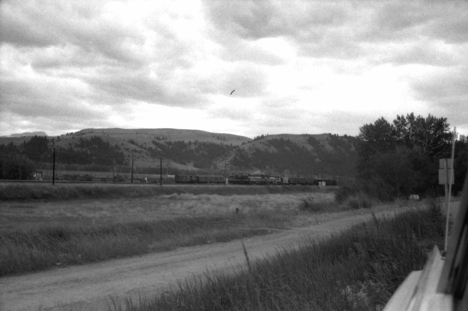 : NP(and also MILW) main at Deer Lodge, MT
大きな地図で見る: Deer Lodge today
 : route map of the virtual trip
2011-10-31 17:52
コメント(0)
Virtual Trip with The Guide – 07 [Column_Photo Archives]
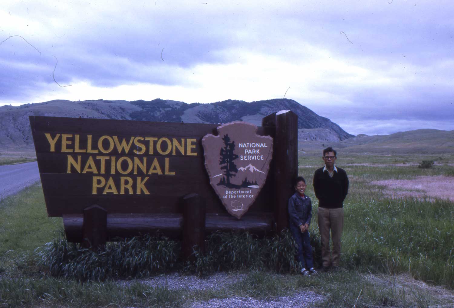 : park sign
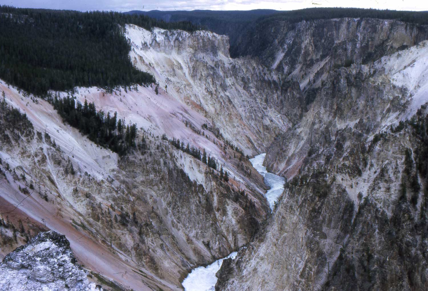 : viewing up the Grand Canyon of the Yellowstone from Inspiration Point
The trip continues.
NP Transport Co. bus takes me to Gardiner, MT, the gateway to Yellowstone National Park.
archive photo of the BN freight train caught at NP’s Gardiner Branch:
Traversing the park, Cody Bus Line bus takes me to Deaver, WY from Cody, WY where I can catch the CB&Q train. CB&Q’s chair car only train No.30 leaves Deaver at 1:15PM and takes me to Denver at 7:35AM next day.
 : real cowboys
 : rodeo
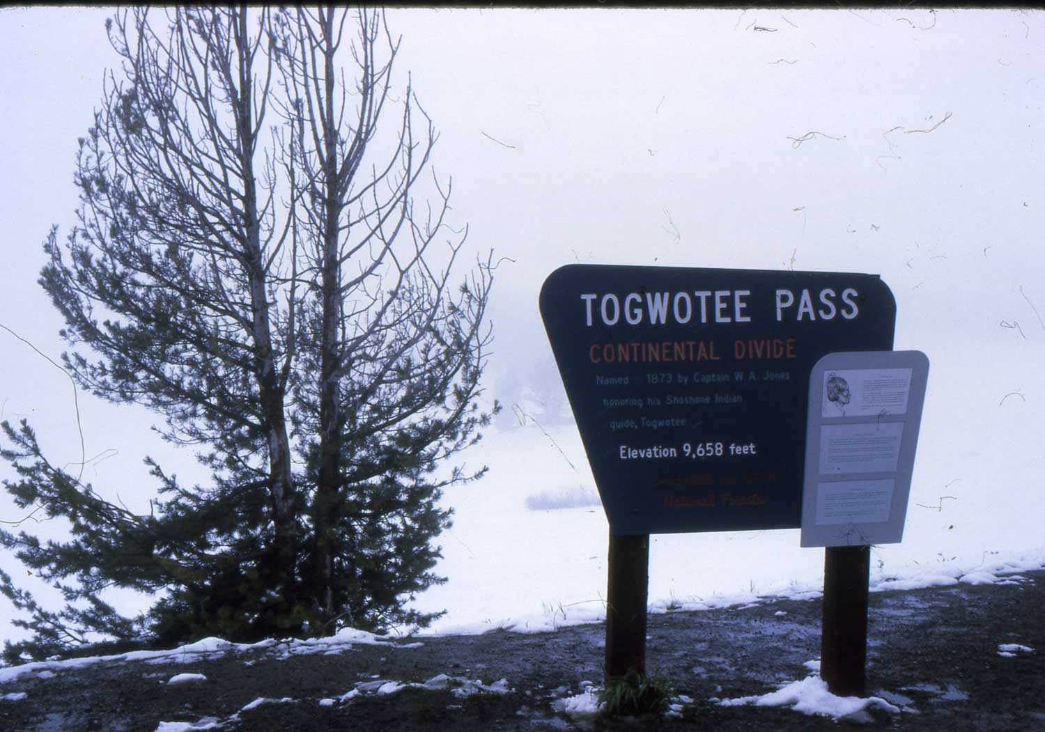 : Continental divide
En route from Yellowstone Park to Denver, I met real cowboys on duty. I also met snow (in August!) at Togwatee Pass on route 26, one of the pass crossing continental divides.
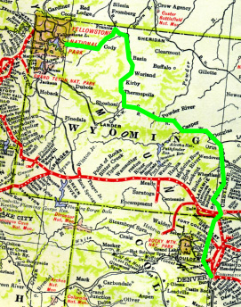 : route map of the virtual trip
2011-10-31 17:58
コメント(2)
Virtual Trip with The Guide – 08 [Column_Photo Archives]
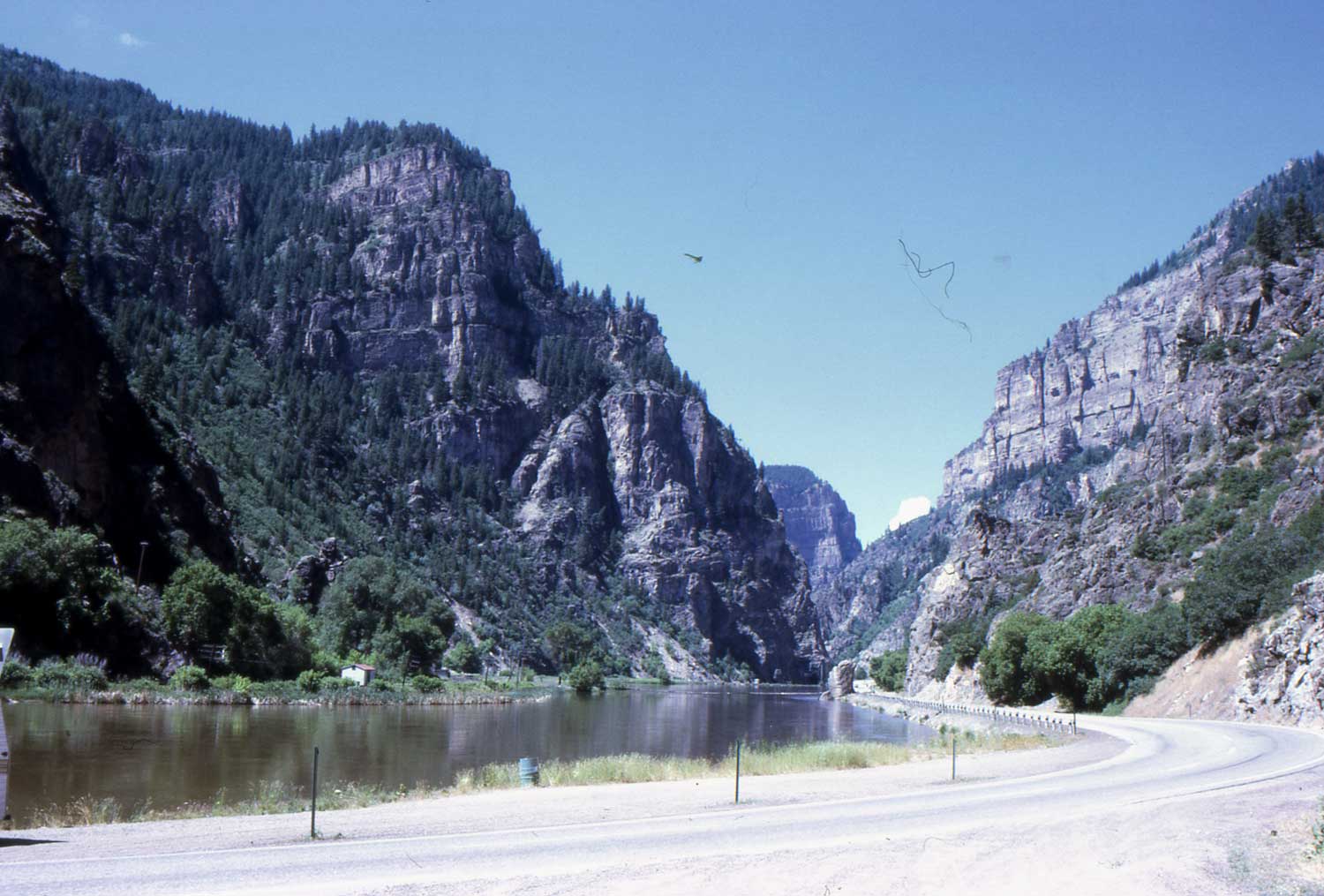 : Glenwood Canyon
The trip continues.
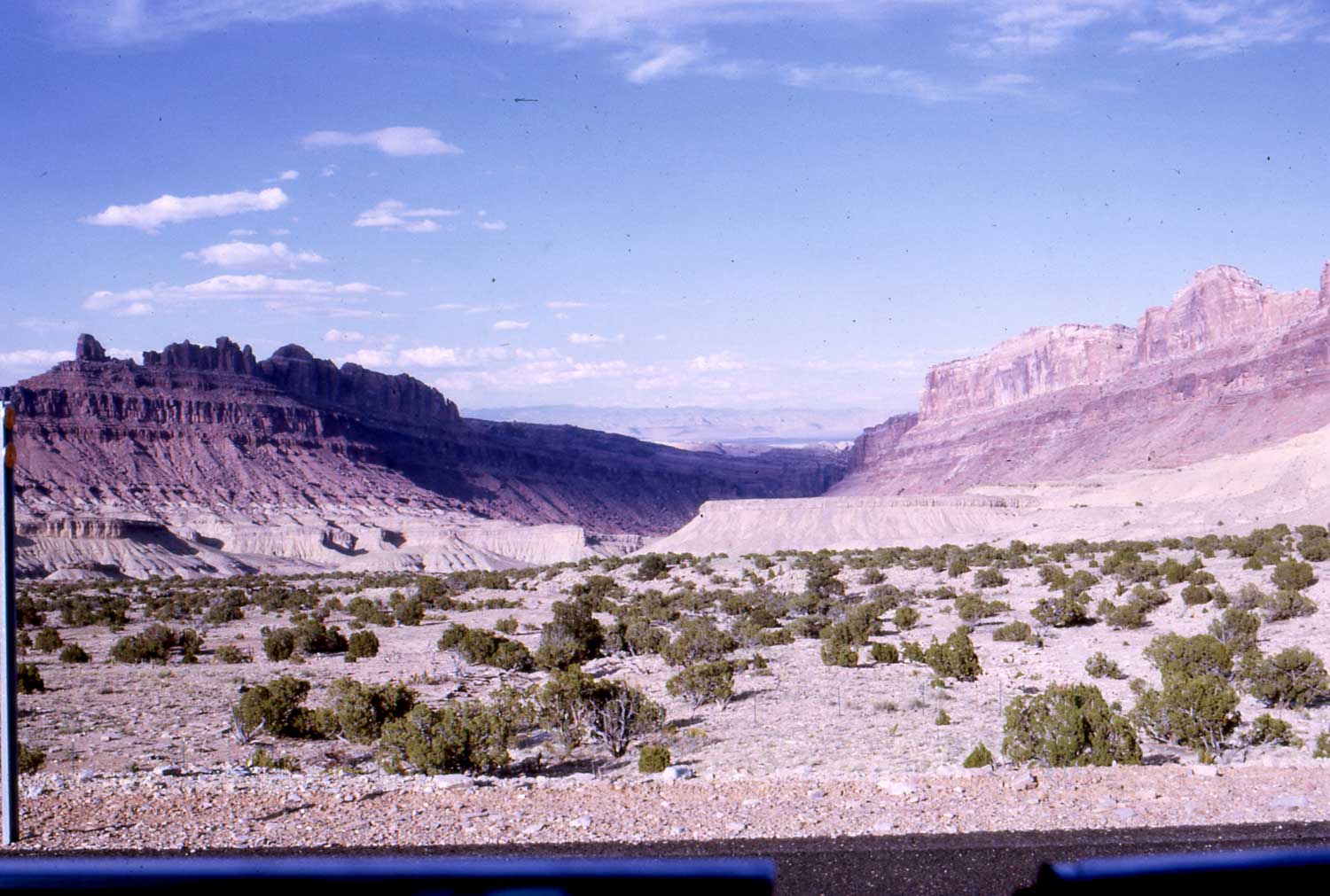
From Denver to the Southwest, there are many “Canyon” National Parks listed in The Guide.
First of all, let’s visit Glenwood Canyon. It’s not designated as National Park, but it’s worth a place to visit, and yes, the Rio Grande climbs towards the Rockies along the Colorado River from the west.
Rio Grande’s train No.17, California Zephyr leaves Denver at 8:40AM. The train climbs the Front Range and runs thru the Rockies to Glenwood Springs at 2:05PM after enjoying the tremendous view of the Glenwood Canyon from the dome. You can see Rio Grande track on the left bunk of the river in the photo above.
archive photo of Rio Grande train at Glenwood Canyon
大きな地図で見る: street view of the canyon
Rio Grande’s Craig Branch diverts from the main at Bond, just east of Glenwood Springs. The branch runs side by side with state highway 131, one of the route from Rocky Mountain National Park to the west.
Here, I caught Rio Grande’s empty coal train powered by a GP9 and F7s just south of Toponas. We can see similar train powered by SD40T-2s in the DVD “Denver & Rio Grande Western” by Pentrex.
Archive photo of Rio Grande’s empty coal train:
大きな地図で見る: street view from state highway 131
 : route map of the virtual trip
2011-10-31 18:05
コメント(0)
Virtual Trip with The Guide – 09 [Column_Photo Archives]
 : deserted land west of Grand Junction
The trip continues.
It changes dramatically, from timberland to deserted land, as I move toward west along Rio Grande (actually route 6) from Denver. En route of Rio Grande, Denver, Glenwood Canyon, Rifle and Cisco, Utah are the places where movie Vanishing Point was taken in 1970.
The last scene of the movie was shot at the town of Cisco, Utah. At that time, some structures existed along the road, but they almost all have gone today.
* Rio Grande freight in the deserted land;
* web page for Cisco and “Vanishing Point” location;
* my archive page introducing the movie;
Southwest of Cisco, I can visit some “Canyon” National Parks.
The Access to the Bryce Canyon National Park is Cedar City, Utah on UP. Making the train connection at Salt Lake City, UP’s No. 5 leaving at 10:00AM brings me to Lund at 2:45PM. An hour bus service is offered from Lund to Cedar City. The city is also the UP’s gateway to Zion National Park and Grand Canyon National Park.
rivised, Oct. 6, 2015
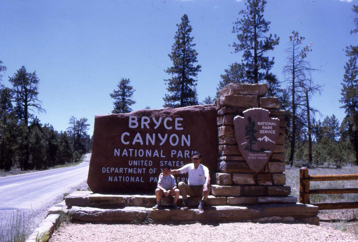 : park sign of Bryce Canyon in 1971
 : park sign of Bryce Canyon in 2014
 : Bryce Canyon
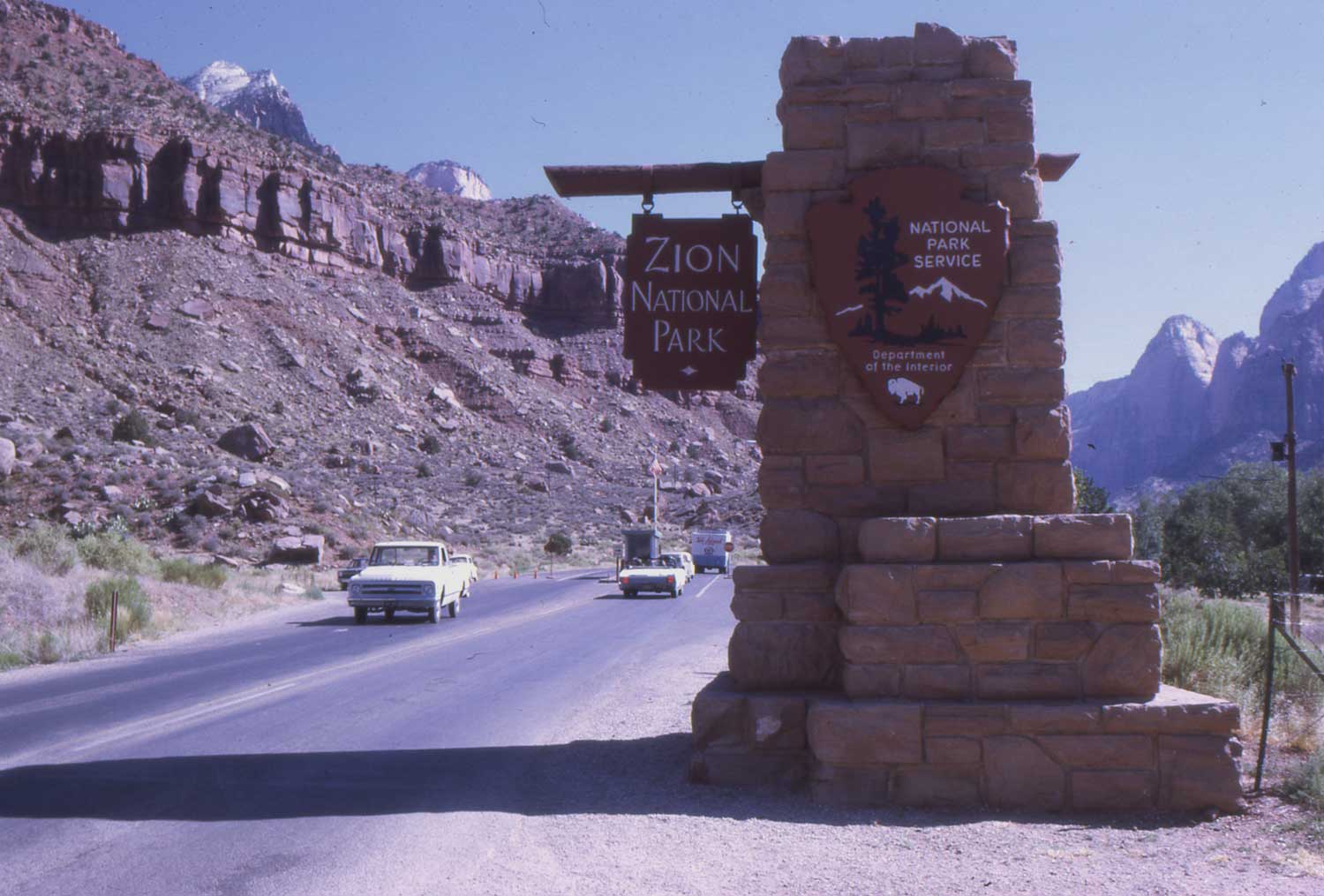 : park sign of Zion
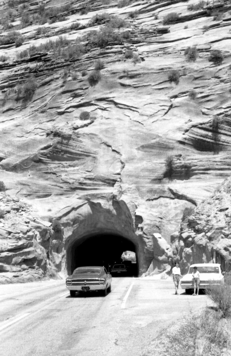 : highway tunnel at Zion National Park
 : park sign of Grand Canyon in 1971
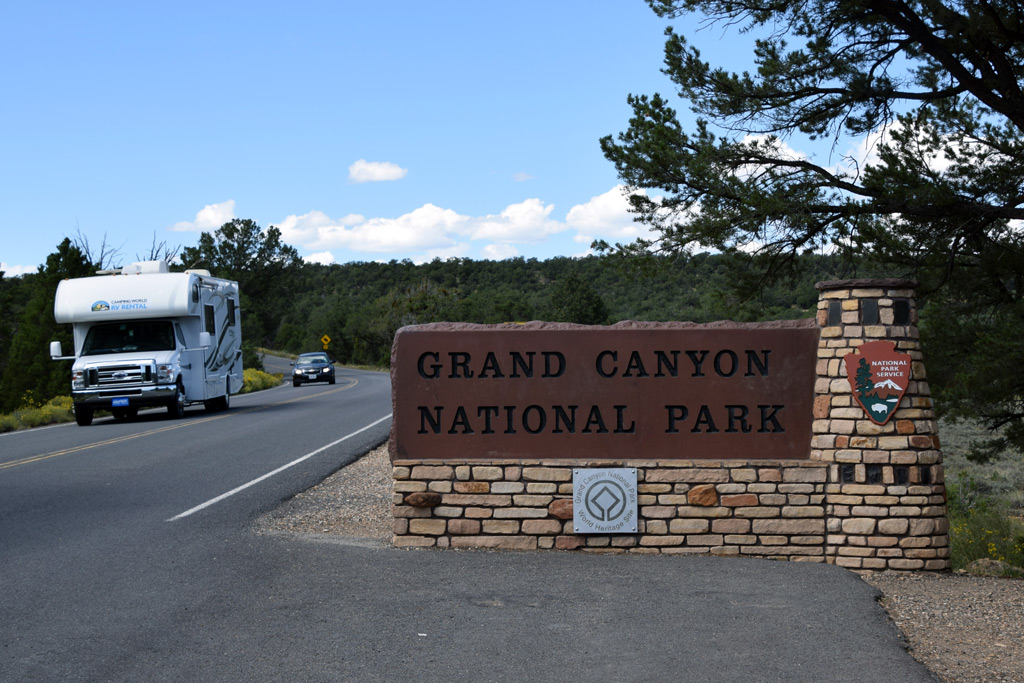 : park sign of Grand Canyon in 2014
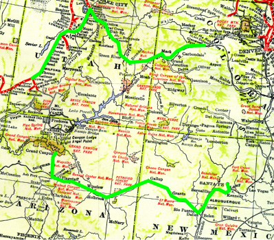 : route map of the virtual trip
2011-12-09 18:50
コメント(0)
Virtual Trip with The Guide – 10 [Column_Photo Archives]
 : San Francisco St. Santa Fe in 1971
 : San Francisco St. Santa Fe in 2015
The trip continues.
From South Rim of Grand Canyon, I can take Santa Fe train. Train No. 15 leaves Grand Canyon station at 6:30PM and arrives at Williams Junction on 9:00PM.
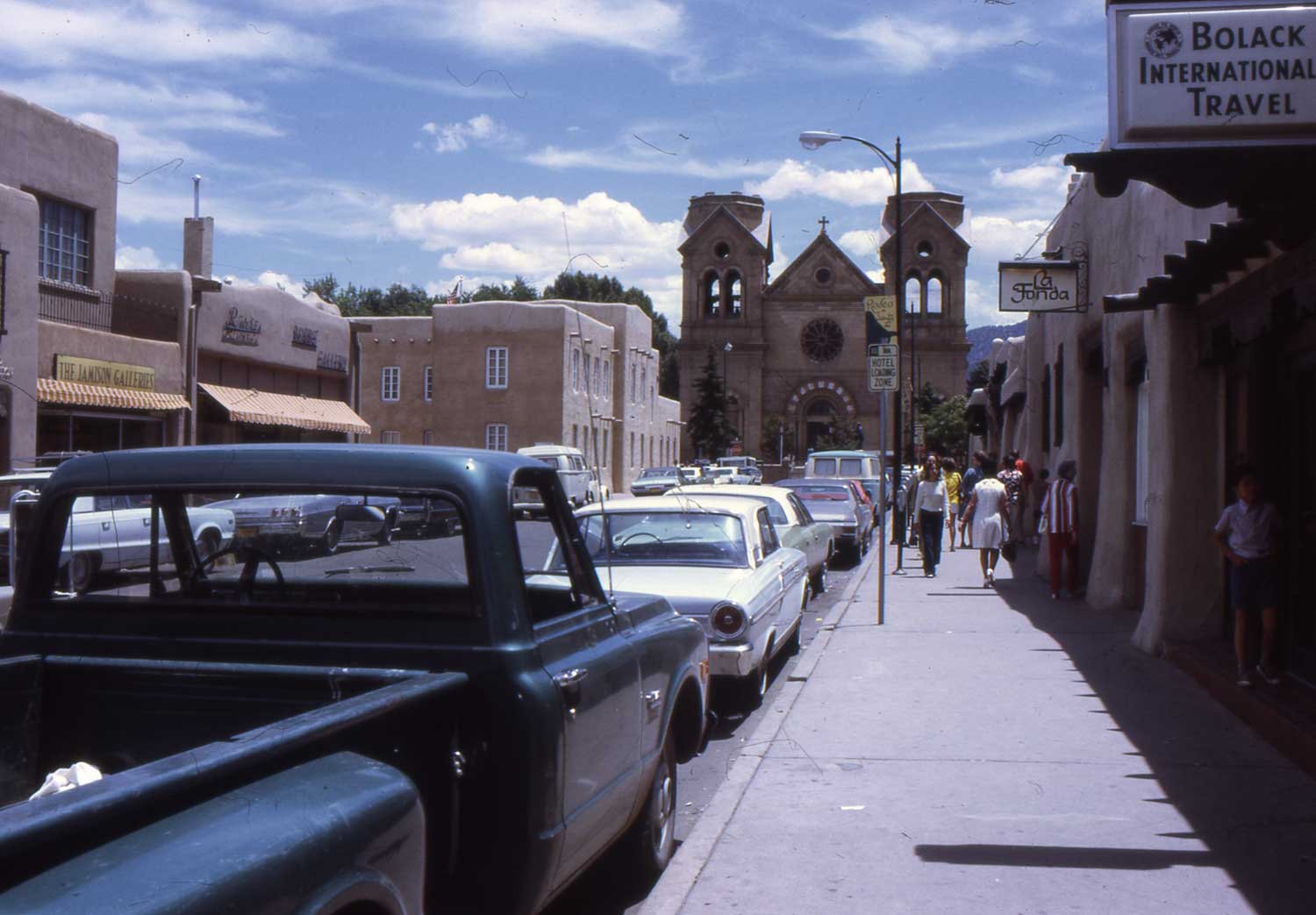
The connecting train, No. 20 The Chief at 9:45PM brings me to Lamy on 5:35AM. Indian Detours Transportation Co. bus takes me to Santa Fe in 30minutes from Lamy.
It seems little changed since my last visit in 1971.
* archive photo of Santa Fe Chief dome car at Lamy:
* archive photo of Santa Fe station at Santa Fe:
revised, Oct. 6, 2015
2011-12-16 17:10
コメント(0)
Virtual Trip with The Guide – 11 [Column_Photo Archives]
 : Dubois, WY on US Hwy 26
 : somewhere on US Hwy 66
Continued from the article written last year; The trip’s final segment.
Once again from Lamy, I take Santa Fe’s No.18, El Capitan at 2:25PM. The train arrives at Kansas City on 5:35AM next morning. Change trains here to SLSF’s No.102, The Southland leaves at 7:40PM bound for Birmingham, AL.
Disembarking at Memphis, TN after 11 and a half hours ride at 7:15AM, my last train for this trip, SOU’s No.42, The Tennessean at 11:00PM brings me back to Knoxville at 12:55PM.
archive photo of Santa Fe El Capitan at Lamy:
archive photo of virtual arrival at Knoxville:-)
Thanks to the Google Street View, I could easily find the place where I took the photo 40 years ago. If the photo would make use of as a historical archive, that's my pleasure. Also are these photos bring the memories of my wonderful time in the United States to life.
How about my pastime using The Guide? Heading East? It’s your turn!
 : city along the route 66. S Boston Ave., Tulsa, OK
大きな地図で見る: street view of S Boston Ave.
 : route map of the virtual trip 1
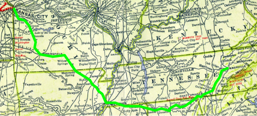 : route map of the virtual trip 2
2012-01-13 11:20
コメント(0)
Revising the Photo Archives [Column_Photo Archives]
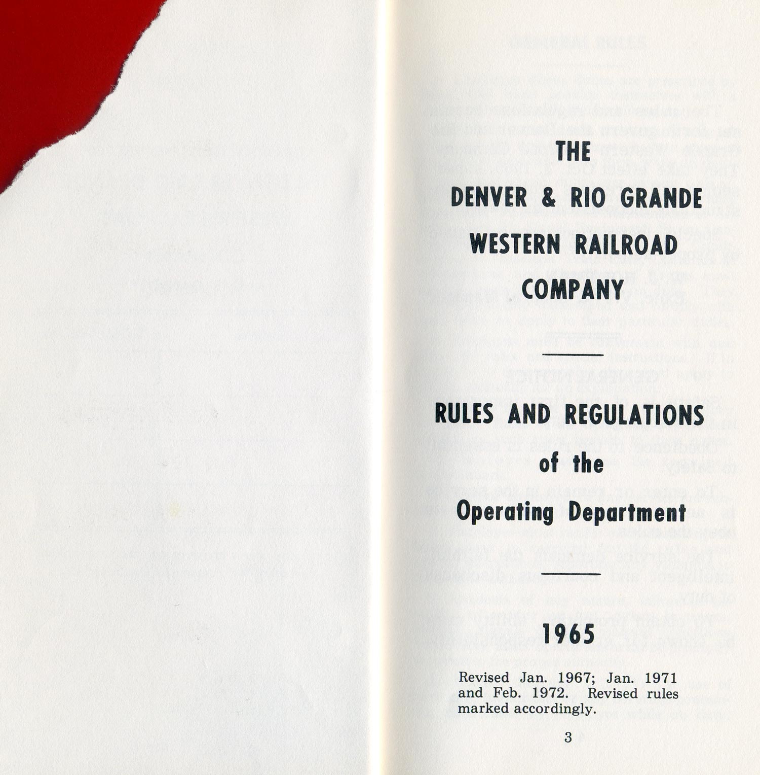 : title page of the revised “Rules and Regulations” of Rio Grande
The “Photo Archive” pages are the backbone of my blog. And, also is that they are one of the most frequently viewed among my blog contents. During these holidays, I’m revising them to add values.
Contents of revision are:
Changing the title of an item to simple “Reporting mark, Model/Type, Number, Notes” to help finding the photo easier.
Compiling the items carrying photos of a same equipment to reduce searching time and effort.
Correcting and adding information for the place of shot using Google map to add accuracy, and also “Past and Present” nostalgia.
Adding previously uploaded photos in columns besides “Photo Archive” to the “Archive” page.
Adding newly found photos to the “Photo Archive” page.
Some of the items are already revised. Corrected places of shot at this moment are BN ex-CBQ SD24 and SLSF train. The rests are going to be uploaded sequentially.
2014-01-10 09:00
コメント(0)
Typologies, part 1 – Main & Center [Column_Photo Archives]
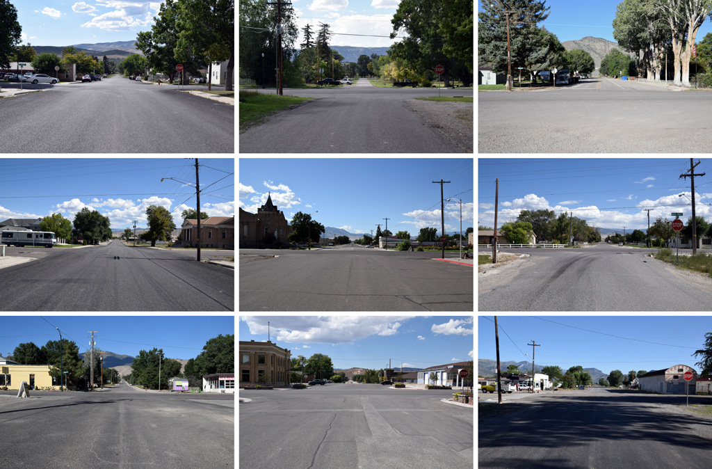 : Main and Center
All the photos above show the corner of Main Street and Center Street at each Utah's Mormon town I visited. These towns were built using the grid plan called plat of the City of Zion[1]. Accordingly, they have the same sequence, street width, and street name; if we check these towns on a road map, they look the same.
Indeed, these towns’ scenes are stereotyped and look same at a glance. But the careful observation reveals the differences. The fact of stereotype conversely emphasizes the difference between these towns, or in other words, the identity of a town.
There are maybe other ways to represent the identity of a town; editing a photo story using a mix of shots like a magazine. But that may bring the photographer’s and/or editor’s subjectivity. The method of arranging photos mechanically may avoid bringing subjectivity and leads the representation to objectivity.
Formality is maybe another condition for revealing the identity. Informal photos would disturb catching the identity. This may be understood considering portraits in ID cards.
German artist duo Bernd and Hilla Becher established this method of revealing and representing the identity and they called their works typologies. Mechanically arranging formal photos of stereotyped objects seems the key to this method of representation.
It’s interesting that these three conditions - mechanical, formal and stereotyped - are suitable for not only my Mormon town photos but also for the towns themselves.
Additionally, what attracted my interest is that there weren’t any chapel or town hall at the corner of Main and Center, compared with the also grid planned Spanish colonial towns: Spanish colonial towns usually have cathedral and plaza at the center.
[1] plat of the City of Zion;
 : TYPOLOGIES by Bernd & Hilla Becher, Schirmer/Mosel Verlag Munchen, 1990
2015-04-10 09:00
コメント(0)
Typologies, part 2 – Crossbucks [Column_Photo Archives]
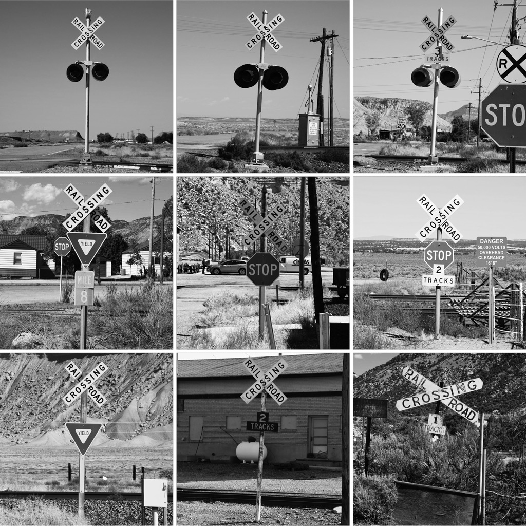 : crossbucks
Here are another “automatically arranged formal photos of same at a glance objects”[1]. These are, of course, photos of crossbucks. To tell the truth, the photos are trimmed and scaled to gray. These make this typologies style representation.
There are more quality examples among railroad photography. Richard Steinheimer presents station signs and locomotive portraits in this way in his book Western Trains[2]. Trains magazine cover shows locomotives in this way[3]. The so-called roster photos maybe also classified as typologies. Accordingly, it seems that objects of railroad photography are suitable for typologies style representation.
Most of the objects of railroad photography are mass-produced industrial products. That is, they look same at a glance; most of the people call the locomotive just “train” whether it’s EMD or GE. But for us, they are definitely different. We capture the identity by way of revealing the scanty differences through careful observation; same way Bechers do. Accordingly, method of railroad photography may resemble to typologies style representation. But it seems chicken-and-egg problem, telling which, object or method of railroad photography, led typologies style representation.
It’s also difficult to tell who established the typologies style representation. Steinheimer’s two mini series were first published in1965, and Bechers’ first exhibition was held in 1963. Both maybe started taking their particular photos in the same era. Jeff Brouws also mentions Campbell’s Soup Cans produced in 1962 by Andy Warhol on this matter[4]. I also want to add Twentysix Gasoline Stations published also in 1962 by Ed Ruscha[5]. Thus, it’s difficult to tell who, Steinheimer, Bechers, Warhol, Ruscha or someone else, established the typologies style representation. I may say that it was such an era.
[1] my column Typologies, part 1;
[2] Richard Steinheimer, Western Trains, 1965
[3] for example, June 1968 and July 1978 issue of Trains magazine
[4] Campbell’s Soup Cans by Andy Warhol;
[5] Twentysix Gasoline Stations by Ed Ruscha;
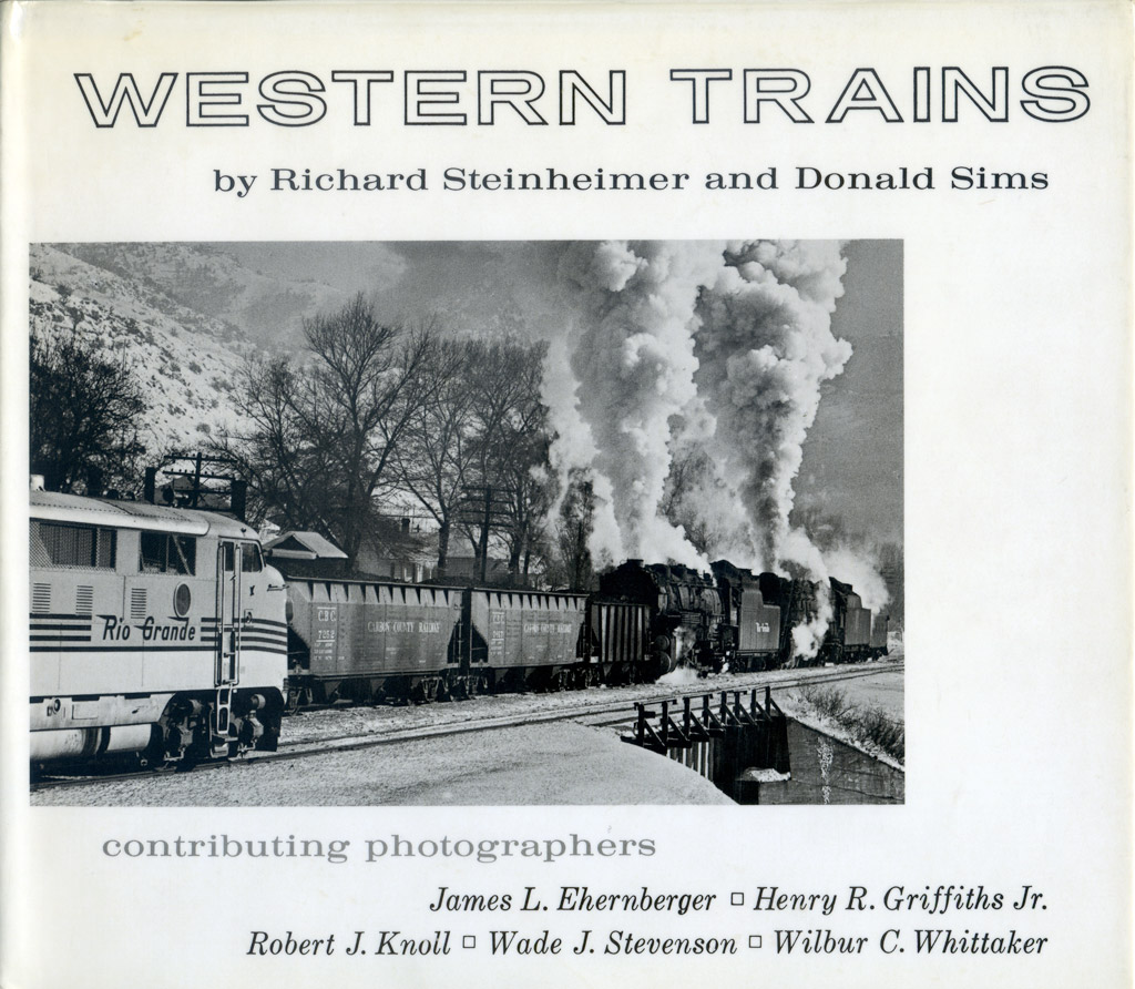 : Richard Steinheimer, Western Trains, 1965
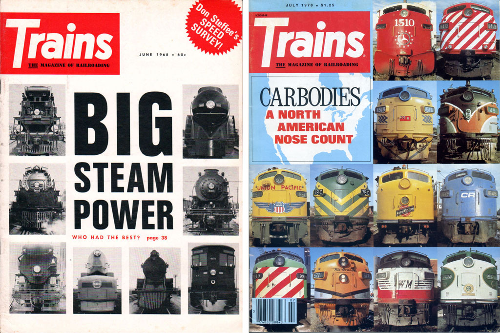 : covers of Trains magazine
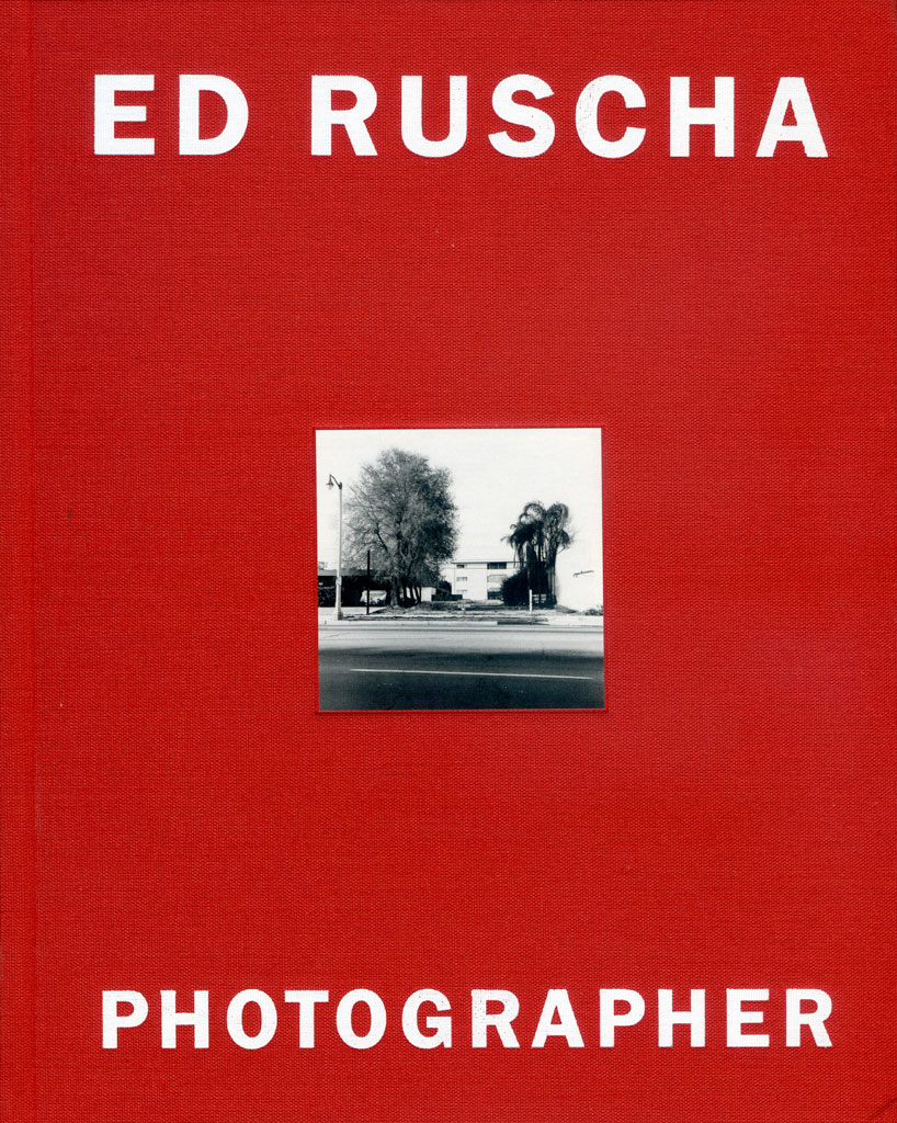 : Ed Ruscha, Photographer, Whitney Museum of American Art, 2006
2015-07-10 09:00
コメント(0)
Dharma-san [Column_Photo Archives]
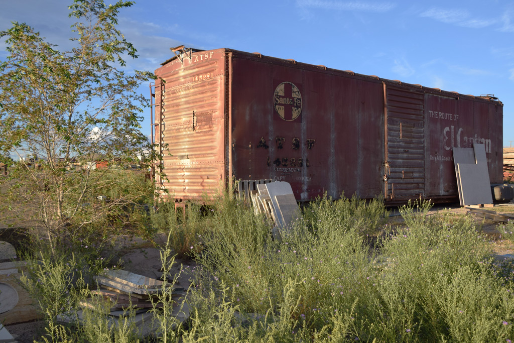 : Albuquerque, NM. Sep. 8, 2015
Boxcar without trucks is called Dharma-san among Japanese enthusiasts.
Bodhidharma was a Buddhist monk of the 5th century who referred to as the founder of Zen. It is said that he lost his legs and arms during his nine years of meditation. In Japan, roly-poly Bodhidharma dolls without legs and arms are made since long ago as the talisman of good luck, and are affectionately called Dharma-san[1]. Accordingly, we call boxcar without trucks sitting on the ground Dharma-san.
Once, Class One railroads played a significant role in establishing regional identities with their own regional identities such as routes, names, logos, and schemes. But Class Ones today overwhelm their own regional identities: they go too far to be regional. Also is that the rising of national chains and the uniforming of structures spoiled the regional landscape: a regional identity may be no longer practical. In Japan, such an inflexibly uniformed is referred to as Kintaro-ame, a traditional candy[2].
Because of its characteristics, our Dharma-sans usually don’t go far from their home rails. And that, most of the Dharma-sans still carry old names, logos, and schemes. Accordingly, they still keep the original regional identities. Why should they contribute to reviving the missed regional identities? I think not only old depots and preserved cabooses but Dharma-sans also contribute to the regions’ reviving lost identities.
I also think that Dharma-sans' original schemes from the ’70s or earlier are worth having a look at. From both viewpoints of reviving identities and of our hobby, I think we should record Dharma-sans before their schemes fade away. Accordingly, here I'll represent some Dharma-sans we found during our trip to New Mexico.
[1] photo of typical Dharuma-san;
[2] photo of typical Kintato-ame;
2016-03-18 09:00
コメント(0)
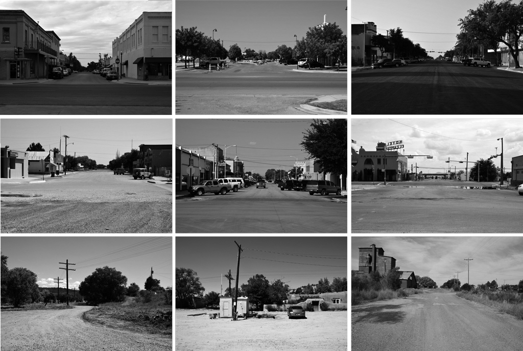
Typologies, part 3 – Overlooking the Depots [Column_Photo Archives]
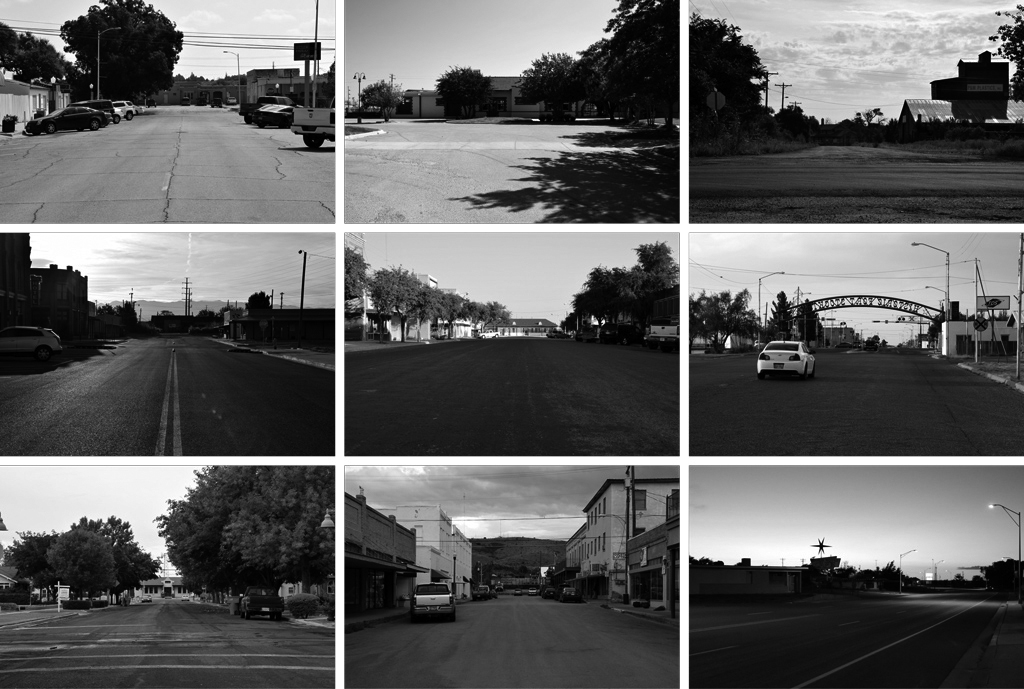
Each of the assorted photos above is taken from a block from the depot on the street considered as Depot Street of the town. They are, so to say, the Typological presentation of the scenes overlooking the depots.
Passenger trains no longer depart from these depots. The streets are somewhat declining. Some structures were lost, and above all, it unmistakably lacks people. For all that, the idea gets into my head that towns were greeting me. I wonder what makes me delusional.
Few will leave hometown by train today. The existence of the depot seems almost forgotten by the locals. But when traveling by train was the norm, the façade of the depot facing the town must have been the focal point of the last scene for the locals leaving their hometown. Whatever the reason for the leaving was, the scene overlooking the depot must have been the symbol of sentiment for the locals leaving their hometown.
For the aliens, the façade of the depot facing the town was the gateway to their hometowns faraway. Accordingly, the scene overlooking the depot must have been also the symbol of sentiment for the aliens. Eventually, the scene overlooking the depot must have been sentimental for all those who connected to trains.
It is said that delusion is one of the psychological attempts to healing the sentiment. And, I also have experience of taking trains. Accordingly, my imaging of town’s greetings might be a delusion caused by my own sentiment. In contrast, I wonder if young Americans who don’t connect to trains would image the towns’ greetings from scenes overlooking the depots.
Young Japanese still connect to trains and depots today. Thus, we often find trains and depots in their representations of the sentiment. The movie above shows the representation of the sentiment, or I may say delusion, by one of the young Japanese creators, Makoto Shinkai.
 : W Las Cruces Ave, Las Cruces, NM. Sep. 10, 2015
 : N 6th St, Alpine, TX. Sep. 10, 2015
 : 8th St, Vaughn, NM. Sep. 12, 2015
 : postcard of Vaughn maybe printed in the 60's
2016-03-25 09:00
コメント(0)
Typologies, part 4 – Overlooking From the Depots [Column_Photo Archives]
Last time, I represented the scenes overlooking the depots to explain the delusion. This time, I represent the scenes overlooking from the depots. These photos looking down the street shown above are backed by the depots. They are, so to say, the Typological presentation of the scenes overlooking from the depots. As you see, both scenes overlooking the depots and scenes overlooking from the depots resemble each other. I wonder which win the sympathy of the viewers.
The sentiment caused by scenes overlooking the depots is stereotyped. Accordingly, scenes overlooking the depots are the lucid scenes easy to gain the sympathy. On the contrary, scenes overlooking from the depots are the fuzzy scenes with complicated sympathy: while some may be relieved at the scenes overlooking from the depots, some may be excited at the scenes overlooking from the depots.
In other words, scenes overlooking the depots are lucid but they are the scenes difficult to gain sympathy of who does not have sentiment for depots or trains. And, scenes overlooking from the depots are fuzzy but they are the scenes able to gain sympathy of both who does and doesn’t have sentiment for depots or trains. Accordingly, scenes overlooking the depots win qualitatively and scenes overlooking from the depots win quantitatively, is maybe the answer to my question.
 : W Fox St, Carlsbad, NM. Sep. 12, 2015
 : W Main St, Mountainair, NM. Sep. 9, 2015
 : Calle Lomita, Glorieta, NM. Sep. 13, 2015
2016-04-01 09:00
コメント(0)
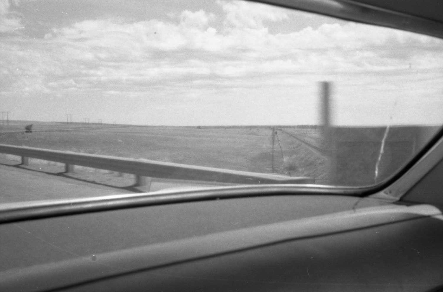
Surfaces - Everyday Life in the Early 70’s [Column_Photo Archives]
Here, I introduce scanned images from my dad’s slides mostly taken in the early 70’s.
1964 Oldsmobile was our only choice for means of family trip to as north as Fairbanks, AK or to as south as Oaxaca, Mexico: we never used airlines. Accordingly, I decided to call this series of posts as “Surfaces”.
 : 9 Ave. SW, Calgary, AB
Railroads had become far beyond everyday life in the early 70’s. But the closer look could find fragments of railroading even in the middle of the city.
2017-08-11 09:00
コメント(0)
Surfaces - Everyday Life in the Early 70’s [Column_Photo Archives]
Here, I introduce scanned images from my dad’s slides mostly taken in the early 70’s.
1964 Oldsmobile was our only choice for means of family trip to as north as Fairbanks, AK or to as south as Oaxaca, Mexico: we never used airlines. Accordingly, I decided to call this series of posts as “Surfaces”.

: 2nd Ave. W, Prince Rupert, BC
And, in the middle of the town.
1964 Oldsmobile was our only choice for means of family trip to as north as Fairbanks, AK or to as south as Oaxaca, Mexico: we never used airlines. Accordingly, I decided to call this series of posts as “Surfaces”.
: 2nd Ave. W, Prince Rupert, BC
And, in the middle of the town.
2017-08-18 09:00
コメント(0)
Surfaces - Everyday Life in the Early 70’s [Column_Photo Archives]
Here, I introduce scanned images from my dad’s slides mostly taken in the early 70’s.
1964 Oldsmobile was our only choice for means of family trip to as north as Fairbanks, AK or to as south as Oaxaca, Mexico: we never used airlines. Accordingly, I decided to call this series of posts as “Surfaces”.
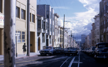
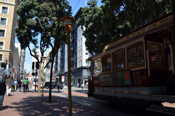
: Jackson St. and Mason St., San Francisco, CA
View from the famous cable car seems changed little.
1964 Oldsmobile was our only choice for means of family trip to as north as Fairbanks, AK or to as south as Oaxaca, Mexico: we never used airlines. Accordingly, I decided to call this series of posts as “Surfaces”.

: Jackson St. and Mason St., San Francisco, CA
View from the famous cable car seems changed little.
2017-09-15 09:00
コメント(0)
Surfaces - Everyday Life in the Early 70’s [Column_Photo Archives]
Here, I introduce scanned images from my dad’s slides mostly taken in the early 70’s.
1964 Oldsmobile was our only choice for means of family trip to as north as Fairbanks, AK or to as south as Oaxaca, Mexico: we never used airlines. Accordingly, I decided to call this series of posts as “Surfaces”.
 : Oct. 1970
 : Sep. 2017. Both at Powell St. and Ellis St., San Francisco, CA
The eye from the hotel window and the eye from the street cross each other after 47 years.
1964 Oldsmobile was our only choice for means of family trip to as north as Fairbanks, AK or to as south as Oaxaca, Mexico: we never used airlines. Accordingly, I decided to call this series of posts as “Surfaces”.
 : Oct. 1970
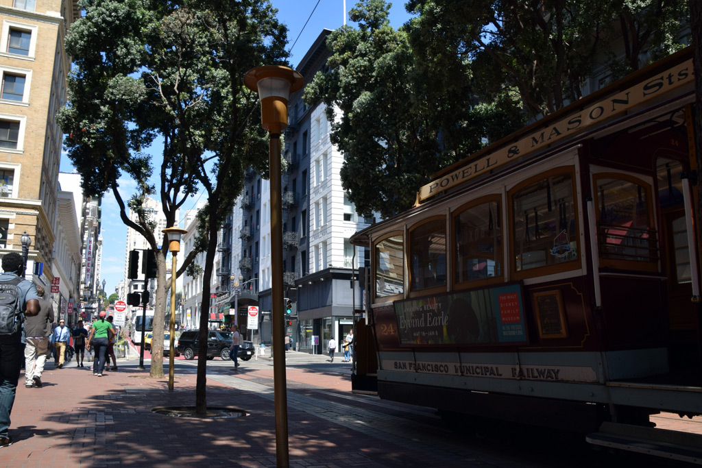 : Sep. 2017. Both at Powell St. and Ellis St., San Francisco, CA
The eye from the hotel window and the eye from the street cross each other after 47 years.
2017-09-22 09:00
コメント(0)
Thompson Hill, part 1 [Column_Photo Archives]
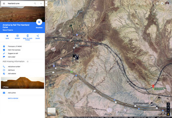 : Google map showing the Thompson Hill
Popular photo opportunities/settings along the former Rio Grande mainline such as Blue Mountain Dr crossing near Clay, East Portal or US Hwy 24 overpass near Malta are all located in Colorado.
But Utah also has several settings where successive photographers were/are fond of. Volumes of great photos taken at such settings can be found on the web.
“Patrick’s Point” west of Floy is one of such a setting with a name: it is said to be named after photographer and former D&RGW officer Melvin N. Patrick[1, 2].
“Thompson Hill” east of Thompson is another such a setting with a name; this setting is also called “Thompson Cut” by some enthusiasts.
Historical photographers visited the “Thompson Hill”. Mac Owen captured Krauss-Maffei in 1962 according to the postcard. Ken Crist captured California Zephyr in 1965 and Ross Grenard captured eastbound freight in 1975 according to the book Rio Grande in Color Vol. 2: Utah. James Belmont also visited the setting in the 70’s[3]. Mike Danneman and Mark W. Hemphill seem visit the setting since the 80’s[4, 5].
Why so many photographers make the pilgrimage to this setting? Let’s have a look.
revised, Feb 1, 2020
[1] Danneman, Mike, (1996) Lunar-like landscape, Flickr;
[2] Patrick, Mel, (1980) RGZ west of Floy, Ut May ’80, Flickr;
[3] Belmont, James, (1979) untitled, RailPictures.net;
[4] Danneman, Mike, (1984) Cresting Thompson Hill, Flickr;
[5] Hemphill, Mark W., (1985) "The Unknown Rio Grande", Trains, Kalmbach Publishing Co.
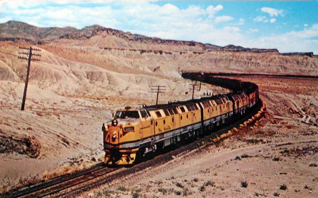 : 1962 postcard photo by Mac Owen
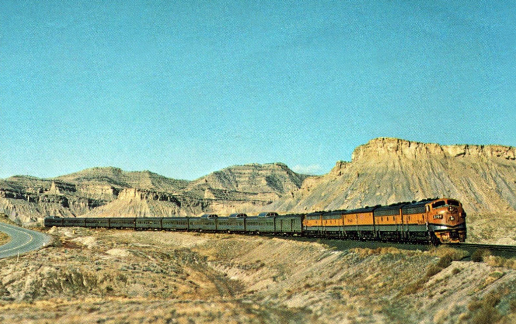 : 1965 postcard photo by Ken Crist
2017-10-06 09:00
コメント(0)
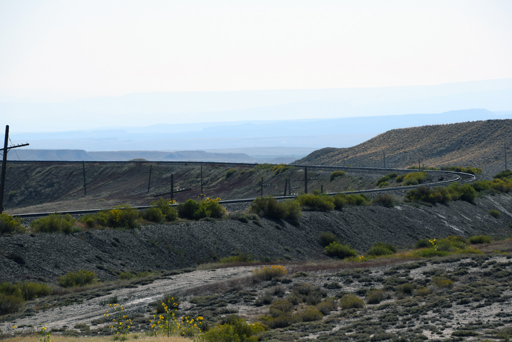
Thompson Hill, part 2 [Column_Photo Archives]
 : 360° view of the Thompson Hill
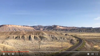
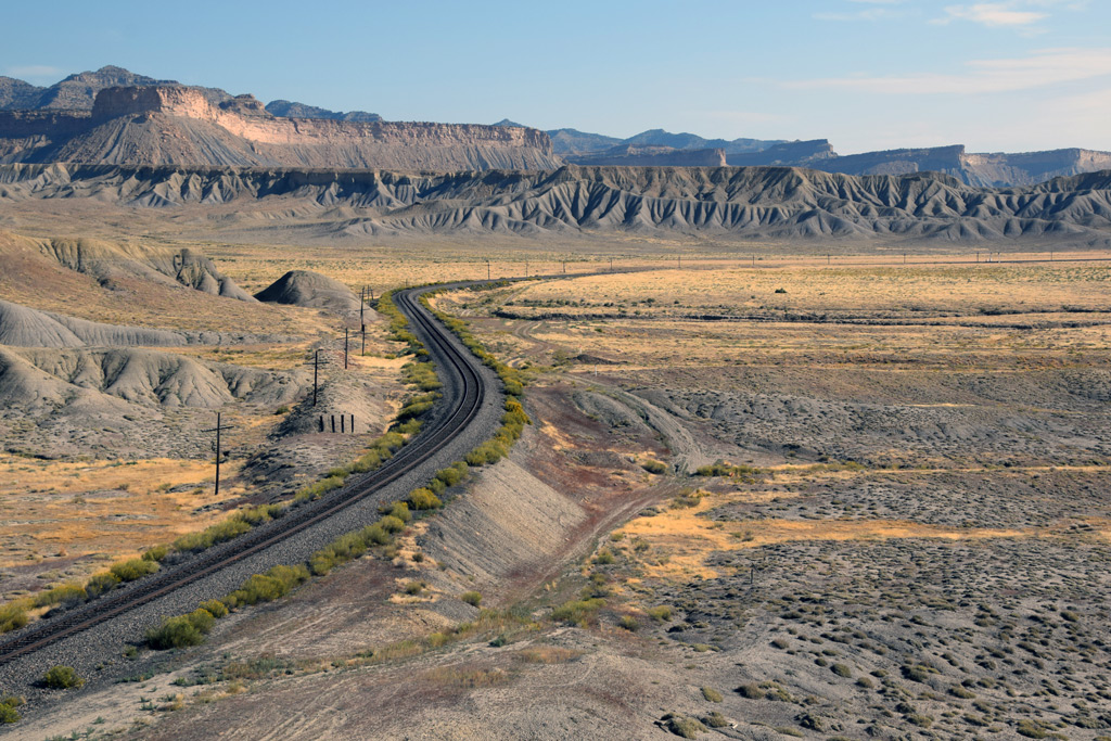
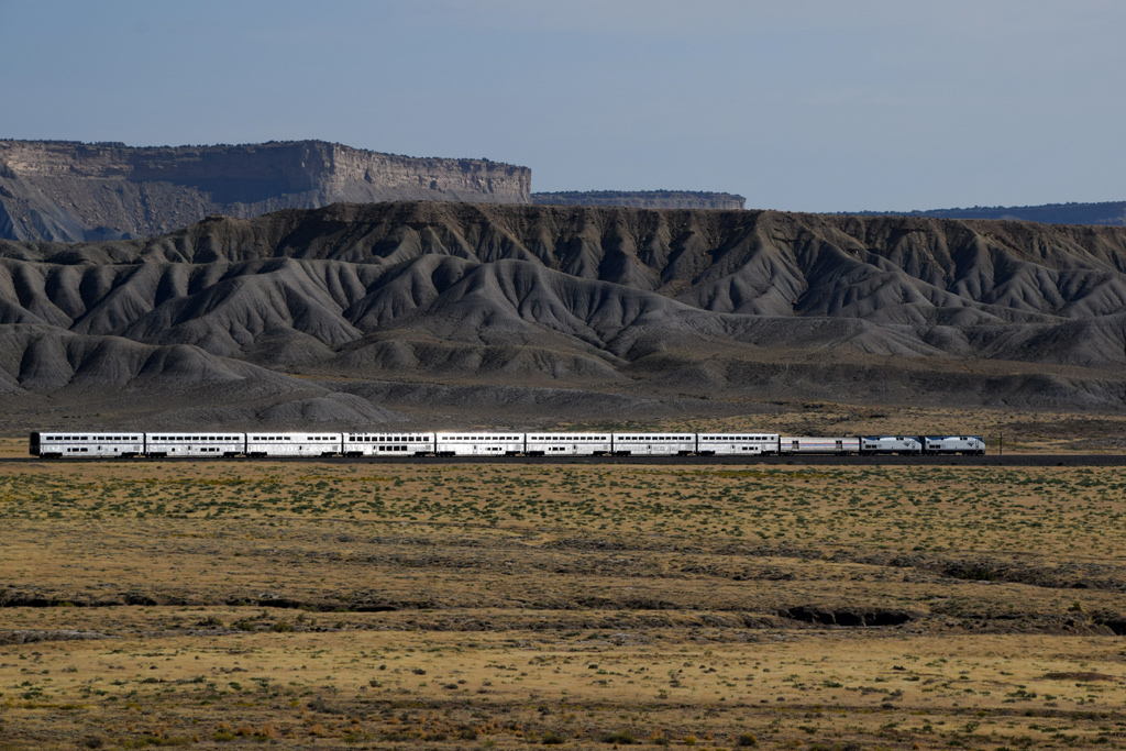
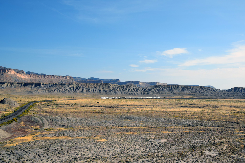
“Thompson Hill” is located about two miles east of Thompson, Utah: on milepost 526 at Rio Grande track charts. It lies next to the Rio Grande's highest point between Grand Junction, Colorado and Green River, Utah.
The Hill is about 500 ft walk from the paved old US Hwy 50 & 6, and another 700 ft walk from Utah Welcome Center on westbound I-70: a little hill climb is needed, but seem far easy to access compared with “Patrick’s Point” west of Floy.
 : Mac Owen's view
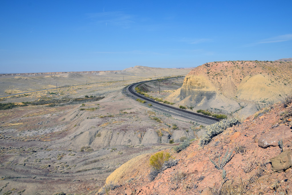 : Mike Danneman's view
The setting is composed of tight and loose curves which lead to reversed curves both directions. Here, also are the cut and fill which allow various heights of viewpoints. The setting faces the south and it seems nothing gets in the way of sunlight all day long. Trains reduce speed due to its 5° curve in both directions. Accordingly, they smoke them up after negotiating it.
As you can see, we can choose the right angle from various opportunities according to the train’s direction, train’s length, the position of sunlight or purpose of the photo. I think that’s why many photographers made the pilgrimage to this setting.
 : Mark M. Hemphill's view
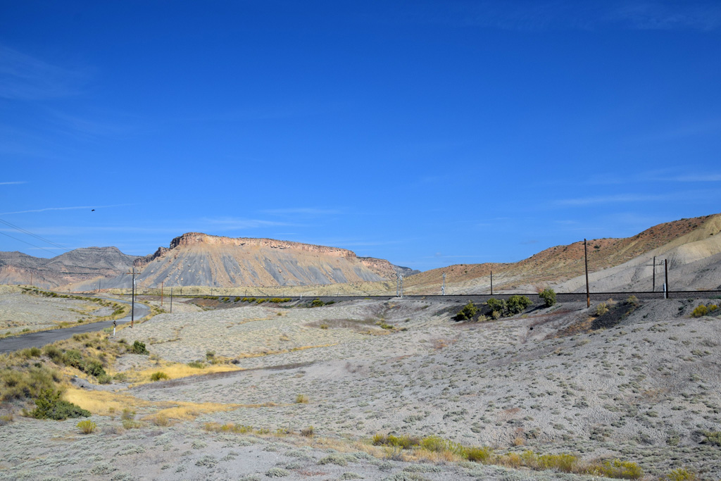 : Ken Crist's view
The view from the point is vast and wonderful without an obstacle. You can admire the breathtaking panorama of the desert, the Book Cliffs and the La Sal Mountains: even my wife, who isn’t interested in trains, could wait an hour for the Zephyr. I believe that’s another reason why many photographers left their footprints here.
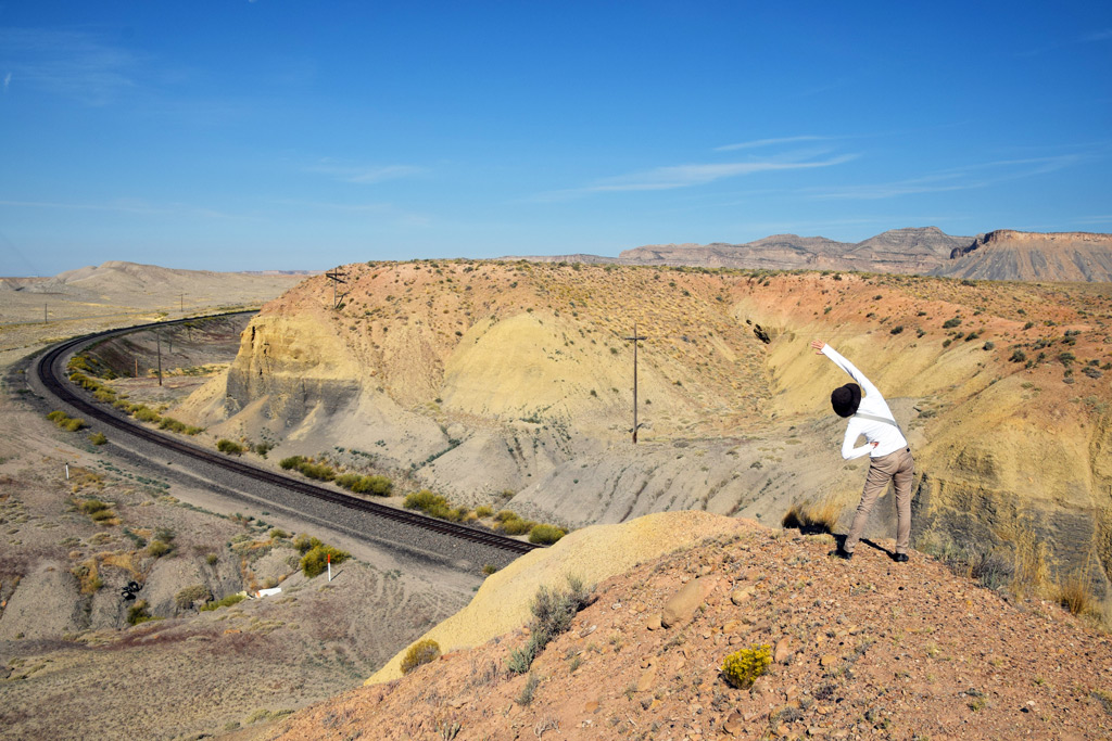 : my wife prepares for the session
 revised, Feb 1, 2020
2017-10-13 09:00
コメント(0)
Thompson Hill, part 3 [Column_Photo Archives]
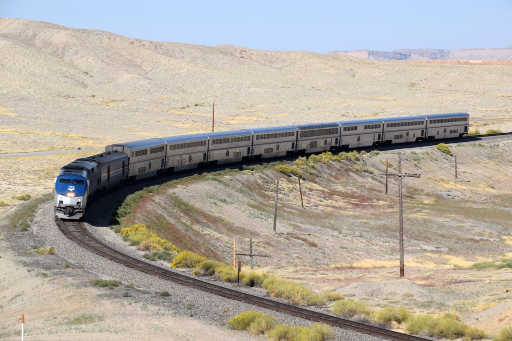
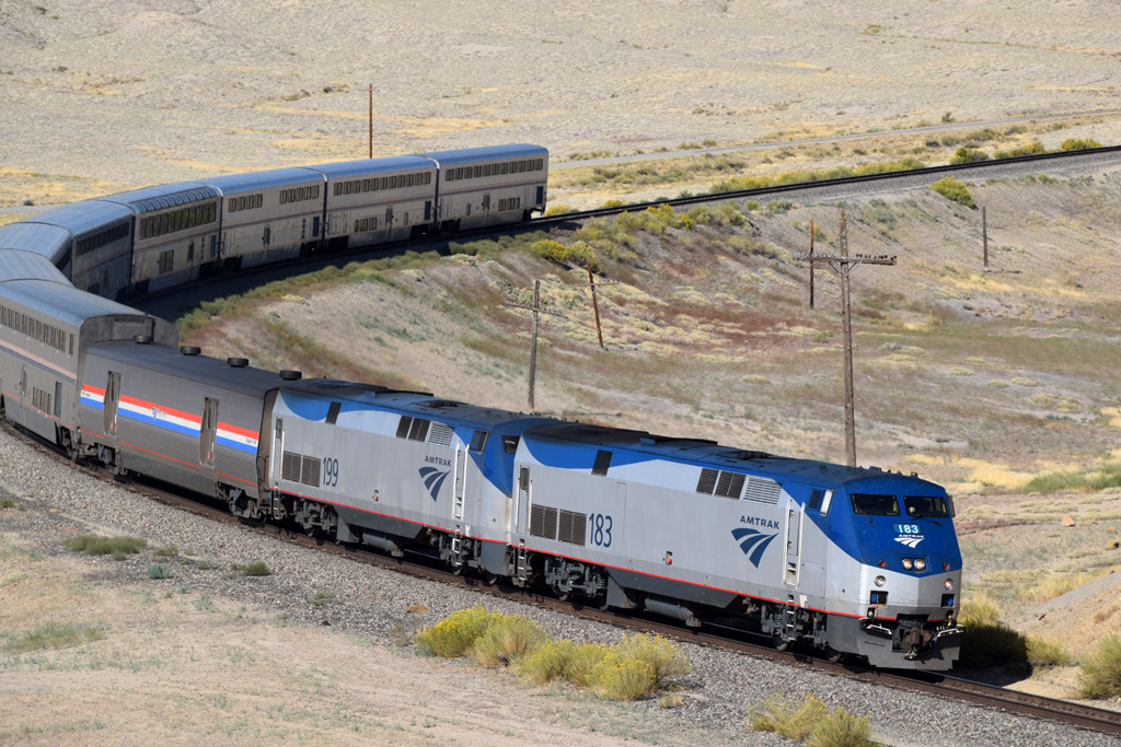
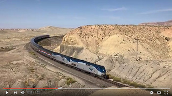 : Amtrak #6
Here are the results of our pilgrimage to the Hill:
The time is around 10:20AM, Sunday, Sep. 10, 2017.
The train is the Amtrak #6, running about 90 minutes late due to the scheduled track work in Colorado.
My wife took the video with iPhone and I took the stills with Nikon.
The only drawback of “Thompson Hill” is that the traffic at this point is relatively low. We only caught this eastbound Amtrak and the westbound Potash Local this morning.
Mike Danneman also missed the train but captured a wonderful twilight here[1, 2].
revised, Feb 1, 2020
[1] Danneman, Mike, (2012) Silence in the desert, Flickr;
[2] Danneman, Mike, (2012) If only a train…, Flickr;

2017-10-20 09:00
コメント(0)
Surfaces - Everyday Life in the Early 70’s [Column_Photo Archives]
Here, I introduce scanned images from my dad’s slides mostly taken in the early 70’s. 1964 Oldsmobile was our only choice for means of family trip to as north as Fairbanks, AK or to as south as Oaxaca, Mexico: we never used airlines. Accordingly, I decided to call this series of posts as “Surfaces”.
 : Knoxville, TN 1971
We can’t escape annual events.
2017-11-17 09:00
コメント(0)
Surfaces - Everyday Life in the Early 70’s [Column_Photo Archives]
Here, I introduce scanned images from my dad’s slides mostly taken in the early 70’s. 1964 Oldsmobile was our only choice for means of family trip to as north as Fairbanks, AK or to as south as Oaxaca, Mexico: we never used airlines. Accordingly, I decided to call this series of posts as “Surfaces”.
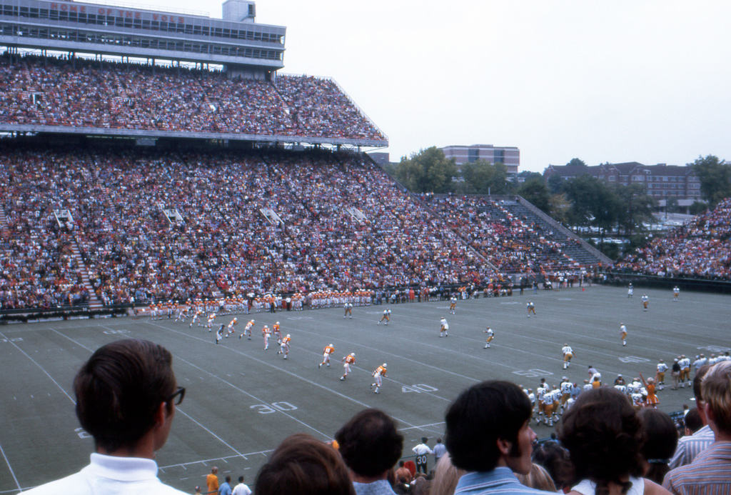 : Knoxville, TN 1970
Go! Vols!!
2017-11-24 09:00
コメント(0)
Surfaces - Everyday Life in the Early 70’s [Column_Photo Archives]
Here, I introduce scanned images from my dad’s slides mostly taken in the early 70’s. 1964 Oldsmobile was our only choice for means of family trip to as north as Fairbanks, AK or to as south as Oaxaca, Mexico: we never used airlines. Accordingly, I decided to call this series of posts as “Surfaces”.
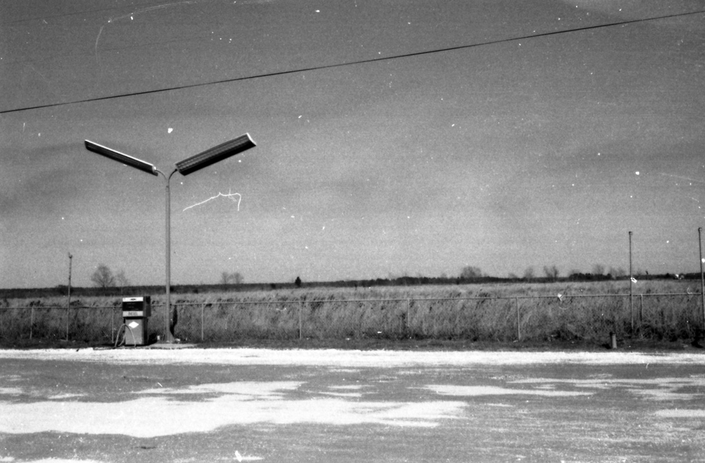 : Texas 1971
Sometimes, cheap gas we filled up at rundown stations made our Oldsmobile sick.
- the particular service station in the photo
above have no connection with the article
And, also is that I couldn't find out where this was.
2018-01-26 09:00
コメント(0)
Surfaces - Everyday Life in the Early 70’s [Column_Photo Archives]
Here, I introduce scanned images from my dad’s slides mostly taken in the early 70’s.
1964 Oldsmobile was our only choice for means of the family trip to as north as Fairbanks, AK or to as south as Oaxaca, Mexico: we never used airlines. Accordingly, I decided to call this series of posts as “Surfaces”.
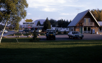 : Speculator, NY Oct. 1968
a historical motel term – “TV”
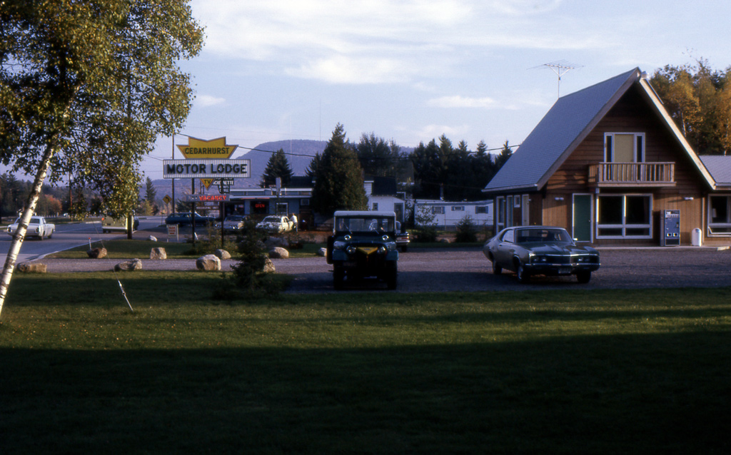 : Speculator, NY Oct. 1968
a historical motel term – “TV”
2018-04-13 09:00
コメント(0)
Surfaces - Everyday Life in the Early 70’s [Column_Photo Archives]
Here, I introduce scanned images from my dad’s slides mostly taken in the early 70’s.
1964 Oldsmobile was our only choice for means of family trip to as north as Fairbanks, AK or to as south as Oaxaca, Mexico: we never used airlines. Accordingly, I decided to call this series of posts as “Surfaces”.
 : Buena Vista, VA 1971
a historical technical term – “Outdoor Pool”
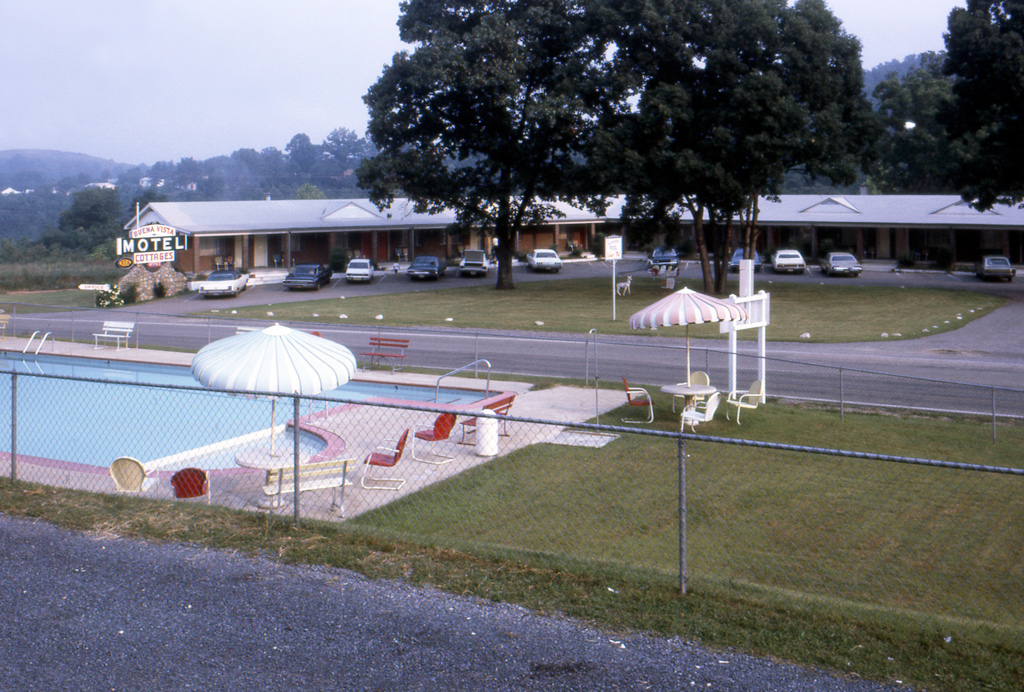 : Buena Vista, VA 1971
a historical technical term – “Outdoor Pool”
2018-06-15 09:00
コメント(0)
Sidings, Leads, and Spurs [Column_Photo Archives]
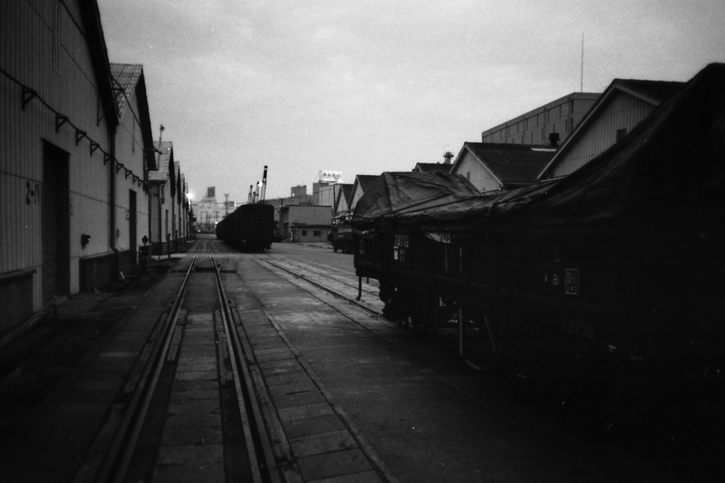 : Hinode-Futo, Tokyo, Japan. early 1980s
Industrial sidings, leads, and spurs diverting from the main track could be found anywhere in the ’70s. And those sleepy vacant spaces were the prime playgrounds for the kids like me: my pole at that time was decoding faded route cards on boxcar doors.
Today, industries served by rail are mostly located not in the town but in the fenced suburban industrial parks where kids aren’t familiar with or far from home. Sidings, leads, and spurs in the town may be missed sooner or later.
Model Railroader magazine often features such trackage in a town as “a railroad you can model”, maybe not only to suggest a switching layout operation but also to sentimentalize the miss of neighboring rails[1]. Hereafter, I’ll represent such industry trackage I happened to meet during the trip along the former D&RGW route.
[1] Richter, David, (1968) “Railroads in the streets”, April 1968, Model Railroader, Kalmbach Publishing
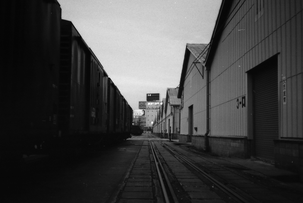 : Hinode-Futo, Tokyo, Japan. early 1980s
2018-07-06 09:00
コメント(0)
arx_Ph.D. さん

Here represented are my model railroad enthusiasm generated from the photos I took during my childhood at Knoxville, Tennessee, or from the photos I took during my recent trips.
I'm a retired professor of design, meanwhile a part-time associate at the architectural design office in Osaka, Japan where I live with my wife.


